File:Karte Ankogelgruppe.png
Jump to navigation
Jump to search

Size of this preview: 547 × 599 pixels. Other resolutions: 219 × 240 pixels | 438 × 480 pixels | 701 × 768 pixels | 935 × 1,024 pixels | 1,870 × 2,048 pixels | 4,202 × 4,601 pixels.
Original file (4,202 × 4,601 pixels, file size: 3.48 MB, MIME type: image/png)
Captions
Captions
Add a one-line explanation of what this file represents
Summary
[edit]
| Description |
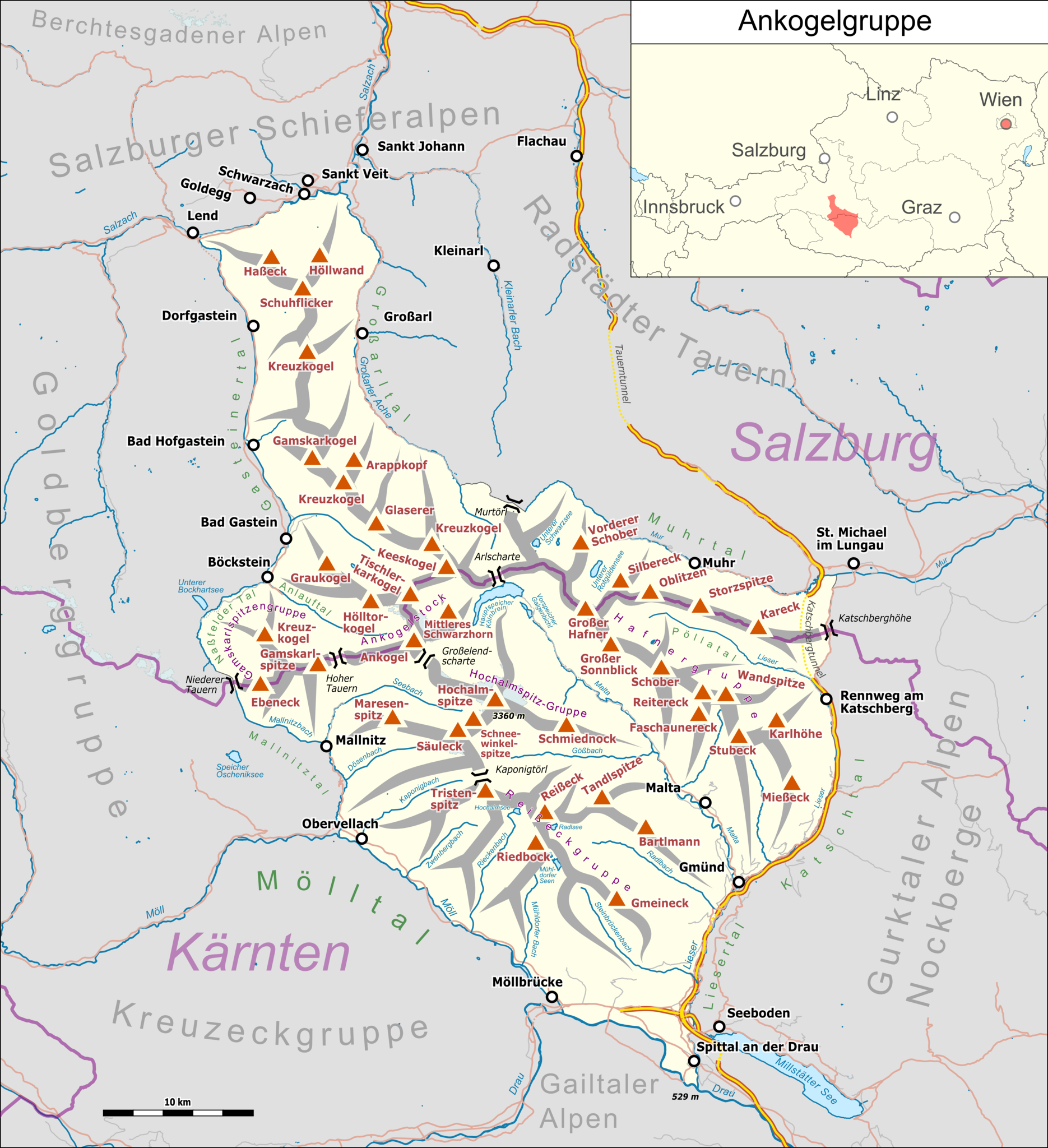
Deutsch: Übersichtskarte der Ankogelgruppe. |
|||||||||
| Date | ||||||||||
| Source |
Own work Map was created using:
|
|||||||||
| Creator |
|
|||||||||
| Permission (Reusing this file) |
Map data (c) OpenStreetMap (and) contributors, CC-BY-SA | |||||||||
| Geotemporal data | ||||||||||
| Bounding box |
|
|||||||||
| Georeferencing | ||||||||||
| This work is licensed under the Open Database License (summary). |
File history
Click on a date/time to view the file as it appeared at that time.
| Date/Time | Thumbnail | Dimensions | User | Comment | |
|---|---|---|---|---|---|
| current | 11:10, 17 February 2019 | | 4,202 × 4,601 (3.48 MB) | Pechristener (talk | contribs) | einige Talbezeichnungen hinzu, tiefster Pkt hinzu, Kleinarler Bach repariert |
| 00:40, 10 February 2019 |  | 4,202 × 4,601 (3.44 MB) | Pechristener (talk | contribs) | diverse korr | |
| 20:42, 3 November 2018 |  | 4,202 × 4,601 (3.42 MB) | Pechristener (talk | contribs) | Location Map added, other details added | |
| 19:46, 3 November 2018 |  | 4,209 × 4,607 (3.19 MB) | Pechristener (talk | contribs) | == {{int:filedesc}} == {{Map |Description={{de|1=Übersichtskarte der {{w|Ankogelgruppe||de}}. }} |Source ={{own}} Map was created using: *[http://www.openstreetmap.org/ Open Street Map] Data *{{w|Austria location map.svg}} for location map |Author = *Hauptkarte: Pechristener *{{w|Austria location map.svg}} : NordNordWest, {{u|Lencer}} |Date =2018-11-03 |Permission =Map data (c) OpenStreetMap (and) contributors, CC-... |
You cannot overwrite this file.
File usage on Commons
The following 3 pages use this file:
File usage on other wikis
The following other wikis use this file:
- Usage on de.wikipedia.org
- Usage on it.wikipedia.org
- Usage on www.wikidata.org