File:Karte Rigi-Kaltbad-Scheidegg-Bahn .svg
Jump to navigation
Jump to search

Size of this PNG preview of this SVG file: 708 × 600 pixels. Other resolutions: 283 × 240 pixels | 567 × 480 pixels | 907 × 768 pixels | 1,209 × 1,024 pixels | 2,418 × 2,048 pixels | 1,568 × 1,328 pixels.
Original file (SVG file, nominally 1,568 × 1,328 pixels, file size: 420 KB)
Captions
Captions
Add a one-line explanation of what this file represents
Summary[edit]
| Description |
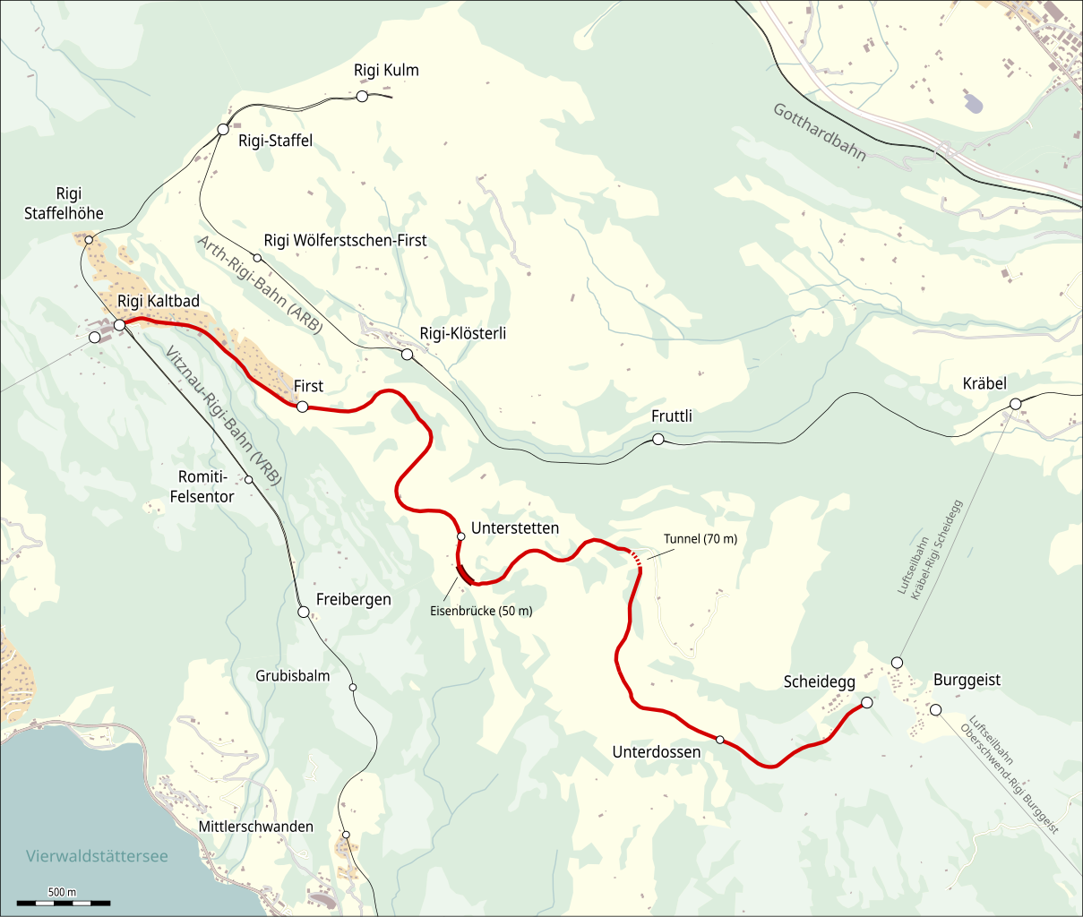
Deutsch: Karte der Rigi-Kaltbad-Scheidegg-Bahn |
||
| Date | |||
| Source |
Map was created using:
|
||
| Author |
|
||
| Permission (Reusing this file) |
|
File history
Click on a date/time to view the file as it appeared at that time.
| Date/Time | Thumbnail | Dimensions | User | Comment | |
|---|---|---|---|---|---|
| current | 20:26, 18 March 2021 | | 1,568 × 1,328 (420 KB) | Pechristener (talk | contribs) | da stand Unterstetten, statt Unterdossen |
| 20:58, 24 February 2020 |  | 1,568 × 1,328 (421 KB) | Pechristener (talk | contribs) | == {{int:filedesc}} == {{Information |description={{de|Karte der Rigi-Kaltbad-Scheidegg-Bahn}} |date=2020-02-24 |source=Map was created using: * [http://www.openstreetmap.org/ Open Street Map] Data |author= * Raw data: OpenStreetMap contributers * Map rendering: Pechristener using [http://maperitive.net/ Maperitive] & [https://inkscape.org/ Inkscape] |permission={{ODbL}} |other versions= }} Category:Rigi-Scheidegg-Bahn |
You cannot overwrite this file.
File usage on Commons
The following page uses this file:
File usage on other wikis
The following other wikis use this file:
- Usage on de.wikipedia.org
- Usage on it.wikipedia.org
- Usage on www.wikidata.org