File:Karte Stumpf 1548 markiert.png

Original file (1,466 × 2,348 pixels, file size: 7.85 MB, MIME type: image/png)
Captions
Captions
Summary[edit]
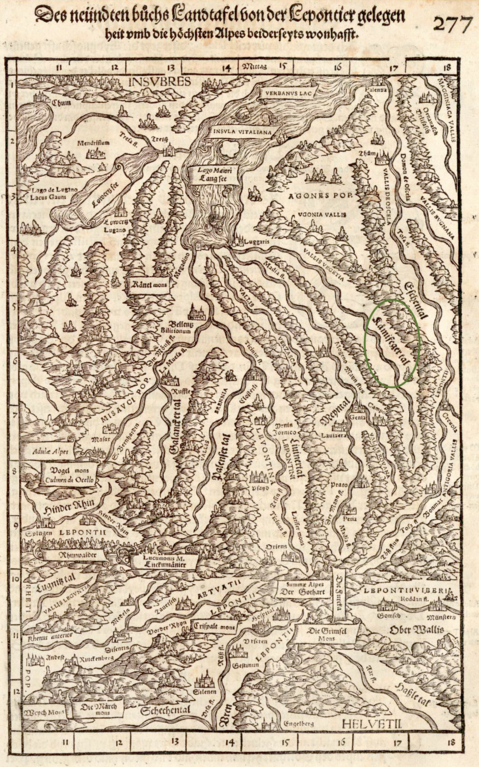
| Description | Tessin, Graubünden, Richtung Süden, 1548, «Kämifegertal» markiert | ||||
| Source | https://doi.org/10.3931/e-rara-5076 Zentralbibliothek Zürich | ||||
| Author | Johannes Stumpf, upload by Adrian Michael | ||||
| Permission (Reusing this file) |
|
||||
File history
Click on a date/time to view the file as it appeared at that time.
| Date/Time | Thumbnail | Dimensions | User | Comment | |
|---|---|---|---|---|---|
| current | 09:43, 27 July 2023 | | 1,466 × 2,348 (7.85 MB) | Parpan05 (talk | contribs) | {{Information |Description=Tessin, Graubünden, Richtung Süden, 1548, «Kämifegertal» markiert |Author=Johannes Stumpf, upload by Adrian Michael |Permission={{PD-old}} |other_versions= }} Category:Maps made in the 16th century Category:Old maps of the canton of Graubünden Category:History of the canton of Graubünden Category:Old maps of the canton of Tessin Category:History of the canton of Tessin [[Category:Gemeiner loblicher Eydgn... |
You cannot overwrite this file.
File usage on Commons
There are no pages that use this file.
File usage on other wikis
The following other wikis use this file:
- Usage on de.wikipedia.org