File:Kasese District in Uganda.svg
Ir a la navegación
Ir a la búsqueda

Tamaño de esta previsualización PNG del archivo SVG: 589 × 599 píxeles. Otras resoluciones: 236 × 240 píxeles | 472 × 480 píxeles | 755 × 768 píxeles | 1007 × 1024 píxeles | 2013 × 2048 píxeles | 1441 × 1466 píxeles.
Archivo original (archivo SVG, nominalmente 1441 × 1466 píxeles, tamaño de archivo: 369 kB)
Leyendas
Leyendas
Añade una explicación corta acerca de lo que representa este archivo
Resumen[editar]
| Descripción |
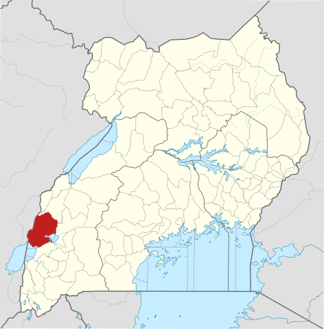
English: The location of Kasese District in Uganda, showing district boundaries as they stood in June 2017. For other districts, see Category:SVG locator maps of Districts in Uganda (location map scheme). This map may be incomplete, and may contain errors. Don't rely solely on it for navigation. In particular, note that this map overlays a spherical pseudo-mercator projection on an equirectangular projection; it is far from technically perfect.
|
|||||||||
| Fecha | ||||||||||
| Fuente |
Derivative of:
|
|||||||||
| Creador |
OpenStreetMap contributors, Jarry1250, NordNordWest |
|||||||||
| Permiso (Reutilización de este archivo) |
Este archivo se encuentra bajo la licencia Creative Commons Genérica de Atribución/Compartir-Igual 3.0. Atribución: © OpenStreetMap contributors, Jarry1250, NordNordWest/Wikipedia
|
|||||||||
| Geotemporal data | ||||||||||
| Map location | Kasese District, Uganda | |||||||||
| Sistema de referencia espacial | equirectangular | |||||||||
| Bounding box |
|
|||||||||
| Georeferencing | If inappropriate please set warp_status = skip to hide. | |||||||||
Historial del archivo
Haz clic sobre una fecha y hora para ver el archivo tal como apareció en ese momento.
| Fecha y hora | Miniatura | Dimensiones | Usuario | Comentario | |
|---|---|---|---|---|---|
| actual | 21:01 25 jun 2017 | | 1441 × 1466 (369 kB) | Jarry1250 (discusión | contribs.) | pattypan 17.05 |
No puedes sobrescribir este archivo.
Usos del archivo
La siguiente página usa este archivo:
Uso global del archivo
Las wikis siguientes utilizan este archivo:
- Uso en en.wikipedia.org
- Kasese District
- Kasese
- Kazinga Channel
- Roman Catholic Diocese of Kasese
- Kagando Hospital
- Kasese Airport
- Mpondwe
- Hima, Uganda
- Wikipedia:WikiProject Uganda/District templates
- Template:Kasese District
- Mweya
- Mweya Airport
- Kasenyi Airport
- Kasenyi, Kasese
- Joy Doreen Biira
- Hima Cement Limited
- Bugoye Hydroelectric Power Station
- Mubuku I Hydroelectric Power Station
- Mubuku III Hydroelectric Power Station
- Mubuku
- Nyamwamba I Hydroelectric Power Station
- Rwimi Hydroelectric Power Station
- Bugoye
- Lubilia Hydroelectric Power Station
- Kilembe Mines
- Bwera General Hospital
- Kilembe, Uganda
- Kilembe Mines Hospital
- Fort Portal–Kasese–Mpondwe Road
- Kikorongo
- Kikorongo–Ishaka Road
- The Rwenzori Times
- Nyamagasani I Hydroelectric Power Station
- Nyamagasani II Hydroelectric Power Station
- Nkenda–Fort Portal–Hoima High Voltage Power Line
- Nkenda–Mpondwe–Beni High Voltage Power Line
- Nkenda
- User:GerardM/Districts of Uganda
- Nyamwamba II Hydroelectric Power Station
- Uso en es.wikipedia.org
- Uso en fa.wikipedia.org
- Uso en fr.wikipedia.org
- Uso en ha.wikipedia.org
- Uso en he.wikipedia.org
- Uso en id.wikipedia.org
- Uso en ig.wikipedia.org
- Uso en ja.wikipedia.org
- Uso en sw.wikipedia.org
- Uso en ts.wikipedia.org
- Uso en www.wikidata.org
Ver más uso global de este archivo.