File:Kazanów (gmina) location map.png
Jump to navigation
Jump to search

Size of this preview: 800 × 517 pixels. Other resolutions: 320 × 207 pixels | 640 × 413 pixels | 909 × 587 pixels.
Original file (909 × 587 pixels, file size: 105 KB, MIME type: image/png)
Captions
Captions
Add a one-line explanation of what this file represents
| Description |
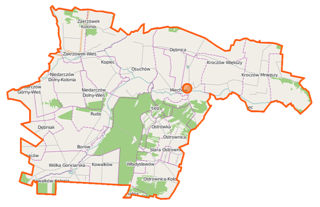
Polski: Mapa gminy Kazanów, Polska
English: Map of Gmina Kazanów, Poland |
|||||||||
| Date | ||||||||||
| Source | You may find a page on the OpenStreetMap wiki page for Kazanów (gmina) | |||||||||
| Creator |
OpenStreetMap contributors OpenStreetMap contributors |
|||||||||
| Permission (Reusing this file) |
OpenStreetMap data is available under the Open Database License (details). Map tiles are licensed under the Creative Commons Attribution-ShareAlike 2.0 license (CC-BY-SA 2.0).
This file is licensed under the Creative Commons Attribution-Share Alike 2.0 Generic license.
|
|||||||||
| Geotemporal data | ||||||||||
| Bounding box |
|
|||||||||
| Georeferencing | If inappropriate please set warp_status = skip to hide. | |||||||||
File history
Click on a date/time to view the file as it appeared at that time.
| Date/Time | Thumbnail | Dimensions | User | Comment | |
|---|---|---|---|---|---|
| current | 06:27, 16 October 2014 | | 909 × 587 (105 KB) | VanWiel (talk | contribs) | {{OpenStreetMap | name = Kazanów (gmina) | location = Kazanów (gmina) | description = {{pl|Mapa gminy Kazanów, Polska}} {{en|Map of Gmina Kazanów, Poland}} | top = 51.3173 | left = 21.3197 | r... |
You cannot overwrite this file.
File usage on Commons
There are no pages that use this file.
File usage on other wikis
The following other wikis use this file:
- Usage on fr.wikipedia.org
- Usage on pl.wikipedia.org
- Kazanów (gmina)
- Kroczów Mniejszy
- Kroczów Większy
- Kowalków
- Kowalków-Kolonia
- Miechów-Kolonia
- Niedarczów Dolny-Kolonia
- Niedarczów Dolny-Wieś
- Niedarczów Górny-Kolonia
- Niedarczów Górny-Wieś
- Ostrownica (powiat zwoleński)
- Ostrownica-Kolonia
- Ostrówka
- Ranachów-Wieś
- Wólka Gonciarska
- Zakrzówek-Kolonia
- Borów (województwo mazowieckie)
- Dębniak (województwo mazowieckie)
- Dębnica (województwo mazowieckie)
- Kazanów (województwo mazowieckie)
- Kopiec (województwo mazowieckie)
- Miechów (województwo mazowieckie)
- Zakrzówek-Wieś (województwo mazowieckie)
- Osuchów (powiat zwoleński)
- Ruda (gmina Kazanów)
- Gajówka Dobiec
- Parafia Przemienienia Pańskiego w Kazanowie Iłżeckim
- Cmentarz żydowski w Kazanowie
- Biedów
- Budy (powiat zwoleński)
- Ignaców (gmina Kazanów)
- Kępa (powiat zwoleński)
- Leśniczówka Ruda
- Łęg (powiat zwoleński)
- Władysławów (gmina Kazanów)
- Stara Ostrownica
- Rochalina
- Poduchowne (województwo mazowieckie)
- Parafia św. Stanisława w Kowalkowie
- Kościół Przemienienia Pańskiego i św. Mikołaja w Kazanowie
- Moduł:Mapa/dane/Kazanów (gmina)
- Rynek (Kazanów)
- Pod Kierkutem
- Usage on pl.wikibooks.org
_location_map.png&oldid=519969778)