File:Kazimierza Wielka (gmina) location map.png

Original file (2,183 × 1,805 pixels, file size: 734 KB, MIME type: image/png)
Captions
Captions
Summary[edit]
_location_map.png&action=edit§ion=1)
| Description |
English: Location map |
| Date | |
| Source | Own work |
| Author | Smat |
| Description |
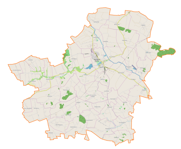
Polski: Mapa gminy Kazimierza Wielka, Polska
English: Map of Kazimierza Wielka (gmina), Poland |
|||||||||
| Date | ||||||||||
| Source | You may find a page on the OpenStreetMap wiki page for Kazimierza Wielka (gmina) | |||||||||
| Creator |
OpenStreetMap contributors OpenStreetMap contributors |
|||||||||
| Permission (Reusing this file) |
OpenStreetMap data is available under the Open Database License (details). Map tiles are licensed under the Creative Commons Attribution-ShareAlike 2.0 license (CC-BY-SA 2.0).
This file is licensed under the Creative Commons Attribution-Share Alike 2.0 Generic license.
|
|||||||||
| Geotemporal data | ||||||||||
| Bounding box |
|
|||||||||
| Georeferencing | If inappropriate please set warp_status = skip to hide. | |||||||||
Licensing[edit]
_location_map.png&action=edit§ion=2)
| This work contains information from OpenStreetMap, which is made available under the Open Database License (ODbL).
The ODbL does not require any particular license for maps produced from ODbL data. Prior to 1 August 2020, map tiles produced by the OpenStreetMap Foundation were licensed under the CC-BY-SA-2.0 license. Maps produced by other people may be subject to other licences. |
File history
Click on a date/time to view the file as it appeared at that time.
| Date/Time | Thumbnail | Dimensions | User | Comment | |
|---|---|---|---|---|---|
| current | 11:33, 19 December 2018 | | 2,183 × 1,805 (734 KB) | Smat (talk | contribs) | User created page with UploadWizard |
You cannot overwrite this file.
File usage on Commons
There are no pages that use this file.
File usage on other wikis
The following other wikis use this file:
- Usage on pl.wikipedia.org
- Kazimierza Wielka
- Boronice
- Chruszczyna Mała
- Chruszczyna Wielka
- Cudzynowice
- Dalechowice
- Donatkowice
- Donosy (województwo świętokrzyskie)
- Cło (województwo świętokrzyskie)
- Gabułtów
- Gunów-Kolonia
- Gunów-Wilków
- Góry Sieradzkie
- Hołdowiec
- Jakuszowice
- Kamyszów
- Kazimierza Mała
- Lekszyce
- Łyczaków (Polska)
- Nagórzanki
- Odonów
- Paśmiechy
- Plechów
- Plechówka
- Sieradzice
- Skorczów
- Stradlice
- Wielgus
- Zięblice
- Zysławice
- Broniszów (województwo świętokrzyskie)
- Głuchów (powiat kazimierski)
- Kamieńczyce (województwo świętokrzyskie)
- Krzyszkowice (województwo świętokrzyskie)
- Łękawa (województwo świętokrzyskie)
- Podolany (województwo świętokrzyskie)
- Słonowice (województwo świętokrzyskie)
- Gorzków (powiat kazimierski)
- Marcinkowice (powiat kazimierski)
- Wojciechów (powiat kazimierski)
- Wojsławice (powiat kazimierski)
- Wymysłów (powiat kazimierski)
- Zagórzyce (województwo świętokrzyskie)
- Parafia Miłosierdzia Bożego w Kazimierzy Wielkiej
- Parafia Podwyższenia Krzyża Świętego w Kazimierzy Wielkiej
- Kazimierza Wielka (stacja kolejowa)
- Donosy (przystanek kolejowy)
- Broniszów (przystanek kolejowy)
- Cudzynowice (stacja kolejowa)
- Wielgus (przystanek kolejowy)
View more global usage of this file.
_location_map.png)
_location_map.png&oldid=704423242)