File:Kenton-Hunt Farmhouse.jpg
Jump to navigation
Jump to search

Size of this preview: 800 × 600 pixels. Other resolutions: 320 × 240 pixels | 640 × 480 pixels | 1,024 × 768 pixels | 1,280 × 960 pixels | 2,560 × 1,920 pixels | 2,816 × 2,112 pixels.
Original file (2,816 × 2,112 pixels, file size: 3.27 MB, MIME type: image/jpeg)
Captions
Captions
Add a one-line explanation of what this file represents
|
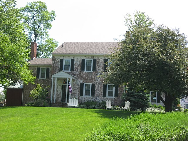
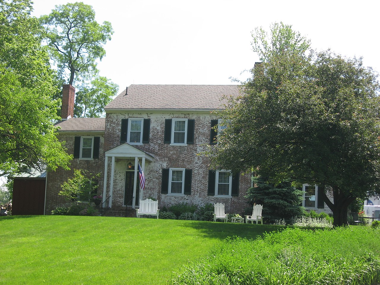
This is an image of a place or building that is listed on the National Register of Historic Places in the United States of America. Its reference number is 80002955. |
| Camera location | | View this and other nearby images on: OpenStreetMap |
|---|
| Description |
English: Front of the farmhouse at the Kenton-Hunt Farm, located at 4690 Urbana Road (State Route 72) north of Springfield in Moorefield Township, Clark County, Ohio, United States. Here Simon Kenton lived before the farmhouse's construction. Built in 1828 and since converted to an inn, the farm is listed on the National Register of Historic Places. |
||
| Date | Taken on 26 May 2010 | ||
| Source | Own work | ||
| Author | Nyttend | ||
| Permission (Reusing this file) |
|
File history
Click on a date/time to view the file as it appeared at that time.
| Date/Time | Thumbnail | Dimensions | User | Comment | |
|---|---|---|---|---|---|
| current | 21:17, 26 May 2010 | | 2,816 × 2,112 (3.27 MB) | Nyttend (talk | contribs) | {{Location|39|59|31|N|83|48|10|W}} {{Information |Description={{en|Front of the farmhouse at the {{w|Kenton-Hunt Farm}}, located at 4690 Urbana Road ({{w|Ohio State Route 72|State Route 72}}) north of {{w|Springfield, Ohio|Springfield}} in {{w|Moorefield |
You cannot overwrite this file.
File usage on Commons
The following page uses this file:
File usage on other wikis
The following other wikis use this file:
- Usage on en.wikipedia.org
- Usage on es.wikipedia.org
- Usage on eu.wikipedia.org
- Usage on fa.wikipedia.org
- Usage on pt.wikipedia.org
- Usage on vi.wikipedia.org
- Usage on www.wikidata.org
- Usage on zh.wikipedia.org