File:Keyesport Illinois with Carlyle Lake filling.jpg
跳转到导航
跳转到搜索
本预览的尺寸:800 × 533像素。 其他分辨率:320 × 213像素 | 640 × 427像素 | 1,024 × 683像素 | 1,500 × 1,000像素。
原始文件 (1,500 × 1,000像素,文件大小:287 KB,MIME类型:image/jpeg)
说明
说明
添加一行文字以描述该文件所表现的内容
| 描述 |
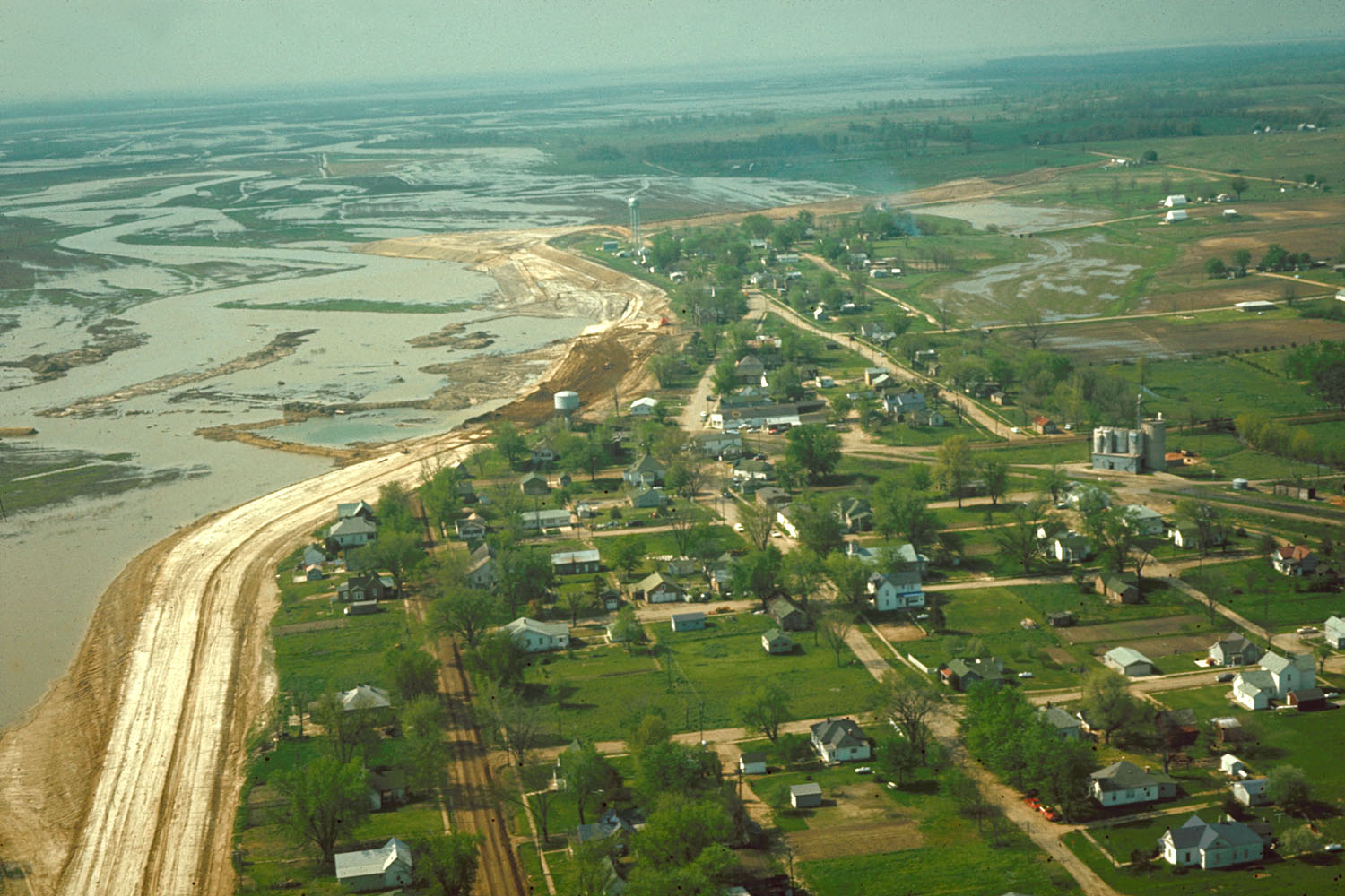
English: Aerial view of Keyesport, Illinois, USA. The photograph was taken in 1967 or 1968 after the Carlyle Lake Dam had been completed and Carlyle Lake was filling. The town now lies directly on the lakeshore. |
|||
| 日期 | 约1968年 | |||
| 来源 |
U.S. Army Corps of Engineers Digital Visual Library Image page Image description page Digital Visual Library home page |
|||
| 作者 | U.S. Army Corps of Engineers, photographer not specified or unknown | |||
| 授权 (二次使用本文件) |
|
|||
| 图中地点 | Keyesport, Illinois, USA |
| 相机位置 | | 在以下服务上查看本图像和附近其他图像: OpenStreetMap |
|---|
文件历史
点击某个日期/时间查看对应时刻的文件。
| 日期/时间 | 缩略图 | 大小 | 用户 | 备注 | |
|---|---|---|---|---|---|
| 当前 | 2007年4月7日 (六) 21:01 | | 1,500 × 1,000(287 KB) | DanMS(留言 | 贡献) | {{Information | Description = {{en|Aerial view of Keyesport, Illinois, USA. The photograph was taken in 1967 or 1968 after the Carlyle Lake Dam had been completed and Carlyle Lake was filling. The town now lies directly on the lakeshore.}} | So |
您不可以覆盖此文件。
文件用途
以下页面使用本文件:
全域文件用途
以下其他wiki使用此文件:
- ar.wikipedia.org上的用途
- ca.wikipedia.org上的用途
- ceb.wikipedia.org上的用途
- cy.wikipedia.org上的用途
- en.wikipedia.org上的用途
- es.wikipedia.org上的用途
- eu.wikipedia.org上的用途
- fr.wikipedia.org上的用途
- ht.wikipedia.org上的用途
- it.wikipedia.org上的用途
- lld.wikipedia.org上的用途
- pl.wikipedia.org上的用途
- pt.wikipedia.org上的用途
- sr.wikipedia.org上的用途
- uk.wikipedia.org上的用途
- vi.wikipedia.org上的用途
- www.wikidata.org上的用途
- zh-min-nan.wikipedia.org上的用途
- zh.wikipedia.org上的用途