File:Kituwah Historical Marker, Ela, NC (45922084404).jpg
Jump to navigation
Jump to search
Size of this preview: 800 × 600 pixels. Other resolutions: 320 × 240 pixels | 640 × 480 pixels | 1,024 × 768 pixels | 1,280 × 960 pixels | 2,560 × 1,920 pixels | 4,032 × 3,024 pixels.
Original file (4,032 × 3,024 pixels, file size: 2.03 MB, MIME type: image/jpeg)
Captions
Captions
Add a one-line explanation of what this file represents
Summary[edit]
.jpg&action=edit§ion=1)
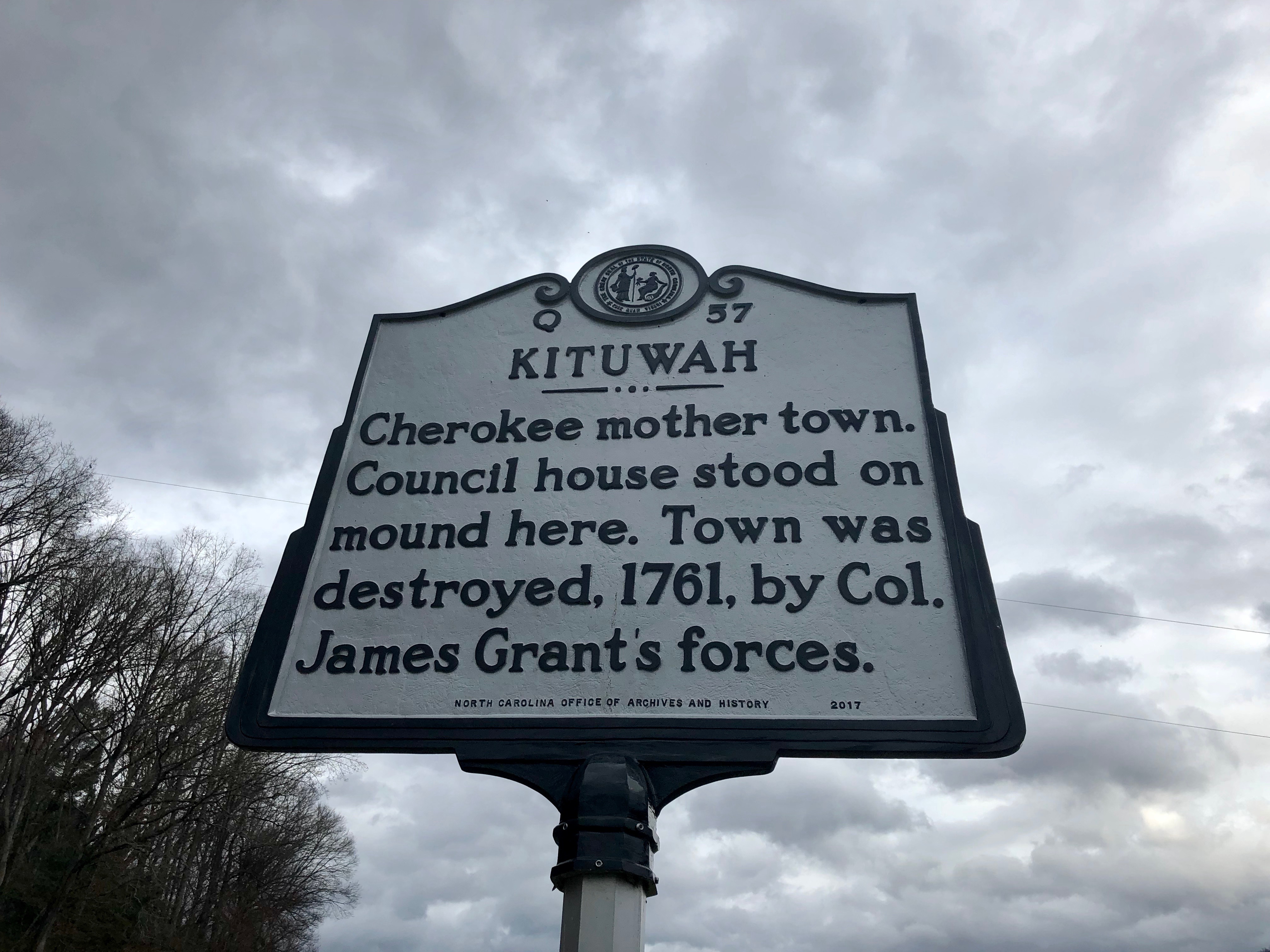
| Description | This is the site of Kituwah, the original settlement and one of the “seven mother towns” of the Cherokee nation in the southeastern United States, located in the bottomlands along the Tuckaseigee River at Ela in Swain County. The site is home to an ancient earthwork mound, likely built by the Mississippian Mound-building culture around 1000 years ago. After the Cherokee culture and identity developed in the region a few centuries later, they held the site in high regard as being sacred, and built a structure atop the mound that housed their sacred flame, kept burning in perpetuity. The inhabitants of the town held great economic, social, and cultural influence over all the “Middle Town” settlements along the Tuckaseigee River and Little Tennessee River. The town was destroyed, along with most of the “Lower Towns” many of the other “Middle Towns” during the Anglo-Cherokee War between 1758 and 1761 by British General James Grant, with the inhabitants scattered to the west, settling at Mialoquo on the Little Tennessee River in modern-day Monroe County, a Tennessee. The town remained part of Cherokee Territory until the 1830s, when they were forced to cede the land to the United States. The area was home to agriculture for the following approximately 160 years, which led to the mound being plowed over and mechanically eroded away, reducing its height to five feet. In 1996, the site was purchased by the Eastern Band of the Cherokee, with archaeological investigations being done, finding a high density of artifacts at the site. The site’s future permanent use is still undetermined, but a consensus has been reached that it should be compatible with the sacred nature of the site. |
| Date | |
| Source | Kituwah Historical Marker, Ela, NC |
| Author | Warren LeMay from Cullowhee, NC, United States |
| Camera location | | View this and other nearby images on: OpenStreetMap |
|---|
.jpg¶ms=035.438706_N_-083.402034_E_globe:Earth_type:camera_source:Flickr_&language=en)
Licensing[edit]
.jpg&action=edit§ion=2)
| This file is made available under the Creative Commons CC0 1.0 Universal Public Domain Dedication. | |
| The person who associated a work with this deed has dedicated the work to the public domain by waiving all of their rights to the work worldwide under copyright law, including all related and neighboring rights, to the extent allowed by law. You can copy, modify, distribute and perform the work, even for commercial purposes, all without asking permission.
|
| This image was originally posted to Flickr by w_lemay at https://flickr.com/photos/59081381@N03/45922084404 (archive). It was reviewed on 25 November 2019 by FlickreviewR 2 and was confirmed to be licensed under the terms of the cc-zero. |
File history
Click on a date/time to view the file as it appeared at that time.
| Date/Time | Thumbnail | Dimensions | User | Comment | |
|---|---|---|---|---|---|
| current | 01:41, 25 November 2019 | | 4,032 × 3,024 (2.03 MB) | Ser Amantio di Nicolao (talk | contribs) | Transferred from Flickr via #flickr2commons |
You cannot overwrite this file.
File usage on Commons
The following page uses this file:
File usage on other wikis
The following other wikis use this file:
- Usage on www.wikidata.org
Metadata
.jpg&oldid=798668274)
Categories:
- Ela, North Carolina
- December 2018 in North Carolina
- Kituwah Historic Marker Q-57
- U.S. Route 19 in North Carolina
- Native American history of North Carolina
- Plaques to Native Americans
- Cherokee
- Memorials of the French and Indian War
- French and Indian War in 1761
- Plaques referencing 1761 in the United States
- 1761 in North Carolina
- Native American history of the 1760s
- Native American villages and towns
- Destroyed towns