File:Klagenfurt Sankt Ruprecht Friedhof und Pfarrkirche Heiliger Ruprecht 24092011 222.jpg
Jump to navigation
Jump to search

Size of this preview: 398 × 599 pixels. Other resolutions: 159 × 240 pixels | 319 × 480 pixels | 510 × 768 pixels | 680 × 1,024 pixels | 1,360 × 2,048 pixels | 2,794 × 4,207 pixels.
Original file (2,794 × 4,207 pixels, file size: 1.63 MB, MIME type: image/jpeg)
Captions
Captions
Add a one-line explanation of what this file represents
Summary
[edit]| Description |
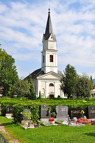
English: Parish church Saint Rupert on Kirchengasse #12 at the 11th district “Sankt Ruprecht”, municipality Klagenfurt on the Lake Woerth, Carinthia, Austria, EU
Deutsch: Stadtpfarrkirche hl. Ruprecht in der Kirchengasse 12 im XI. Bezirk „Sankt Ruprecht“, Landeshauptadt Klagenfurt, Kärnten, Österreich, EU
|
||
| Date | |||
| Source | Own work | ||
| Author | Johann Jaritz | ||
| Permission (Reusing this file) |
I, the copyright holder of this work, hereby publish it under the following licenses:
This file is licensed under the Creative Commons Attribution-Share Alike 3.0 Austria license.
 You may select the license of your choice. |


|
This image was uploaded as part of Wiki Loves Monuments 2011.
|
| Object location | | View this and other nearby images on: OpenStreetMap |
|---|
File history
Click on a date/time to view the file as it appeared at that time.
| Date/Time | Thumbnail | Dimensions | User | Comment | |
|---|---|---|---|---|---|
| current | 18:36, 24 September 2011 | | 2,794 × 4,207 (1.63 MB) | Johann Jaritz (talk | contribs) | {{Information |Description={{en|1=Parish church Saint Ruprecht on the Sankt Ruprecht cemetery in the 11th district “Sankt Ruprecht” of Klagenfurt on the Lake Woerth, Carinthia, Austria}} {{de|1=Pfarrkirche Heiliger Ruprecht am Sankt Ruprechter Friedho |
You cannot overwrite this file.
File usage on Commons
The following 2 pages use this file:
File usage on other wikis
The following other wikis use this file:
- Usage on de.wikipedia.org
- Usage on www.wikidata.org