File:Kobyla Góra (gmina) location map.png
Jump to navigation
Jump to search

Size of this preview: 542 × 599 pixels. Other resolutions: 217 × 240 pixels | 434 × 480 pixels | 674 × 745 pixels.
Original file (674 × 745 pixels, file size: 85 KB, MIME type: image/png)
Captions
Captions
Add a one-line explanation of what this file represents
| Description |
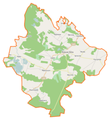
Polski: Mapa gminy Kobyla Góra, Polska
English: Map of Gmina Kobyla Góra, Poland |
|||||||||
| Date | ||||||||||
| Source | You may find a page on the OpenStreetMap wiki page for Kobyla Góra (gmina) | |||||||||
| Creator |
OpenStreetMap contributors OpenStreetMap contributors |
|||||||||
| Permission (Reusing this file) |
OpenStreetMap data is available under the Open Database License (details). Map tiles are licensed under the Creative Commons Attribution-ShareAlike 2.0 license (CC-BY-SA 2.0).
This file is licensed under the Creative Commons Attribution-Share Alike 2.0 Generic license.
|
|||||||||
| Geotemporal data | ||||||||||
| Bounding box |
|
|||||||||
| Georeferencing | If inappropriate please set warp_status = skip to hide. | |||||||||
File history
Click on a date/time to view the file as it appeared at that time.
| Date/Time | Thumbnail | Dimensions | User | Comment | |
|---|---|---|---|---|---|
| current | 20:06, 18 December 2014 | | 674 × 745 (85 KB) | VanWiel (talk | contribs) | {{OpenStreetMap | name = Kobyla Góra (gmina) | location = Kobyla Góra (gmina) | description = {{pl|Mapa gminy Kobyla Góra, Polska}} {{en|Map of Gmina Kobyla Góra, Poland}} | top = 51.4476 | bottom... |
You cannot overwrite this file.
File usage on Commons
There are no pages that use this file.
File usage on other wikis
The following other wikis use this file:
- Usage on fr.wikipedia.org
- Usage on pl.wikipedia.org
- Kobyla Góra (województwo wielkopolskie)
- Kobyla Góra (gmina)
- Bałdowice
- Kuźnica Myślniewska
- Marcinki (wieś)
- Myślniew
- Parzynów
- Rybin
- Zmyślona Ligocka
- Bierzów (województwo wielkopolskie)
- Ignaców (województwo wielkopolskie)
- Mąkoszyce (województwo wielkopolskie)
- Pisarzowice (województwo wielkopolskie)
- Ligota (powiat ostrzeszowski)
- Mostki (powiat ostrzeszowski)
- Kobyla Góra (Wzgórza Ostrzeszowskie)
- Zmyślona Parzynowska
- Cmentarz żydowski w Kobylej Górze
- Parafia św. Jadwigi Śląskiej w Kobylej Górze
- Parafia św. Mikołaja w Parzynowie
- Kościół św. Jadwigi Śląskiej w Kobylej Górze
- Kościół św. Mikołaja w Parzynowie
- Marcinki (SIMC 0200199)
- Marcinki (SIMC 0200182)
- Wilcze Oko
- Kościół ewangelicki w Pisarzowicach
- Moduł:Mapa/dane/Kobyla Góra (gmina)
- Lipnik (Kobyla Góra)
- Wesoła (Kobyla Góra)
- Pustki (Kobyla Góra)
- Sójka (Kobyla Góra)
- Parafia Najświętszego Serca Pana Jezusa i Wszystkich Świętych w Mąkoszycach
- Blewązka
- Kościół ewangelicki w Kobylej Górze
View more global usage of this file.
_location_map.png)
_location_map.png&oldid=519970384)