File:Kokudo457GoKurikoma.jpg
Jump to navigation
Jump to search

Size of this preview: 800 × 600 pixels. Other resolutions: 320 × 240 pixels | 640 × 480 pixels | 1,024 × 768 pixels | 1,280 × 960 pixels | 1,600 × 1,200 pixels.
Original file (1,600 × 1,200 pixels, file size: 966 KB, MIME type: image/jpeg)
Captions
Captions
Add a one-line explanation of what this file represents
Summary[edit]
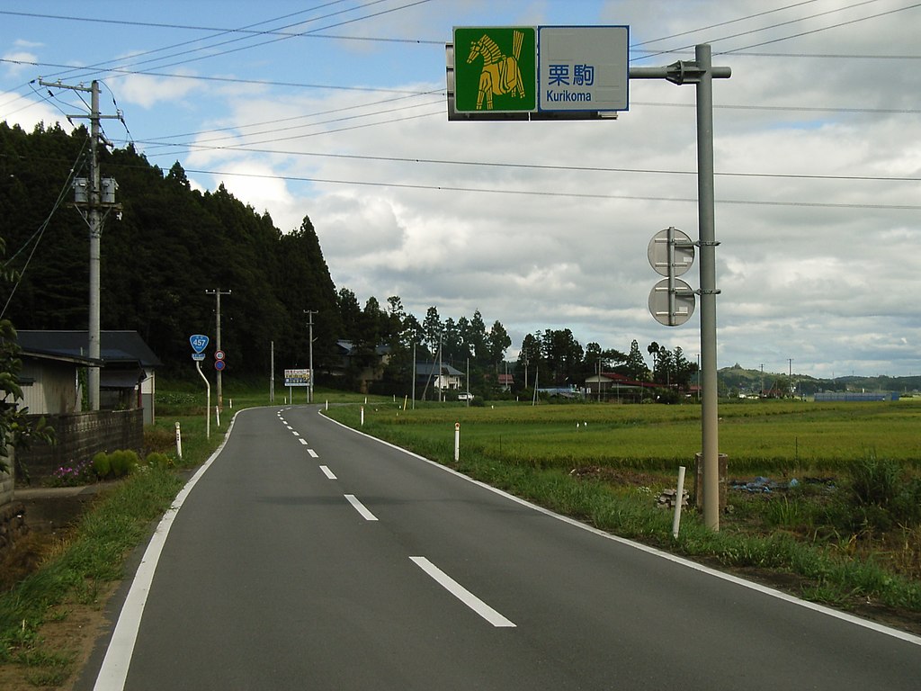
| Description | Route 457 (National Highway 457) of Japan. Kurihara, Miyagi prefecture, Japan. |
| Date | |
| Source | Own work |
| Author | Kinori |
English: Route 457 - Kurihara, Miyagi prefecture, Japan. Border of recently annexed Uguisuzawa and Kurikoma town. So the sign is partly painted white. The picture is a horce toy made by rice straw.
Español: Carretera Nacional 457 - Kurihara, la prefectura de Miyagi, Japōn. Había sido el línea del Municipio Uguisuzawa y el Municipio Kurikoma hasta la fusión al Municipio Kurikoma. Por lo que un parte del señal se pinta de blanco. El cuadro es un juguete de caballo de para.
Licensing[edit]
| I, the copyright holder of this work, release this work into the public domain. This applies worldwide. In some countries this may not be legally possible; if so: I grant anyone the right to use this work for any purpose, without any conditions, unless such conditions are required by law. |
File history
Click on a date/time to view the file as it appeared at that time.
| Date/Time | Thumbnail | Dimensions | User | Comment | |
|---|---|---|---|---|---|
| current | 21:18, 25 October 2007 | | 1,600 × 1,200 (966 KB) | Kinori (talk | contribs) | {{Information |Description=Route 457 (National Highway 457) of Japan. Kurihara, Miyagi prefecture, Japan. |Source=self-made |Date=2005/98/08 |Author= Kinori }} {{ja}} '''ja:国道457号''' - 日本国、宮城県、ja:栗原市 |
You cannot overwrite this file.
File usage on Commons
The following page uses this file:
File usage on other wikis
The following other wikis use this file:
- Usage on en.wikipedia.org
- Usage on ja.wikipedia.org
- Usage on www.wikidata.org