File:Komisariat SG Horodenka.png
Jump to navigation
Jump to search

Size of this preview: 676 × 600 pixels. Other resolutions: 271 × 240 pixels | 541 × 480 pixels | 866 × 768 pixels | 1,252 × 1,111 pixels.
Original file (1,252 × 1,111 pixels, file size: 2.53 MB, MIME type: image/png)
Captions
Captions
Add a one-line explanation of what this file represents
Summary
[edit]
| Description |
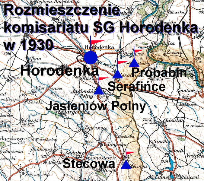
Polski: Rozmieszczenie komisariatu SG Horodenka w 1930 |
|||||
| Date | ||||||
| Source |
Baza mapy: Wojskowy Instytut Geograficzny, arkusz 97 - rok wydania 1930, skala 1:300 000,
|
|||||
| Author | Baza mapy: WIG, arkusz 97, rok wydania 1930, Mapa ze znakami taktycznymi -Kerim44 |
File history
Click on a date/time to view the file as it appeared at that time.
| Date/Time | Thumbnail | Dimensions | User | Comment | |
|---|---|---|---|---|---|
| current | 15:59, 7 January 2018 | | 1,252 × 1,111 (2.53 MB) | Kerim44 (talk | contribs) | {{Information |Description ={{pl|1=Horodenka}} |Source ={{own}} |Author =Kerim44 |Date = |Permission = |other_versions = }} |
You cannot overwrite this file.
File usage on Commons
There are no pages that use this file.
File usage on other wikis
The following other wikis use this file: