File:Korolev E I.jpg
Jump to navigation
Jump to search

Size of this preview: 394 × 599 pixels. Other resolutions: 158 × 240 pixels | 315 × 480 pixels | 505 × 768 pixels | 673 × 1,024 pixels | 1,534 × 2,334 pixels.
Original file (1,534 × 2,334 pixels, file size: 273 KB, MIME type: image/jpeg)
Captions
Captions
Add a one-line explanation of what this file represents
Summary
[edit]
| Description |
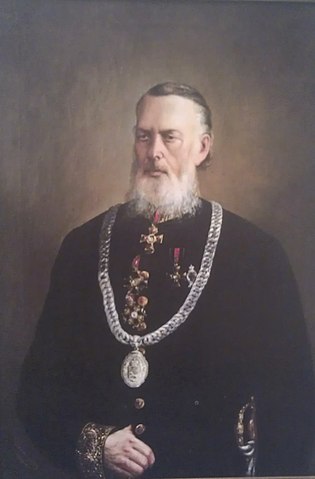
Русский: Евграф Иванович Королёв |
| Date | |
| Source | Томский областной краеведческий музей |
| Author | Винокуров |
| Camera location | | View this and other nearby images on: OpenStreetMap |
|---|
Licensing
[edit]
|
This is a faithful photographic reproduction of a two-dimensional, public domain work of art. The work of art itself is in the public domain for the following reason:
The official position taken by the Wikimedia Foundation is that "faithful reproductions of two-dimensional public domain works of art are public domain".
This photographic reproduction is therefore also considered to be in the public domain in the United States. In other jurisdictions, re-use of this content may be restricted; see Reuse of PD-Art photographs for details. | ||||
File history
Click on a date/time to view the file as it appeared at that time.
| Date/Time | Thumbnail | Dimensions | User | Comment | |
|---|---|---|---|---|---|
| current | 20:30, 10 October 2013 | | 1,534 × 2,334 (273 KB) | Bogdanov-62 (talk | contribs) | User created page with UploadWizard |
You cannot overwrite this file.
File usage on Commons
There are no pages that use this file.
File usage on other wikis
The following other wikis use this file:
- Usage on ru.wikipedia.org
- Usage on www.wikidata.org