File:Krakow tram line 17.svg
Jump to navigation
Jump to search

Size of this PNG preview of this SVG file: 800 × 473 pixels. Other resolutions: 320 × 189 pixels | 640 × 378 pixels | 1,024 × 605 pixels | 1,280 × 757 pixels | 2,560 × 1,514 pixels | 1,030 × 609 pixels.
Original file (SVG file, nominally 1,030 × 609 pixels, file size: 45 KB)
Captions
Captions
Add a one-line explanation of what this file represents
Summary
[edit]
| Description |
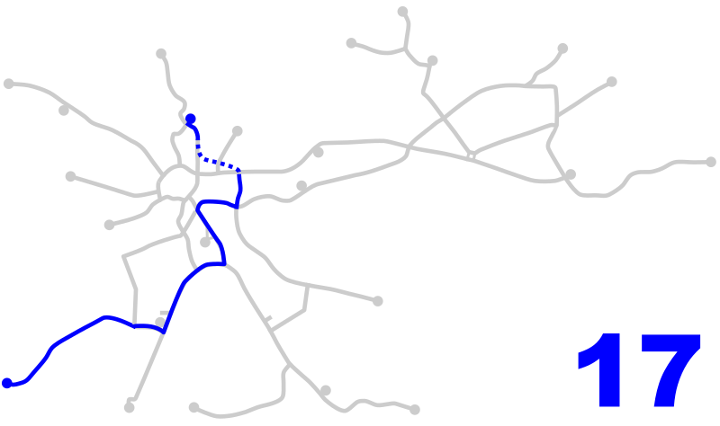
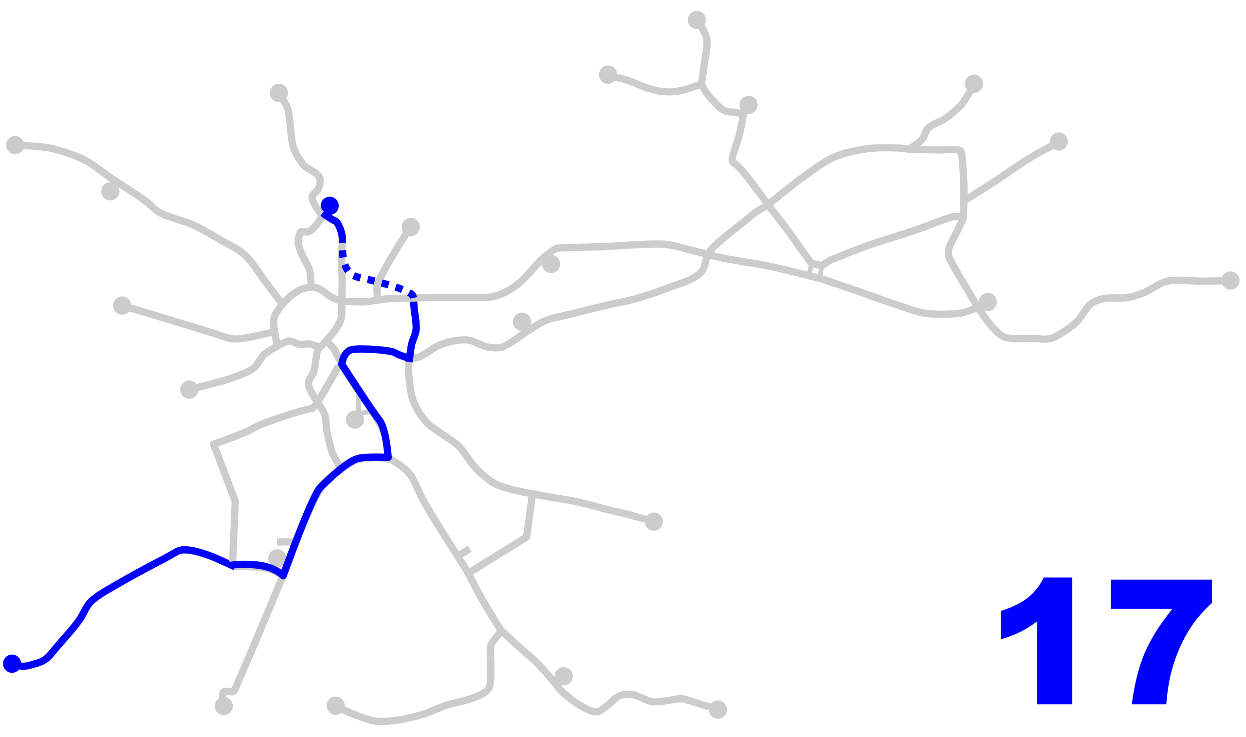
English: Tram line 17 in Kraków - dashed line shows the extended rush hour route.
Polski: Linia tramwajowa 17 w Krakowie - linia przerywana oznacza rozszerzoną trasę kursów wariantowych w godzinach szczytu. |
| Date | |
| Source | Own work |
| Author | Zyxist |
Licensing
[edit]
| I, the copyright holder of this work, release this work into the public domain. This applies worldwide. In some countries this may not be legally possible; if so: I grant anyone the right to use this work for any purpose, without any conditions, unless such conditions are required by law. |
File history
Click on a date/time to view the file as it appeared at that time.
| Date/Time | Thumbnail | Dimensions | User | Comment | |
|---|---|---|---|---|---|
| current | 09:18, 30 December 2019 | | 1,030 × 609 (45 KB) | Astero77 (talk | contribs) | There was bad route of line 17 since 3 September of 2018. |
| 11:21, 23 February 2018 |  | 1,030 × 609 (45 KB) | Winnetou14 (talk | contribs) | route change 2018 | |
| 07:34, 31 October 2010 |  | 1,030 × 609 (37 KB) | Zyxist (talk | contribs) | Route change. | |
| 10:42, 2 August 2010 |  | 1,030 × 609 (37 KB) | Zyxist (talk | contribs) | New track open - 3/4 August 2010. | |
| 10:51, 5 July 2010 |  | 1,030 × 609 (62 KB) | Zyxist (talk | contribs) | {{Information |Description={{en|1=Tram line 17 in Kraków - dashed line shows the extended rush hour route.}} {{pl|1=Linia tramwajowa 17 w Krakowie - linia przerywana oznacza rozszerzoną trasę kursów wariantowych w godzinach szczytu.}} |Source={{own}} |
You cannot overwrite this file.
File usage on Commons
The following 7 pages use this file:
- User:Chumwa/OgreBot/Potential transport maps/2018 February 19-28
- User:Chumwa/OgreBot/Potential transport maps/2019 December 21-31
- User:Chumwa/OgreBot/Public transport information/2018 February 19-28
- User:Chumwa/OgreBot/Public transport information/2019 December 21-31
- User:Chumwa/OgreBot/Transport Maps/2018 February 19-28
- User:Chumwa/OgreBot/Transport Maps/2019 December 21-31
- User:Chumwa/OgreBot/Travel and communication maps/2018 February 19-28