File:KrasnayaZarya1939.jpg
Jump to navigation
Jump to search
No higher resolution available.
KrasnayaZarya1939.jpg (450 × 475 pixels, file size: 121 KB, MIME type: image/jpeg)
Captions
Captions
Add a one-line explanation of what this file represents
Summary
[edit]
| Description |
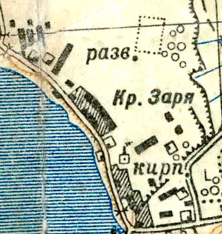
Русский: Топографическая карта Ленинградской области, квадрат О-36-2-А-в (Ново-Саратовская колония), посёлок Красная Заря и посёлок Рабочий |
| Date | |
| Source | http://maps.mapywig.org/m/Russian_and_Soviet_maps/series/025K/O-36-2-A-v_(NOVO-SARATOVSKAYA_KOLONIYA).jpg |
| Author | Производственное объединение «Геокартпром» Военно-Топографического Управления ГУРККА. |
.jpg)
Licensing
[edit]
|
This work is in the public domain in its country of origin and other countries and areas where the copyright term is the author's life plus 70 years or fewer. | |
| This file has been identified as being free of known restrictions under copyright law, including all related and neighboring rights. | |
File history
Click on a date/time to view the file as it appeared at that time.
| Date/Time | Thumbnail | Dimensions | User | Comment | |
|---|---|---|---|---|---|
| current | 18:26, 24 March 2016 | | 450 × 475 (121 KB) | Valeriy10f (talk | contribs) | {{Information |Description ={{ru|1=== {{int:filedesc}} == {{Information |Description ={{ru|1= Топографическая карта Ленинградской области, квадрат О-36-2-А-в (Ново-Саратовская ко... |
You cannot overwrite this file.
File usage on Commons
There are no pages that use this file.
File usage on other wikis
The following other wikis use this file:
- Usage on ru.wikipedia.org