File:Kreis-Herford-Admin-68.png
Jump to navigation
Jump to search
Size of this preview: 800 × 534 pixels. Other resolutions: 320 × 214 pixels | 640 × 427 pixels | 1,024 × 683 pixels | 1,280 × 854 pixels | 2,392 × 1,596 pixels.
Original file (2,392 × 1,596 pixels, file size: 435 KB, MIME type: image/png)
Captions
Captions
Add a one-line explanation of what this file represents
| Description |
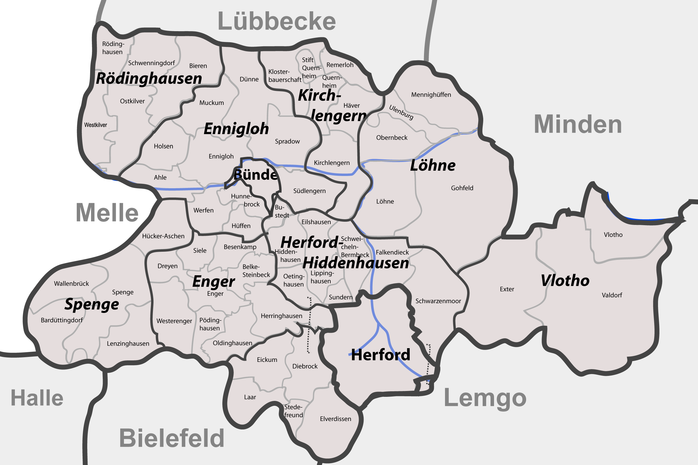
English: Districts (Ämter) and communities (Gemeinden, Städte) in rural and urban district of Herford as of 12-31-1968 before beeing reincorporated as a “new” district of Herford. |
| Date |
11 October 2007 (original upload date) |
| Source | Based on Google Earth and Geoserver NRW |
| Author | Me, myself and I: de:Benutzer:TUBS |
| Permission (Reusing this file) |
Use it and improve it |
| Other versions | Adobe Illustator vector graphics available |
| Object location | | View this and other nearby images on: OpenStreetMap |
|---|
Licensing
[edit]
| I, the copyright holder of this work, release this work into the public domain. This applies worldwide. In some countries this may not be legally possible; if so: I grant anyone the right to use this work for any purpose, without any conditions, unless such conditions are required by law. |
Original upload log
[edit]
Transferred from de.wikipedia to Commons by TUBS using CommonsHelper.
The original description page was here. All following user names refer to de.wikipedia.
- 2007-10-11 20:43 TUBS 2392×1596× (445369 bytes) Bruchmühlen was Westkilver back then
- 2007-10-11 20:40 TUBS 2392×1596× (445369 bytes) {{Information |Beschreibung = |Quelle = |Urheber = |Datum = |Genehmigung = |Andere Versionen = |Anmerkungen = }}
- 2007-10-11 15:48 TUBS 2392×1596× (445266 bytes) {{Information |Beschreibung = |Quelle = |Urheber = |Datum = |Genehmigung = |Andere Versionen = |Anmerkungen = }}
- 2007-10-11 11:37 TUBS 1871×1232× (388399 bytes) {{Information |Beschreibung = |Quelle = |Urheber = |Datum = |Genehmigung = |Andere Versionen = |Anmerkungen = }}
File history
Click on a date/time to view the file as it appeared at that time.
| Date/Time | Thumbnail | Dimensions | User | Comment | |
|---|---|---|---|---|---|
| current | 14:55, 27 December 2008 | | 2,392 × 1,596 (435 KB) | File Upload Bot (Magnus Manske) (talk | contribs) | {{BotMoveToCommons|de.wikipedia}} {{Information |Description={{de|Maps of de:Kreis Herford (Germany) series. Shows districts (Ãmter) and communities (Gemeinden, Städte) in rural and urban district of Herford as of 12 |
You cannot overwrite this file.
File usage on Commons
There are no pages that use this file.
File usage on other wikis
The following other wikis use this file:
- Usage on de.wikipedia.org
- Usage on ja.wikipedia.org