File:Kunene River System OSM.png
Jump to navigation
Jump to search
Size of this preview: 540 × 600 pixels. Other resolutions: 216 × 240 pixels | 432 × 480 pixels | 946 × 1,051 pixels.
Original file (946 × 1,051 pixels, file size: 1.27 MB, MIME type: image/png)
Captions
Captions
Add a one-line explanation of what this file represents
Summary[edit]
| Description |
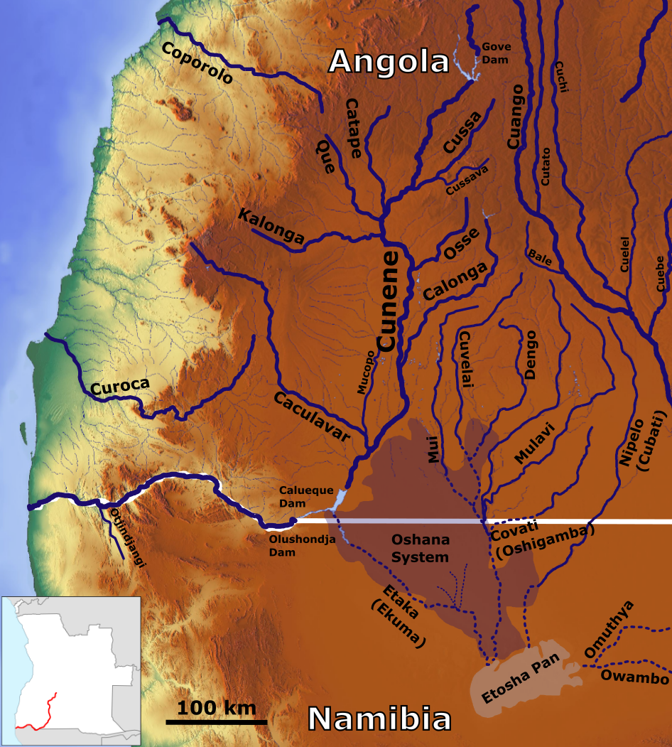
English: The Kunene River with its Tributaries, the Oshana system and the Etosha Pan_OSM, Based up on US Army map SE33 |
| Date | |
| Source | https://maps-for-free.com, https://maps.lib.utexas.edu/maps/imw/, Location map:https://commons.wikimedia.org/wiki/File:Angola_hydrologyWO.svg |
| Author | Hans Braxmeier & Peter in s, Location map:Ruben JC Furtado |
This file is licensed under the Creative Commons Attribution-Share Alike 2.0 Generic license.
- You are free:
- to share – to copy, distribute and transmit the work
- to remix – to adapt the work
- Under the following conditions:
- attribution – You must give appropriate credit, provide a link to the license, and indicate if changes were made. You may do so in any reasonable manner, but not in any way that suggests the licensor endorses you or your use.
- share alike – If you remix, transform, or build upon the material, you must distribute your contributions under the same or compatible license as the original.
File history
Click on a date/time to view the file as it appeared at that time.
| Date/Time | Thumbnail | Dimensions | User | Comment | |
|---|---|---|---|---|---|
| current | 17:49, 21 March 2020 | | 946 × 1,051 (1.27 MB) | Peter in s (talk | contribs) | {{Information |description ={{en|1=The Kunene River with its Tributaries, the Oshana system and the Etosha Pan_OSM}} |date =2020-03-21 |source =https://maps-for-free.com |author =Hans Braxmeier & Peter in s }} {{cc-by-sa-2.0}} Category:Maps of rivers of Angola Category:Rivers of Namibia |
You cannot overwrite this file.
File usage on Commons
The following 3 pages use this file:
File usage on other wikis
The following other wikis use this file:
- Usage on de.wikipedia.org
- Usage on en.wikipedia.org
- Usage on fi.wikipedia.org