File:Léman CarteTectonique.svg
Jump to navigation
Jump to search

Size of this PNG preview of this SVG file: 600 × 600 pixels. Other resolutions: 240 × 240 pixels | 480 × 480 pixels | 768 × 768 pixels | 1,024 × 1,024 pixels | 2,048 × 2,048 pixels | 1,525 × 1,525 pixels.
Original file (SVG file, nominally 1,525 × 1,525 pixels, file size: 140 KB)
Captions
Captions
Add a one-line explanation of what this file represents
Summary
[edit]
| Description |
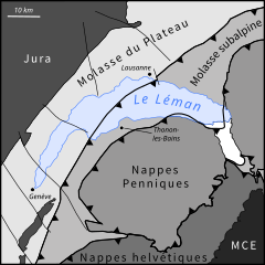
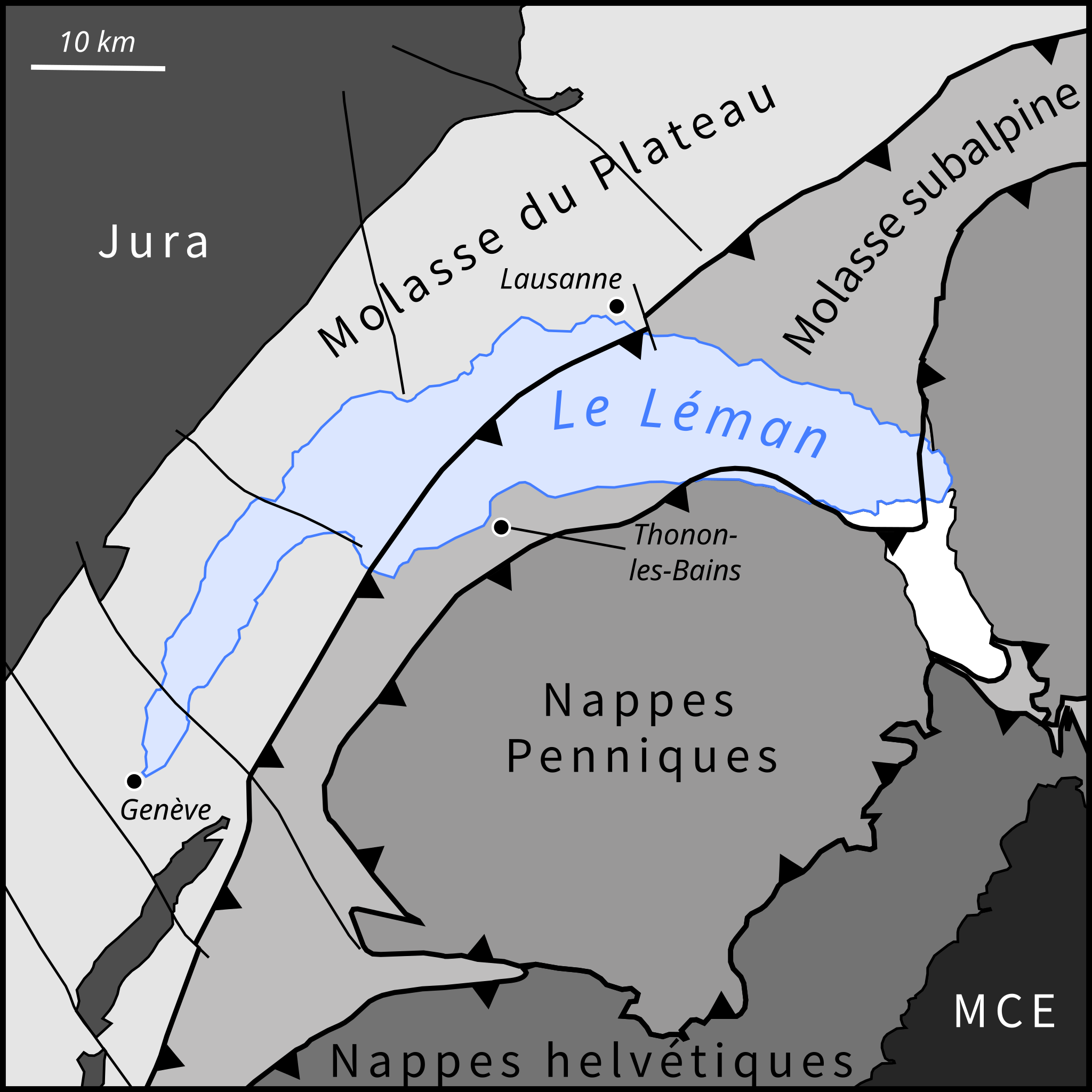
Français : Carte tectonique simplifiée de la région lémanique. MCE = Massifs cristallins externes |
| Date | |
| Source | Own work à partir de la carte tectonique de la Suisse au 1/500 000e et de la figure 1 de "Analyse structurale de la région lémanique basée sur la sismique réflexion dans le Léman (Grand Lac et Haut Lac) et la géologie des rives nord et sud" (Dupuy et al., 2014). |
| Author | JRagusa |
| Other versions | Derivative works of this file: Léman CarteTectonique.png |
Licensing
[edit]
I, the copyright holder of this work, hereby publish it under the following license:
This file is licensed under the Creative Commons Attribution-Share Alike 4.0 International license.
- You are free:
- to share – to copy, distribute and transmit the work
- to remix – to adapt the work
- Under the following conditions:
- attribution – You must give appropriate credit, provide a link to the license, and indicate if changes were made. You may do so in any reasonable manner, but not in any way that suggests the licensor endorses you or your use.
- share alike – If you remix, transform, or build upon the material, you must distribute your contributions under the same or compatible license as the original.
File history
Click on a date/time to view the file as it appeared at that time.
| Date/Time | Thumbnail | Dimensions | User | Comment | |
|---|---|---|---|---|---|
| current | 18:48, 2 November 2023 | | 1,525 × 1,525 (140 KB) | JRagusa (talk | contribs) | Changement de nappes subalpines pour nappes helvétiques |
| 18:22, 8 August 2022 |  | 1,525 × 1,525 (131 KB) | JRagusa (talk | contribs) | Changement des nom de reliefs par les unités tectoniques repesctives | |
| 17:25, 22 July 2022 |  | 1,525 × 1,525 (138 KB) | JRagusa (talk | contribs) | Texte en chemins | |
| 13:37, 21 June 2022 |  | 1,525 × 1,525 (76 KB) | JRagusa (talk | contribs) | Uploaded own work with UploadWizard |
You cannot overwrite this file.
File usage on Commons
There are no pages that use this file.
File usage on other wikis
The following other wikis use this file:
- Usage on fr.wikipedia.org