File:LE MONT NOIR à Saint Jans Cappel - Flandres Françaises - château des familles Dufresne puis de Crayencourt.jpg
Jump to navigation
Jump to search

Size of this preview: 800 × 501 pixels. Other resolutions: 320 × 200 pixels | 640 × 401 pixels | 1,024 × 641 pixels | 1,280 × 801 pixels | 2,560 × 1,602 pixels | 3,347 × 2,095 pixels.
Original file (3,347 × 2,095 pixels, file size: 3.82 MB, MIME type: image/jpeg)
Captions
Captions
Add a one-line explanation of what this file represents
Summary
[edit]
| Description |
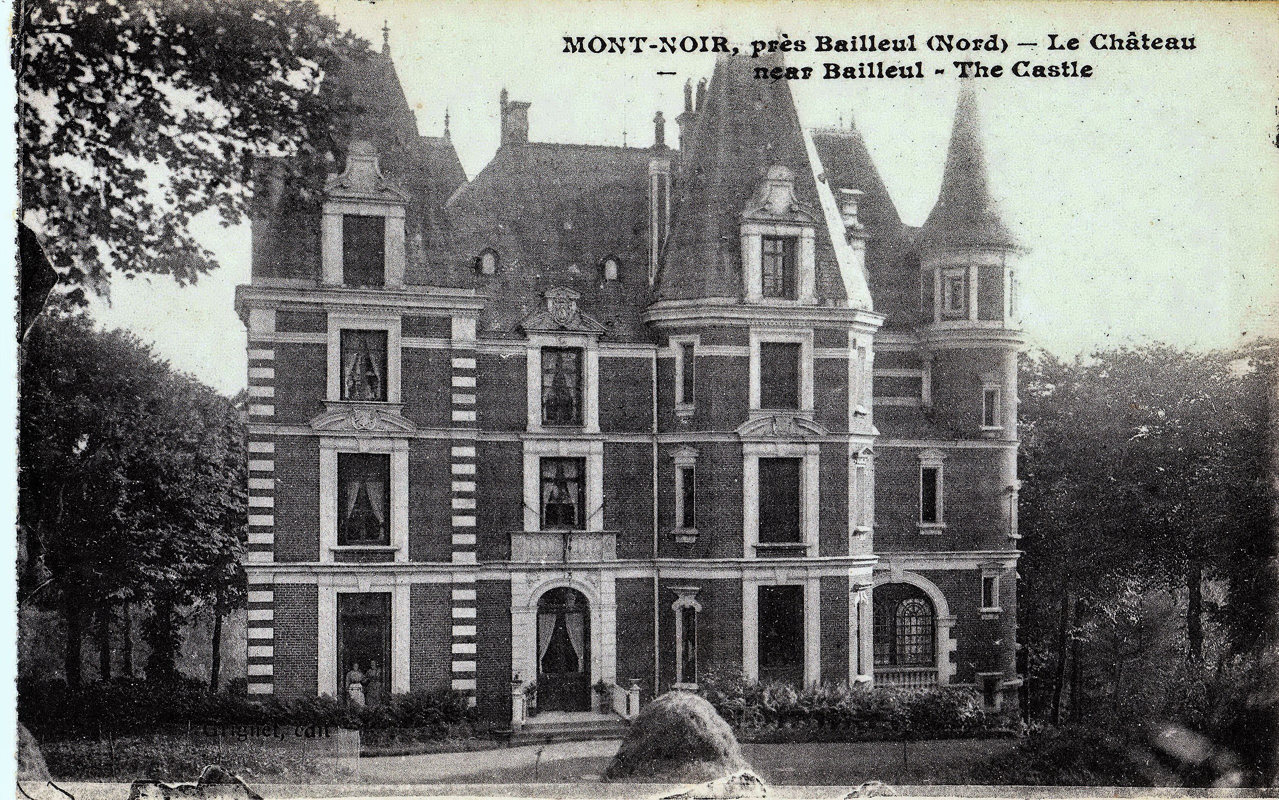
Français : château d'enfance de l'écrivaine Marguerite YOURCENAR construit en 1824
voir : https://fr.wikipedia.org/wiki/Famille_Cleenewerck_de_Crayencour
English: Le Mont Noir (The Black Mount )" municipality of saint Jans Cappel - French Flanders . Castle of childhood of the writer Marguerite YOURCENAR , destroyed during the WWI
Nederlands: Kasteel van Zwart-Berg, Frans-Vlaanderen. Vernietigd tijdens de Eerste Wereldoorlog
zien : https://nl.wikipedia.org/wiki/Villa_Marguerite_Yourcenar |
| Date | |
| Source | collection personnelle de cartes anciennes |
| Author | éditeur Ernest le Deley 127 boulevard de Sébastopol paris (-prise de vue : plus de 100 ans) |
| Camera location | | View this and other nearby images on: OpenStreetMap |
|---|
Licensing
[edit]
|
This work is in the public domain in its country of origin and other countries and areas where the copyright term is the author's life plus 70 years or fewer. This work is in the public domain in the United States because it was published (or registered with the U.S. Copyright Office) before January 1, 1929. | |
| This file has been identified as being free of known restrictions under copyright law, including all related and neighboring rights. | |
File history
Click on a date/time to view the file as it appeared at that time.
| Date/Time | Thumbnail | Dimensions | User | Comment | |
|---|---|---|---|---|---|
| current | 10:52, 19 August 2017 | | 3,347 × 2,095 (3.82 MB) | Jpcuvelier (talk | contribs) | User created page with UploadWizard |
You cannot overwrite this file.
File usage on Commons
There are no pages that use this file.
File usage on other wikis
The following other wikis use this file:
- Usage on fr.wikipedia.org
- Usage on it.wikipedia.org
- Usage on ja.wikipedia.org