File:LIE Calvary Cem jeh.jpg
Jump to navigation
Jump to search

Size of this preview: 800 × 580 pixels. Other resolutions: 320 × 232 pixels | 640 × 464 pixels | 1,024 × 743 pixels | 1,280 × 929 pixels | 2,560 × 1,857 pixels | 4,116 × 2,986 pixels.
Original file (4,116 × 2,986 pixels, file size: 2.1 MB, MIME type: image/jpeg)
Captions
Captions
Add a one-line explanation of what this file represents
Summary
[edit]
| Description |
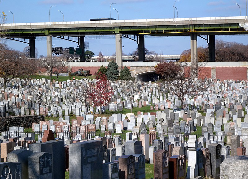
English: Looking northwest from 55th Avenue across New Calvary Cemetery at LIE viaduct on a sunny midday. EXIF location is approx 1 km too far west, due to photographer's error. |
| Date | Taken on 22 November 2009 |
| Source | Own work |
| Author | Jim.henderson |
| Camera location | | View this and other nearby images on: OpenStreetMap |
|---|
Licensing
[edit]
| This file is made available under the Creative Commons CC0 1.0 Universal Public Domain Dedication. | |
| The person who associated a work with this deed has dedicated the work to the public domain by waiving all of their rights to the work worldwide under copyright law, including all related and neighboring rights, to the extent allowed by law. You can copy, modify, distribute and perform the work, even for commercial purposes, all without asking permission.
|
File history
Click on a date/time to view the file as it appeared at that time.
| Date/Time | Thumbnail | Dimensions | User | Comment | |
|---|---|---|---|---|---|
| current | 23:17, 3 December 2009 | | 4,116 × 2,986 (2.1 MB) | Jim.henderson (talk | contribs) | {{Information |Description={{en|1=Looking northwest across Calvary Cemetery at LIE viaduct on a sunny midday Category:Interstate 495 (New York)}} |Source={{own}} |Author=Jim.henderson |Date=2009-11-22 |Permission= |other_version |
You cannot overwrite this file.
File usage on Commons
The following 3 pages use this file:
File usage on other wikis
The following other wikis use this file:
- Usage on en.wikipedia.org
- Usage on no.wikipedia.org
- Usage on www.wikidata.org
Metadata
Categories:
- Calvary Cemetery (Queens)
- Queens–Midtown Expressway (Interstate 495) upper level from Brooklyn-Queens Expressway to Maurice Avenue
- Trestle bridges in the United States
- November 2009 in New York City
- Queens–Midtown Expressway (Interstate 495) lower level from Brooklyn-Queens Expressway to Maurice Avenue
- Cemeteries in 2009