File:LK6509-Garching-Süd-Luftbild.jpg
跳至導覽
跳至搜尋

預覽大小:800 × 545 像素。 其他解析度:320 × 218 像素 | 640 × 436 像素 | 1,024 × 698 像素 | 1,280 × 872 像素 | 2,861 × 1,950 像素。
原始檔案 (2,861 × 1,950 像素,檔案大小:4.68 MB,MIME 類型:image/jpeg)
說明
說明
添加單行說明來描述出檔案所代表的內容
摘要[編輯]
| 描述 |
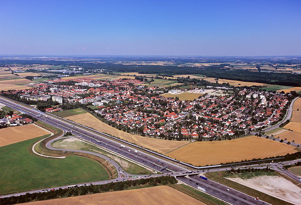
English: Aerial photograph of Garching town. Garching is situated 15 kilometres north of Munich. The motorway A9 from Munich to Berlin passes the western side of Garching. Many research facilities of the Munich universities and private companies reside in Garching.
Deutsch: Luftbildaufnahme von Garching. Garching liegt 15 km Norden Münchens. Die Bundesautobahn A9 von München nach Berlin führt an Garching im Westen vorbei. Viele Forschungseinrichtungen der Münchner Universitäten und Unternehmen haben hier ihren Sitz. |
||||
| 日期 | |||||
| 來源 | 自己的作品 | ||||
| 作者 | M-Luftbild | ||||
| 授權許可 (重用此檔案) |
If you want to use this file commercially, you have to do this under the terms of the GFDL.
|

| 拍攝地點 | | 位於此地的本圖片與其他圖片: OpenStreetMap |
|---|
授權條款[編輯]
我,本作品的著作權持有者,決定用以下授權條款發佈本作品:
此檔案採用創用CC 姓名標示-相同方式分享 3.0 未在地化版本授權條款。
- 您可以自由:
- 分享 – 複製、發佈和傳播本作品
- 重新修改 – 創作演繹作品
- 惟需遵照下列條件:
- 姓名標示 – 您必須指名出正確的製作者,和提供授權條款的連結,以及表示是否有對內容上做出變更。您可以用任何合理的方式來行動,但不得以任何方式表明授權條款是對您許可或是由您所使用。
- 相同方式分享 – 如果您利用本素材進行再混合、轉換或創作,您必須基於如同原先的相同或兼容的條款,來分布您的貢獻成品。
| 註解 | 該圖片含有註解:在維基媒體共享資源上查看註解 |
|
|
檔案歷史
點選日期/時間以檢視該時間的檔案版本。
| 日期/時間 | 縮圖 | 尺寸 | 使用者 | 備註 | |
|---|---|---|---|---|---|
| 目前 | 2011年6月6日 (一) 20:35 | | 2,861 × 1,950(4.68 MB) | Lmbuga(留言 | 貢獻) | Vignetting, noise, unsharp... |
| 2009年11月18日 (三) 20:09 |  | 2,926 × 2,034(2.28 MB) | M-Luftbild(留言 | 貢獻) | {{Information |Description={{en|1=Aerial photograph of Garching town. Garching is situated 15 kilometres north of Munich. The motorway A9 from Munich to Berlin passes the western side of Garching. Many research facilities of the Munich universities and pr |
無法覆蓋此檔案。
檔案用途
下列7個頁面有用到此檔案:
- Garching bei München
- User talk:M-Luftbild
- Commons:Quality images/Subject/Places/Man made structures/Buildings, Exterior/Part 1
- Commons:Quality images candidates/Archives June 2011
- Commons talk:Quality images/Subject/Places/Man made structures
- Category:Garching bei München
- Category:Views of Garching bei München
全域檔案使用狀況
以下其他 wiki 使用了這個檔案:
- an.wikipedia.org 的使用狀況
- ar.wikipedia.org 的使用狀況
- azb.wikipedia.org 的使用狀況
- ceb.wikipedia.org 的使用狀況
- ce.wikipedia.org 的使用狀況
- da.wikipedia.org 的使用狀況
- de.wikipedia.org 的使用狀況
- de.wikivoyage.org 的使用狀況
- en.wikipedia.org 的使用狀況
- en.wikivoyage.org 的使用狀況
- es.wikipedia.org 的使用狀況
- fa.wikipedia.org 的使用狀況
- fi.wikipedia.org 的使用狀況
- fr.wikipedia.org 的使用狀況
- he.wikipedia.org 的使用狀況
- hu.wikipedia.org 的使用狀況
- hy.wikipedia.org 的使用狀況
- id.wikipedia.org 的使用狀況
- it.wikipedia.org 的使用狀況
- ja.wikipedia.org 的使用狀況
- ku.wikipedia.org 的使用狀況
- lld.wikipedia.org 的使用狀況
- lmo.wikipedia.org 的使用狀況
- ms.wikipedia.org 的使用狀況
- nl.wikipedia.org 的使用狀況
- no.wikipedia.org 的使用狀況
- pl.wikipedia.org 的使用狀況
- pt.wikipedia.org 的使用狀況
- ro.wikipedia.org 的使用狀況
- ru.wikipedia.org 的使用狀況
- simple.wikipedia.org 的使用狀況
- sk.wikipedia.org 的使用狀況
- sr.wikipedia.org 的使用狀況
- sv.wikipedia.org 的使用狀況
- tr.wikipedia.org 的使用狀況
- tt.wikipedia.org 的使用狀況
- uk.wikipedia.org 的使用狀況
- uz.wikipedia.org 的使用狀況
- vi.wikipedia.org 的使用狀況
- www.wikidata.org 的使用狀況
- zh.wikipedia.org 的使用狀況