File:LROtopography.jpg
Jump to navigation
Jump to search
Size of this preview: 800 × 600 pixels. Other resolutions: 320 × 240 pixels | 640 × 480 pixels | 1,000 × 750 pixels.
Original file (1,000 × 750 pixels, file size: 530 KB, MIME type: image/jpeg)
Captions
Captions
Add a one-line explanation of what this file represents
Summary
[edit]
| Description |
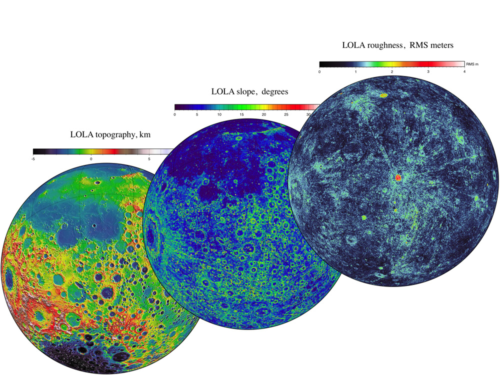
English: LOLA data give us three complementary views of the near side of the moon: the topography (left) along with new maps of the surface slope values (middle) and the roughness of the topography (right). All three views are centered on the relatively young impact crater Tycho, with the Orientale basin on the left side. |
| Date | |
| Source | http://www.nasa.gov/images/content/527958main_release5a.jpg |
| Author | NASA |
Licensing
[edit]
| This file is in the public domain in the United States because it was solely created by NASA. NASA copyright policy states that "NASA material is not protected by copyright unless noted". (See Template:PD-USGov, NASA copyright policy page or JPL Image Use Policy.) | ||
 |
Warnings:
|
File history
Click on a date/time to view the file as it appeared at that time.
| Date/Time | Thumbnail | Dimensions | User | Comment | |
|---|---|---|---|---|---|
| current | 14:56, 12 April 2011 | | 1,000 × 750 (530 KB) | IntrplnetSarah (talk | contribs) | {{Information |Description ={{en|1=LOLA data give us three complementary views of the near side of the moon: the topography (left) along with new maps of the surface slope values (middle) and the roughness of the topography (right). All three views are |
You cannot overwrite this file.
File usage on Commons
There are no pages that use this file.
File usage on other wikis
The following other wikis use this file:
- Usage on en.wikipedia.org
- Usage on fr.wikipedia.org
- Usage on nl.wikipedia.org
- Usage on ru.wikipedia.org