File:La Palma Los Cuarteles R01.jpg
Jump to navigation
Jump to search

Size of this preview: 800 × 504 pixels. Other resolutions: 320 × 202 pixels | 640 × 403 pixels | 1,024 × 645 pixels | 1,280 × 806 pixels | 2,560 × 1,613 pixels | 5,140 × 3,238 pixels.
Original file (5,140 × 3,238 pixels, file size: 13.76 MB, MIME type: image/jpeg)
Captions
Captions
Add a one-line explanation of what this file represents
Summary
[edit]
| Description |
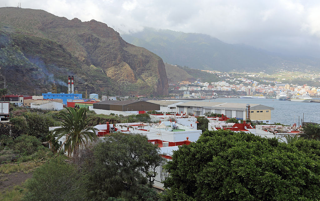
Nederlands: Breña Baja (La Palma, Canarische eilanden): het industriegebied van Los Cuarteles. Links: de elektriciteitscentrale van Los Guinchos, gelegen op het grondgebied van de gemeente Breña Alta. In de verte rechts: haven en stad Santa Cruz de La Palma. English: Breña Baja (La Palma, Canary Islands): the industrial zone of Los Cuarteles. Left: the power plant of Los Guinchos (Breña Alta). Far right: the port and town of Santa Cruz de La Palma. Français : Breña Baja (La Palma, Îles Canaries): la zone industrielle de Los Cuarteles. A gauche: la centrale électrique de Los Guinchos, située sur le territoire de la commune de Breña Alta. Au loin à droite: le port et la ville de Santa Cruz de La Palma. |
| Date | |
| Source | Own work |
| Author | Marc Ryckaert (MJJR) |
| Camera location | | View this and other nearby images on: OpenStreetMap |
|---|
Licensing
[edit]
I, the copyright holder of this work, hereby publish it under the following license:
This file is licensed under the Creative Commons Attribution 3.0 Unported license.
- You are free:
- to share – to copy, distribute and transmit the work
- to remix – to adapt the work
- Under the following conditions:
- attribution – You must give appropriate credit, provide a link to the license, and indicate if changes were made. You may do so in any reasonable manner, but not in any way that suggests the licensor endorses you or your use.
File history
Click on a date/time to view the file as it appeared at that time.
| Date/Time | Thumbnail | Dimensions | User | Comment | |
|---|---|---|---|---|---|
| current | 10:51, 15 January 2014 | | 5,140 × 3,238 (13.76 MB) | MJJR (talk | contribs) | User created page with UploadWizard |
You cannot overwrite this file.
File usage on Commons
There are no pages that use this file.
File usage on other wikis
The following other wikis use this file:
- Usage on zh.wikipedia.org