File:Lake Kozjak in February.jpg
From Wikimedia Commons, the free media repository
Jump to navigation
Jump to search
![File:Lake Kozjak in February.jpg](https://upload.wikimedia.org/wikipedia/commons/thumb/0/08/Lake_Kozjak_in_February.jpg/800px-Lake_Kozjak_in_February.jpg?20130323224300)
Size of this preview: 800 × 533 pixels. Other resolutions: 320 × 213 pixels | 640 × 427 pixels | 1,024 × 683 pixels | 1,280 × 853 pixels | 2,560 × 1,707 pixels | 3,469 × 2,313 pixels.
Original file (3,469 × 2,313 pixels, file size: 5.9 MB, MIME type: image/jpeg)
File information
Structured data
Captions
Captions
Add a one-line explanation of what this file represents
DescriptionLake Kozjak in February.jpg |
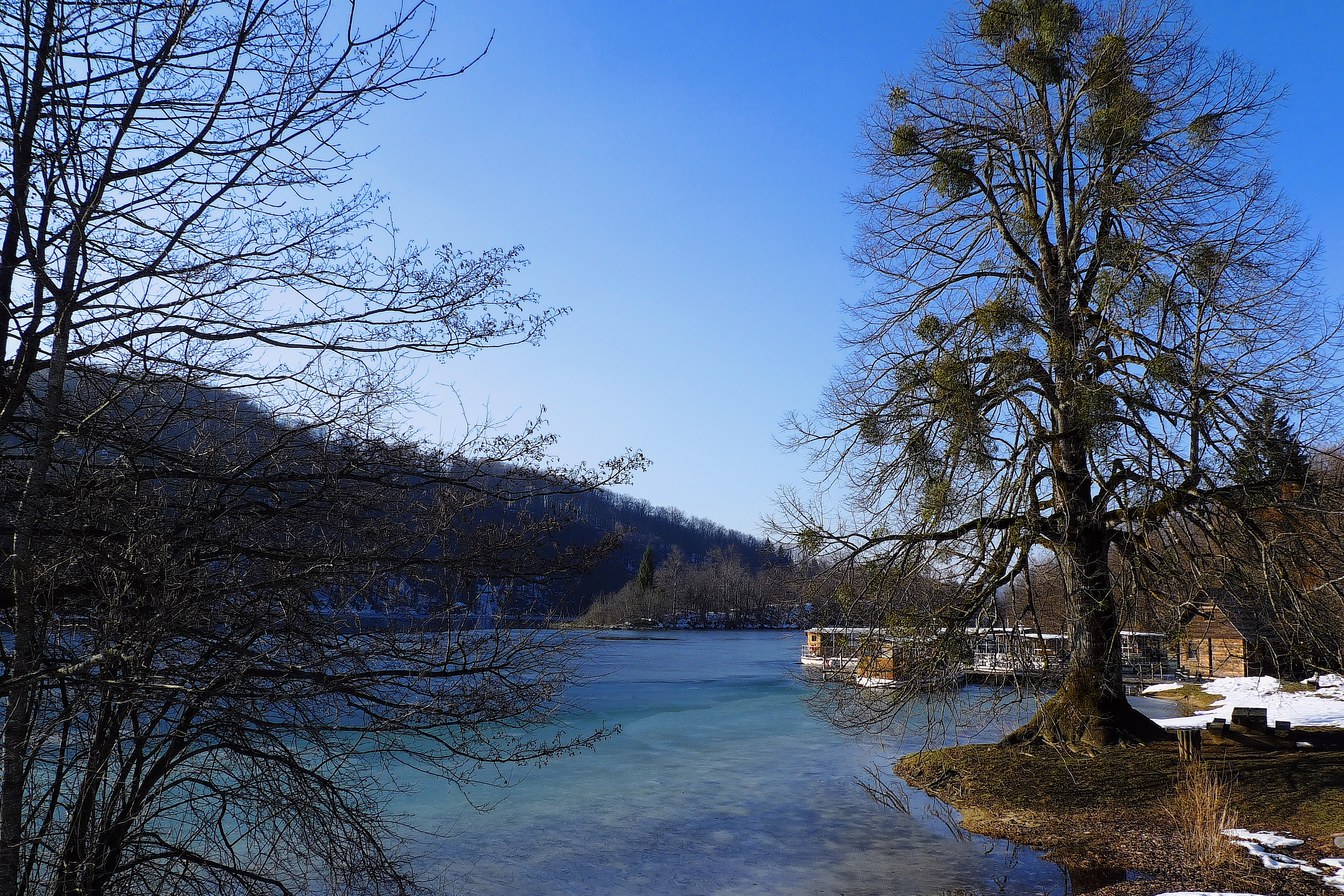
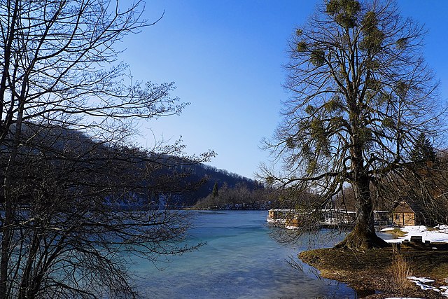
English: Lake Kozjak in February, Plitvice Lakes National Park. Hrvatski: Jezero Kozjak u veljači, Nacionalni park Plitvička jezera. Русский: Озеро Козьяк в феврале, Национальный парк Плитвицкие озера. 日本語: 2月の湖Kozjak、プリトヴィツェ湖群国立公園。 中文:的Kozjak在湖2月,十六湖国家公园。 |
||
Date | |||
Source | Flickr: Plitvice プリトヴィツェ 普里特维采 201102 | ||
Author | Dayou_X from Kawasaki, Japan | ||
Permission (Reusing this file) |
![]() ![]() ![]() This file is licensed under the Creative Commons Attribution-Share Alike 2.0 Generic license.
|
Camera location | 44° 52′ 46.87″ N, 15° 37′ 04.01″ E ![]() | View this and other nearby images on: OpenStreetMap | ![]() |
---|
File history
Click on a date/time to view the file as it appeared at that time.
Date/Time | Thumbnail | Dimensions | User | Comment | |
---|---|---|---|---|---|
current | 22:43, 23 March 2013 | ![]() | 3,469 × 2,313 (5.9 MB) | Flickr upload bot (talk | contribs) | Uploaded from http://flickr.com/photo/63004467@N00/5926131747 using Flickr upload bot |
You cannot overwrite this file.
File usage on Commons
There are no pages that use this file.
File usage on other wikis
The following other wikis use this file:
- Usage on hy.wikipedia.org
Metadata
This file contains additional information such as Exif metadata which may have been added by the digital camera, scanner, or software program used to create or digitize it. If the file has been modified from its original state, some details such as the timestamp may not fully reflect those of the original file. The timestamp is only as accurate as the clock in the camera, and it may be completely wrong.
Camera manufacturer | Panasonic |
---|---|
Camera model | DMC-LX3 |
Exposure time | 1/400 sec (0.0025) |
F-number | f/4 |
ISO speed rating | 80 |
Date and time of data generation | 15:11, 9 February 2011 |
Lens focal length | 5.1 mm |
Latitude | 44° 52′ 46.87″ N |
Longitude | 15° 37′ 4.01″ E |
Altitude | 608.6 meters above sea level |
Orientation | Normal |
Horizontal resolution | 72 dpi |
Vertical resolution | 72 dpi |
Software used | PMB |
File change date and time | 09:15, 10 July 2011 |
White point chromaticity |
|
Chromaticities of primarities |
|
Color space transformation matrix coefficients |
|
Y and C positioning | Co-sited |
Exposure Program | Normal program |
Exif version | 2.21 |
Date and time of digitizing | 23:11, 9 February 2011 |
Meaning of each component |
|
Image compression mode | 4 |
APEX exposure bias | 0 |
Maximum land aperture | 2 APEX (f/2) |
Metering mode | Center weighted average |
Light source | Unknown |
Flash | Flash did not fire, compulsory flash suppression |
Supported Flashpix version | 1 |
Color space | Uncalibrated |
Sensing method | One-chip color area sensor |
Custom image processing | Custom process |
Exposure mode | Auto exposure |
Digital zoom ratio | 0 |
Focal length in 35 mm film | 24 mm |
Scene capture type | Standard |
GPS time (atomic clock) | 14:11 |
Satellites used for measurement | 14,2,14,318,35,4,45,296,46,7,16,185,35,10,19,293,34,11,4,165,0,13,66,249,34,16,5,87,0,17,10,236,32,20,52,101,48,23,74,40,46,24,12,157,37,30,9,71,0,31,8,33,0,32,25,99,36 |
Receiver status | Measurement in progress |
Measurement mode | 3-dimensional measurement |
Measurement precision | Poor (3.6) |
Speed unit | Kilometers per hour |
Speed of GPS receiver | 2.3 |
Reference for direction of movement | True direction |
Direction of movement | 180.1 |
Geodetic survey data used | WGS-84 |
GPS date | 9 February 2011 |
GPS differential correction | 0 |
GPS tag version | 0.0.2.2 |