File:Land boundary agreement map ja.svg
Jump to navigation
Jump to search

Size of this PNG preview of this SVG file: 778 × 539 pixels. Other resolutions: 320 × 222 pixels | 640 × 443 pixels | 1,024 × 709 pixels | 1,280 × 887 pixels | 2,560 × 1,774 pixels.
Original file (SVG file, nominally 778 × 539 pixels, file size: 76 KB)
Captions
Captions
Add a one-line explanation of what this file represents
W3C-validity not checked.
Summary[edit]
| Description |
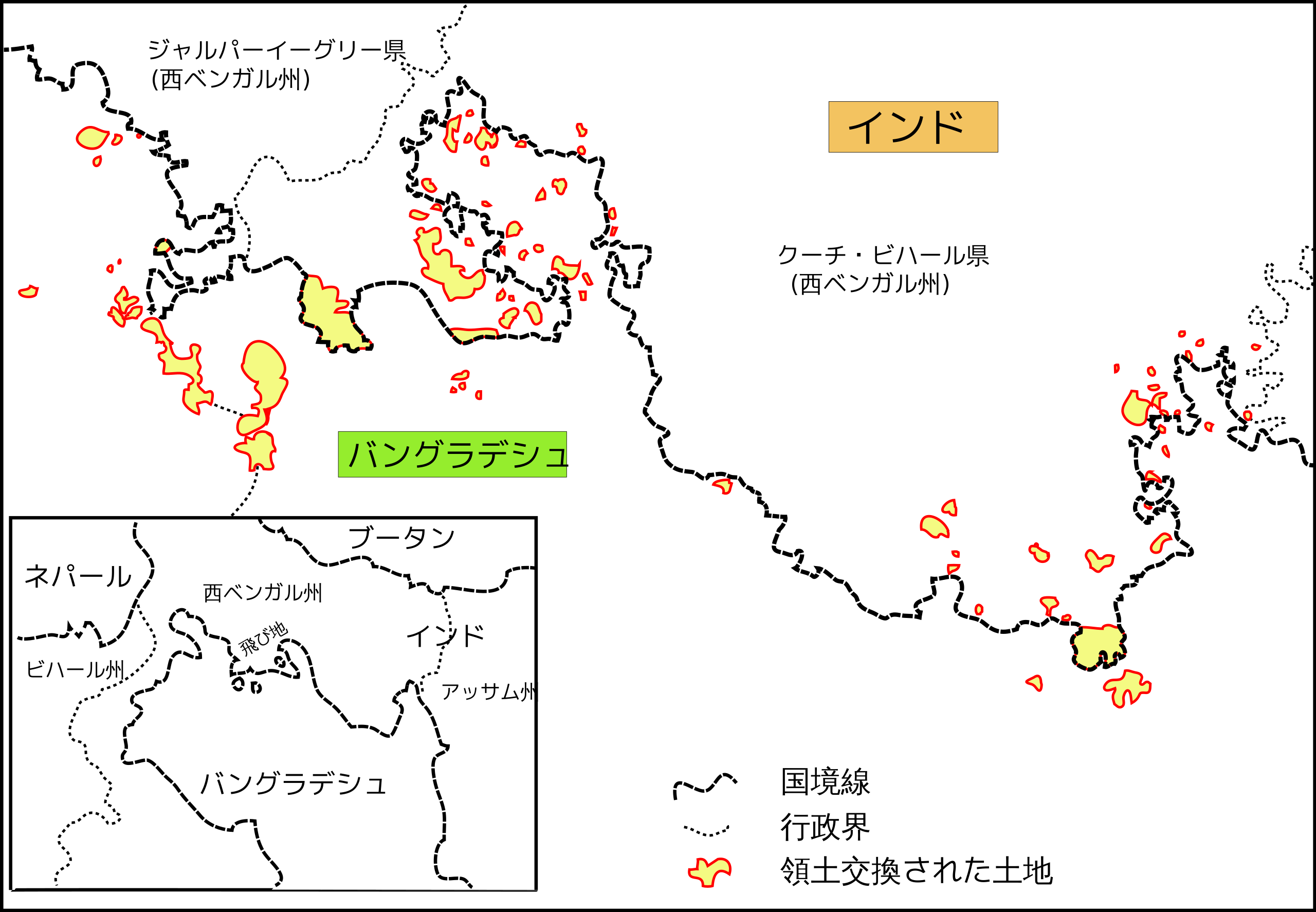
日本語: 2015年のインド・バングラデシュ国境の飛地解消で領土交換された土地の概略図。
Deutsch: Grenzvertrag zwischen Indien und Bangladesch 2015: Enklaven. Die Karte gibt nur einen groben Überblick.
English: India-Bangladesh land border agreeement 2015: enclaves. This map is not very detailed but only gives a rough overview.
বাংলা: ভারত-বাংলাদেশ স্থল সীমান্ত চুক্তি ২০১৫। এই মানচিত্র খুব বিস্তারিত নয় কিন্তু এটি শুধুমাত্র মোটামুটি একটি ওভারভিউ দেয়। |
| Date | |
| Source | File:Land boundary agreement map.svg |
| Author | User:Furfur, Own work |
| Other versions |
|


Licensing[edit]
This file is licensed under the Creative Commons Attribution-Share Alike 4.0 International license.
- You are free:
- to share – to copy, distribute and transmit the work
- to remix – to adapt the work
- Under the following conditions:
- attribution – You must give appropriate credit, provide a link to the license, and indicate if changes were made. You may do so in any reasonable manner, but not in any way that suggests the licensor endorses you or your use.
- share alike – If you remix, transform, or build upon the material, you must distribute your contributions under the same or compatible license as the original.
File history
Click on a date/time to view the file as it appeared at that time.
| Date/Time | Thumbnail | Dimensions | User | Comment | |
|---|---|---|---|---|---|
| current | 04:28, 8 December 2016 | | 778 × 539 (76 KB) | Kahusi (talk | contribs) | fill="#F3C360"のrectを調整 |
| 04:22, 8 December 2016 |  | 778 × 539 (76 KB) | Kahusi (talk | contribs) | User created page with UploadWizard |
You cannot overwrite this file.
File usage on Commons
The following 3 pages use this file:
File usage on other wikis
The following other wikis use this file:
- Usage on ja.wikipedia.org