File:Landslide on Mt. Logan.jpg

Original file (3,611 × 2,309 pixels, file size: 7.74 MB, MIME type: image/jpeg)
Captions
Captions
Summary
[edit]
| Description |
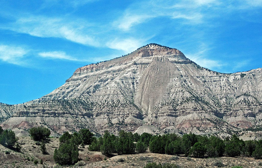
English: Landslide on Mount Logan in Colorado, USA.
In geology, landslide events are referred to as mass wasting. There are many specific types of mass wasting including mudflows, debris flows, earth flows, rock falls, debris falls, rock slides, debris slides, lahars, avalanches, solifluction, slump, and creep. The landslide seen in the middle of this picture is on south-southeastern face of Mt. Logan, at the eroded far-southern edge of the Roan Plateau. Mt. Logan is capped by Uinta Formation sedimentary rocks (Eocene in age). The slopes consist of the Green River Formation (also Eocene). Locality: Mt. Logan (looking ~north from Interstate 70 at mileposts 65 and 66), >8 air miles west-southwest of the town of Parachute, southern Garfield County, western Colorado, USA (39° 23' 56.12" North latitude, 108° 11' 08.19" West longitude) |
| Date | |
| Source | https://www.flickr.com/photos/jsjgeology/37045937042/ |
| Author | James St. John |
Licensing
[edit]
- You are free:
- to share – to copy, distribute and transmit the work
- to remix – to adapt the work
- Under the following conditions:
- attribution – You must give appropriate credit, provide a link to the license, and indicate if changes were made. You may do so in any reasonable manner, but not in any way that suggests the licensor endorses you or your use.
| This image was originally posted to Flickr by James St. John at https://flickr.com/photos/47445767@N05/37045937042. It was reviewed on 13 July 2022 by FlickreviewR 2 and was confirmed to be licensed under the terms of the cc-by-2.0. |
File history
Click on a date/time to view the file as it appeared at that time.
| Date/Time | Thumbnail | Dimensions | User | Comment | |
|---|---|---|---|---|---|
| current | 00:50, 13 July 2022 | | 3,611 × 2,309 (7.74 MB) | Ron Clausen (talk | contribs) | Uploaded a work by James St. John from https://www.flickr.com/photos/jsjgeology/37045937042/ with UploadWizard |
You cannot overwrite this file.
File usage on Commons
There are no pages that use this file.
File usage on other wikis
The following other wikis use this file:
- Usage on en.wikipedia.org