File:Lange Straße 9.jpg
![File:Lange Straße 9.jpg](https://upload.wikimedia.org/wikipedia/commons/thumb/0/08/Lange_Stra%C3%9Fe_9.jpg/800px-Lange_Stra%C3%9Fe_9.jpg?20210723124447)
Original file (6,776 × 3,913 pixels, file size: 8.99 MB, MIME type: image/jpeg)
Captions
Captions
Summary
[edit]DescriptionLange Straße 9.jpg |
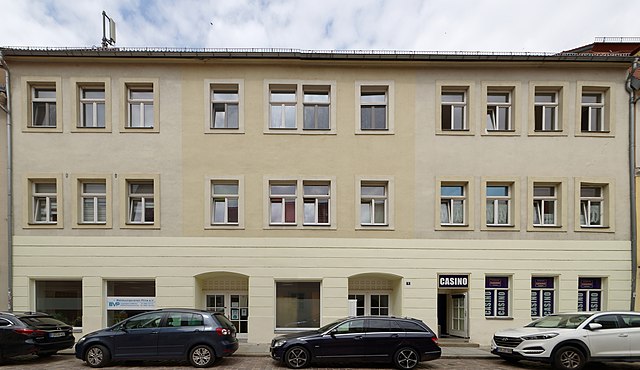
Deutsch: Wohnhaus in geschlossener Bebauung, mit Hinterhaus,
baugeschichtlich und städtebaulich von Bedeutung, im hinteren Bereich verlief die Stadtmauer (vielleicht Reste noch vorhanden), Trivia: ehemaliges Kino "Astoria",später Bekleidungsgeschäft; rechts war die Tanzbar "Serenade" |
Date | |
Source | Own work |
Author | VSchagow |
Camera location | 50° 57′ 48.45″ N, 13° 56′ 28.3″ E ![]() ![]() | View this and other nearby images on: OpenStreetMap | ![]() |
---|
![]() |
This image was uploaded as part of Wiki Loves Monuments 2022.
Afrikaans ∙ Alemannisch ∙ azərbaycanca ∙ Bahasa Indonesia ∙ Bahasa Melayu ∙ Bikol Central ∙ bosanski ∙ brezhoneg ∙ català ∙ čeština ∙ Cymraeg ∙ dansk ∙ davvisámegiella ∙ Deutsch ∙ eesti ∙ English ∙ español ∙ Esperanto ∙ euskara ∙ français ∙ Frysk ∙ Gaeilge ∙ galego ∙ hrvatski ∙ Ido ∙ italiano ∙ latviešu ∙ Lëtzebuergesch ∙ Malagasy ∙ magyar ∙ Malti ∙ Nederlands ∙ norsk ∙ norsk nynorsk ∙ norsk bokmål ∙ polski ∙ português ∙ português do Brasil ∙ română ∙ shqip ∙ sicilianu ∙ slovenčina ∙ slovenščina ∙ suomi ∙ svenska ∙ Tagalog ∙ Türkçe ∙ Yorùbá ∙ Zazaki ∙ Ελληνικά ∙ беларуская ∙ беларуская (тарашкевіца) ∙ български ∙ кыргызча ∙ македонски ∙ русский ∙ српски / srpski ∙ українська ∙ ქართული ∙ հայերեն ∙ नेपाली ∙ हिन्दी ∙ বাংলা ∙ മലയാളം ∙ ไทย ∙ 한국어 ∙ +/− |
![]() |
:
Licensing
[edit]![w:en:Creative Commons](https://upload.wikimedia.org/wikipedia/commons/thumb/7/79/CC_some_rights_reserved.svg/90px-CC_some_rights_reserved.svg.png)
![attribution](https://upload.wikimedia.org/wikipedia/commons/thumb/1/11/Cc-by_new_white.svg/24px-Cc-by_new_white.svg.png)
![share alike](https://upload.wikimedia.org/wikipedia/commons/thumb/d/df/Cc-sa_white.svg/24px-Cc-sa_white.svg.png)
- You are free:
- to share – to copy, distribute and transmit the work
- to remix – to adapt the work
- Under the following conditions:
- attribution – You must give appropriate credit, provide a link to the license, and indicate if changes were made. You may do so in any reasonable manner, but not in any way that suggests the licensor endorses you or your use.
- share alike – If you remix, transform, or build upon the material, you must distribute your contributions under the same or compatible license as the original.
Annotations InfoField | This image is annotated: View the annotations at Commons |
Stiching error
File history
Click on a date/time to view the file as it appeared at that time.
Date/Time | Thumbnail | Dimensions | User | Comment | |
---|---|---|---|---|---|
current | 12:44, 23 July 2021 | ![]() | 6,776 × 3,913 (8.99 MB) | VSchagow (talk | contribs) | Uploaded own work with UploadWizard |
You cannot overwrite this file.
File usage on Commons
There are no pages that use this file.
File usage on other wikis
The following other wikis use this file:
- Usage on de.wikipedia.org
Metadata
This file contains additional information such as Exif metadata which may have been added by the digital camera, scanner, or software program used to create or digitize it. If the file has been modified from its original state, some details such as the timestamp may not fully reflect those of the original file. The timestamp is only as accurate as the clock in the camera, and it may be completely wrong.
Author | VEIT SCHAGOW |
---|---|
Copyright holder |
|
Date and time of data generation | 12:59, 22 July 2021 |
Latitude | 50° 57′ 48.44″ N |
Longitude | 13° 56′ 28.3″ E |
Altitude | 107.2 meters above sea level |
Width | 10,752 px |
Height | 5,623 px |
Bits per component |
|
Pixel composition | RGB |
Orientation | Normal |
Number of components | 3 |
Horizontal resolution | 300 dpi |
Vertical resolution | 300 dpi |
Software used | Microsoft ICE v2.0.3.0 |
File change date and time | 00:05, 23 July 2021 |
Exif version | 2.21 |
Date and time of digitizing | 12:59, 22 July 2021 |
Color space | sRGB |
GPS time (atomic clock) | 11:59 |
Satellites used for measurement | 07 |
Receiver status | Measurement in progress |
Measurement mode | 3-dimensional measurement |
Speed unit | Kilometers per hour |
Speed of GPS receiver | 1.38 |
Reference for direction of movement | True direction |
Direction of movement | 26.88 |
Reference for direction of image | True direction |
Direction of image | 348.15 |
Geodetic survey data used | WGS-84 |
GPS date | 22 July 2021 |
GPS tag version | 2.3.0.0 |
Date metadata was last modified | 16:07, 23 July 2021 |
Unique ID of original document | 8EB26E98CC631C402BABAFDEB719A3C2 |
Keywords |
|
Contact information |
|
IIM version | 4 |
Structured data
Items portrayed in this file
depicts
22 July 2021
50°57'48.445"N, 13°56'28.302"E
image/jpeg
- Files with coordinates missing SDC location of creation
- Images from Wiki Loves Monuments 2022
- Images from Wiki Loves Monuments 2022 in Germany
- Images from Wiki Loves Monuments missing SDC depicts
- Images from Wiki Loves Monuments missing SDC location of creation
- Images from Wiki Loves Monuments 2022, DE-SN
- CC-BY-SA-4.0
- Self-published work
- Files by User:VSchagow
- Images with annotations
- Pages with maps