File:Laura 2020-08-27 0616Z.jpg
Jump to navigation
Jump to search
Size of this preview: 800 × 480 pixels. Other resolutions: 320 × 192 pixels | 1,024 × 614 pixels | 1,280 × 768 pixels | 2,500 × 1,500 pixels.
Original file (2,500 × 1,500 pixels, file size: 513 KB, MIME type: image/jpeg)
Captions
Captions
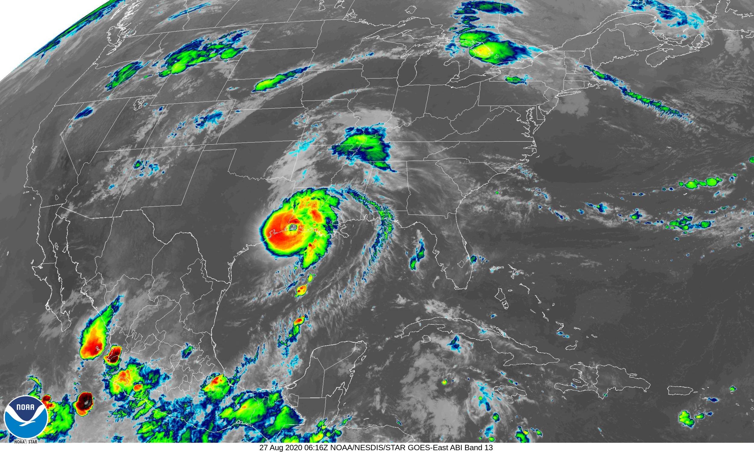
Hurricane Laura at landfall in Louisiana.
Summary
[edit]
| Description |
English: Hurricane Laura making landfall in Cameron, Louisiana just after peak intensity. |
| Date | |
| Source | https://www.star.nesdis.noaa.gov/GOES/conus_band.php?sat=G16&band=13&length=24 |
| Author | NOAA / NESDIS Center for Satellite Applications and Research |
| Camera location | | View this and other nearby images on: OpenStreetMap |
|---|
Licensing
[edit]
This image is in the public domain because it contains materials that originally came from the U.S. National Oceanic and Atmospheric Administration, taken or made as part of an employee's official duties.
|
File history
Click on a date/time to view the file as it appeared at that time.
| Date/Time | Thumbnail | Dimensions | User | Comment | |
|---|---|---|---|---|---|
| current | 22:40, 27 August 2020 | | 2,500 × 1,500 (513 KB) | ChessEric (talk | contribs) | Uploaded a work by NOAA / NESDIS Center for Satellite Applications and Research from https://www.star.nesdis.noaa.gov/GOES/conus_band.php?sat=G16&band=13&length=24 with UploadWizard |
You cannot overwrite this file.
File usage on Commons
The following 2 pages use this file:
- File:20202400616 GOES16-ABI-CONUS-13-2500x1500.jpg (file redirect)
- File:Laura 2020-08-27 0616Z GOES16-ABI-CONUS-13.jpg (file redirect)
File usage on other wikis
The following other wikis use this file:
- Usage on en.wikipedia.org