File:Laura intensification and landfall satellite loop.gif
Jump to navigation
Jump to search
No higher resolution available.
Laura_intensification_and_landfall_satellite_loop.gif (720 × 576 pixels, file size: 43.9 MB, MIME type: image/gif, looped, 228 frames, 6.8 s)
Captions
Captions
Add a one-line explanation of what this file represents
Summary
[edit]
| Description |
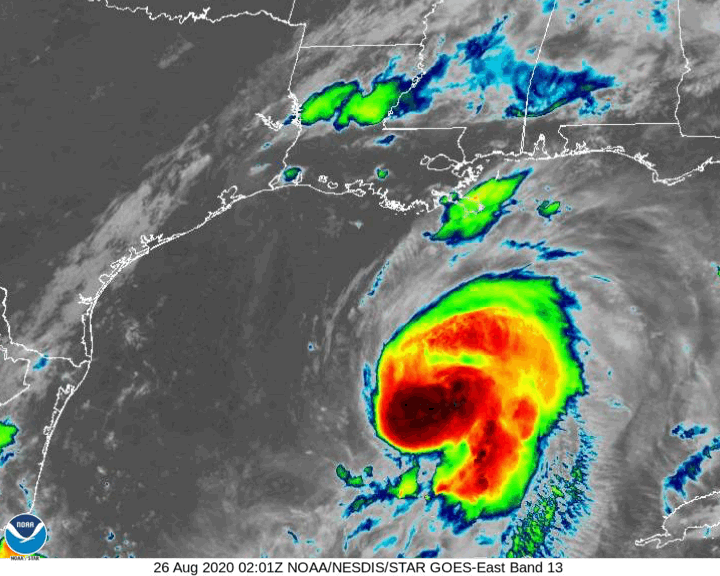
English: Hurricane Laura satellite loop (August 26 02:00 UTC-August 27 12:00 UTC) covering rapid intensification and landfall in Louisiana.
Italiano: Sequenza di immagini satellitari dell'uragano Laura (26 agosto 02:00 UTC-27 agosto 12:00 UTC) che copre la fase di rapida intensificazione e dell'approdo in Louisiana. |
| Date | |
| Source | https://www.star.nesdis.noaa.gov/GOES/sector_band.php?sat=G16§or=gm&band=13&length=240 |
| Author | NOAA, edited by L9A8M |
Licensing
[edit]
This image is in the public domain because it contains materials that originally came from the U.S. National Oceanic and Atmospheric Administration, taken or made as part of an employee's official duties.
|
File history
Click on a date/time to view the file as it appeared at that time.
| Date/Time | Thumbnail | Dimensions | User | Comment | |
|---|---|---|---|---|---|
| current | 15:02, 27 August 2020 | | 720 × 576 (43.9 MB) | L9A8M (talk | contribs) | Uploaded a work by NOAA, edited by L9A8M from https://www.star.nesdis.noaa.gov/GOES/sector_band.php?sat=G16§or=gm&band=13&length=240 with UploadWizard |
You cannot overwrite this file.
File usage on Commons
There are no pages that use this file.
File usage on other wikis
The following other wikis use this file:
- Usage on fr.wikipedia.org
- Usage on it.wikipedia.org