File:Le-fort-national-1800.jpg
Jump to navigation
Jump to search

Size of this preview: 800 × 348 pixels. Other resolutions: 320 × 139 pixels | 640 × 279 pixels | 1,024 × 446 pixels | 1,280 × 557 pixels | 4,135 × 1,800 pixels.
Original file (4,135 × 1,800 pixels, file size: 840 KB, MIME type: image/jpeg)
Captions
Captions
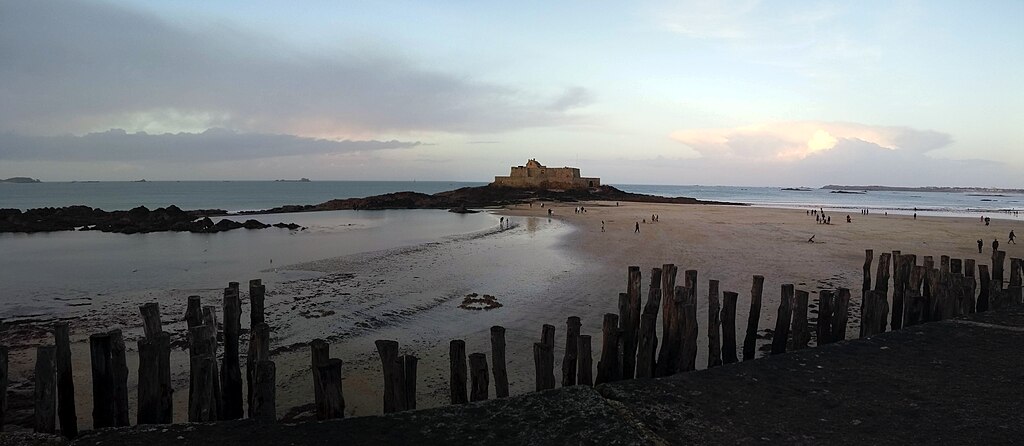
Fort National (not at high tide)
Summary
[edit]
| Description |
English: Le Fort National is a tidal fort on an island off Saint-Malo in Brittany France. The picture was taken from the mainland and the coastal defences to the mainland are visible in the foreground, with the beach between them and the fort. |
| Date | |
| Source | Own work |
| Author | Ajt-france |
| Camera location | | View this and other nearby images on: OpenStreetMap |
|---|
Licensing
[edit]
I, the copyright holder of this work, hereby publish it under the following license:
This file is licensed under the Creative Commons Attribution-Share Alike 4.0 International license.
- You are free:
- to share – to copy, distribute and transmit the work
- to remix – to adapt the work
- Under the following conditions:
- attribution – You must give appropriate credit, provide a link to the license, and indicate if changes were made. You may do so in any reasonable manner, but not in any way that suggests the licensor endorses you or your use.
- share alike – If you remix, transform, or build upon the material, you must distribute your contributions under the same or compatible license as the original.
File history
Click on a date/time to view the file as it appeared at that time.
| Date/Time | Thumbnail | Dimensions | User | Comment | |
|---|---|---|---|---|---|
| current | 17:28, 21 April 2021 | | 4,135 × 1,800 (840 KB) | Ajt-france (talk | contribs) | Uploaded own work with UploadWizard |
You cannot overwrite this file.
File usage on Commons
There are no pages that use this file.
File usage on other wikis
The following other wikis use this file:
- Usage on en.wikipedia.org
- Usage on zh.wikipedia.org