File:Le transport inter-urbain et les impacts du COVID-19.jpg
Jump to navigation
Jump to search
Size of this preview: 800 × 538 pixels. Other resolutions: 320 × 215 pixels | 640 × 430 pixels | 1,024 × 689 pixels | 1,280 × 861 pixels | 1,728 × 1,162 pixels.
Original file (1,728 × 1,162 pixels, file size: 555 KB, MIME type: image/jpeg)
Captions
Captions
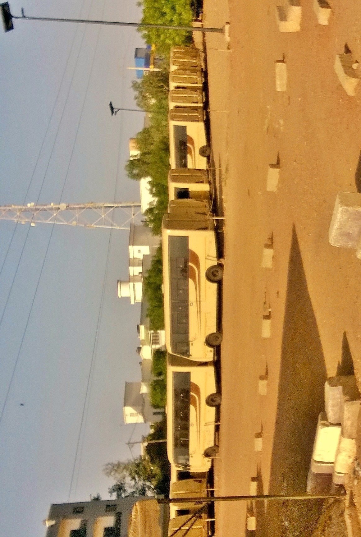
the largest land transport company in Senegal is affected by the presence of the new coronavirus in the country.
Summary[edit]
| Description |
Français : l'interdiction du transport urbain et inter-urbain au Sénégal par le gouvernement a impacté le transport des personnes et marchandises de façon très négative car les compagnies ont suspendu les liaisons inter-urbains et cela peut entraîner dans les jours avenir une crise économie dans le secteur du transport au Sénégal.
English: the ban on urban and inter-urban transport in Senegal by the government has impacted the transport of people and goods in a very negative way because the companies have suspended the inter-urban routesThis may lead in the future to an economic crisis in the transport sector in Senegal.
中文:塞内加尔政府禁止城市和城市间运输,这对人员和货物的运输产生了非常不利的影响,因为这些公司已经停止了城市间的运输路线,这可能在今后几天中导致国内运输部门的经济危机 塞内加尔
العربية: وقد أثر الحظر الذي فرضته الحكومة على النقل الحضري والنقل بين المدن في السنغال على نقل الأشخاص والسلع بطريقة سلبية للغاية لأن الشركات أوقفت الطرق بين المدن وقد يؤدي ذلك في الأيام المقبلة إلى أزمة اقتصادية في قطاع النقل في السنغال.
Español: la prohibición del transporte urbano e interurbano en Senegal por parte del Gobierno ha afectado de manera muy negativa al transporte de personas y mercancías, ya que las compañías han suspendido los enlaces interurbanos y esto puede provocar en los próximos días una crisis económica en el sector del transporte en Senegal.
Deutsch: Das von der Regierung verhängte Verbot des Stadt- und Überlandverkehrs in Senegal hat den Personen- und den Verkehrssektor in Senegal.
|
||
| Date | |||
| Source | Own work | ||
| Author | Babacar Dioum |
| Camera location | | View this and other nearby images on: OpenStreetMap |
|---|
Licensing[edit]
I, the copyright holder of this work, hereby publish it under the following license:
This file is licensed under the Creative Commons Attribution-Share Alike 4.0 International license.
- You are free:
- to share – to copy, distribute and transmit the work
- to remix – to adapt the work
- Under the following conditions:
- attribution – You must give appropriate credit, provide a link to the license, and indicate if changes were made. You may do so in any reasonable manner, but not in any way that suggests the licensor endorses you or your use.
- share alike – If you remix, transform, or build upon the material, you must distribute your contributions under the same or compatible license as the original.

|
This image was uploaded as part of Wiki Loves Africa 2020 photographic contest.
|
File history
Click on a date/time to view the file as it appeared at that time.
| Date/Time | Thumbnail | Dimensions | User | Comment | |
|---|---|---|---|---|---|
| current | 15:55, 26 March 2020 | | 1,728 × 1,162 (555 KB) | Babacar Dioum (talk | contribs) | Uploaded own work with UploadWizard |
You cannot overwrite this file.
File usage on Commons
There are no pages that use this file.