File:Levant 07-Zelaf (FL155317996 2369583).jpg
Jump to navigation
Jump to search

Size of this preview: 480 × 599 pixels. Other resolutions: 192 × 240 pixels | 385 × 480 pixels | 615 × 768 pixels | 821 × 1,024 pixels | 1,641 × 2,048 pixels | 13,623 × 16,999 pixels.
Original file (13,623 × 16,999 pixels, file size: 257.99 MB, MIME type: image/jpeg)
Captions
Captions
Add a one-line explanation of what this file represents
Summary
[edit]| Levant
( |
||||||||||||||||||||||||
|---|---|---|---|---|---|---|---|---|---|---|---|---|---|---|---|---|---|---|---|---|---|---|---|---|
| Title |
Levant |
|||||||||||||||||||||||
| Publisher |
Bureau topographique |
|||||||||||||||||||||||
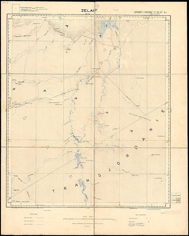
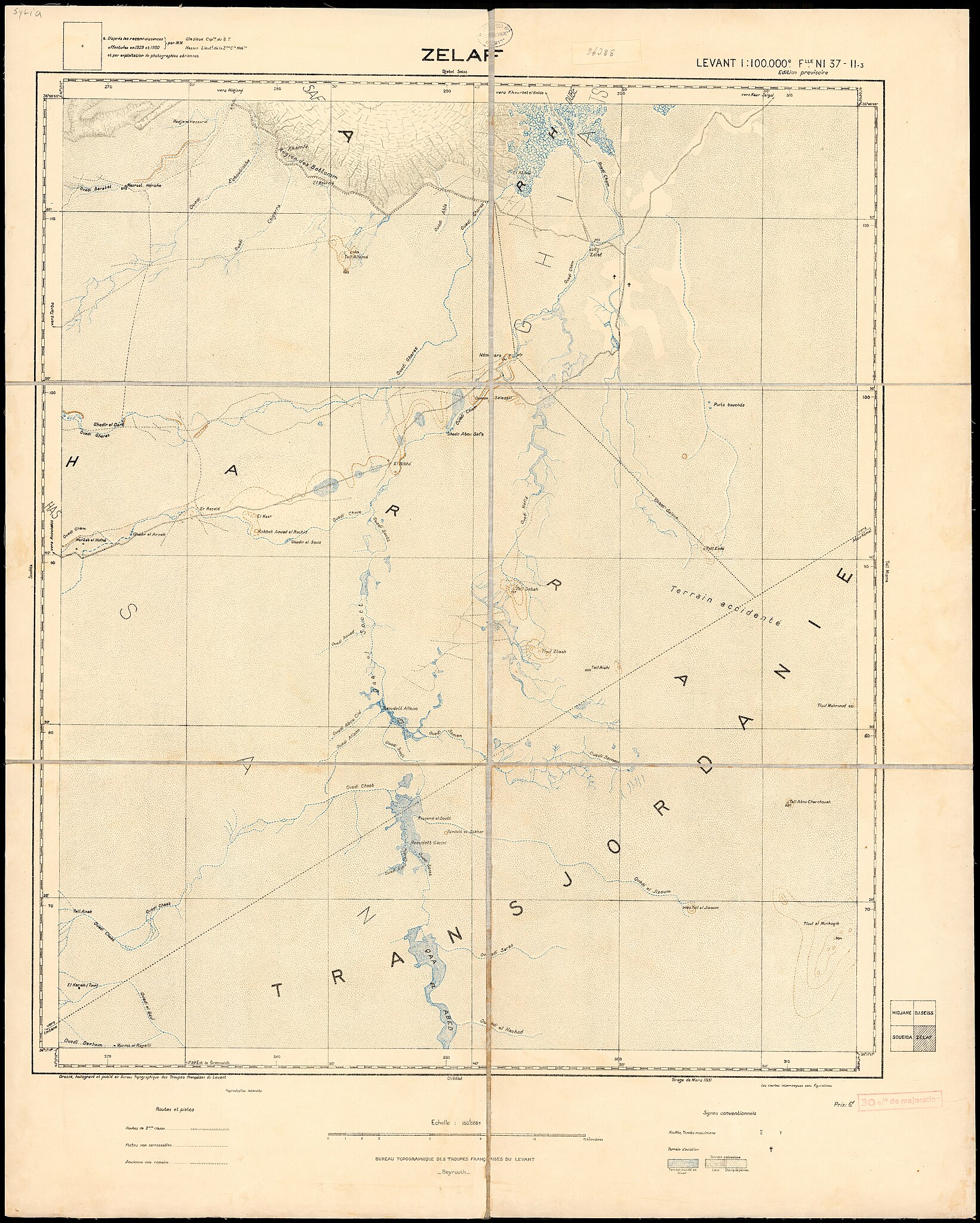
| Description |
Levant 1:100,000. Capitaine Dujardin, Lieutenanat Gastaldo. |
|||||||||||||||||||||||
| Language | French | |||||||||||||||||||||||
| Publication date | from 1931 until 1932 | |||||||||||||||||||||||
| Collection |
|
|||||||||||||||||||||||
| Current location |
|
|||||||||||||||||||||||
| Place of publication | Beirut | |||||||||||||||||||||||
| search Merhav catalog | Beirut | |||||||||||||||||||||||
| Notes | Dressé, héliogravé et publié au Bureau topographique des troupes françaises du Levant.; בגליון Soueida ציון הר הדרוזים.; Levant. 1:100,000; NI 37-I, 37-II, 37-VII, 37-VIII, 37-XIII; הר הדרוזים בגליון Soueida | |||||||||||||||||||||||
| scale | 1:100,000 cm | |||||||||||||||||||||||
| IE PID | IE155317973 | |||||||||||||||||||||||
| Rosetta filename | FL155317996 | |||||||||||||||||||||||
| NNL item ID (P3959) | 990023695830205171 | |||||||||||||||||||||||
| search Merhav catalog | French | |||||||||||||||||||||||
| search Merhav catalog | SoueidaVallee du YarmoukZelafDjebel SeissSalkhadHomsHidjaneDeraaBureau topographique | |||||||||||||||||||||||
| Source/Photographer |
|
|||||||||||||||||||||||
| Other versions | ||||||||||||||||||||||||
| Jpg / Tif version |
|
|||||||||||||||||||||||

.jpg)

.jpg&action=edit§ion=1)
Licensing
[edit].jpg&action=edit§ion=2)
This work is in the public domain in France for one of the following reasons:
|
 |
[[Category:]]
File history
Click on a date/time to view the file as it appeared at that time.
| Date/Time | Thumbnail | Dimensions | User | Comment | |
|---|---|---|---|---|---|
| current | 14:48, 12 August 2023 | | 13,623 × 16,999 (257.99 MB) | Geagea (talk | contribs) | pattypan 22.03 |
You cannot overwrite this file.
File usage on Commons
The following page uses this file:
.jpg&oldid=851540504)