File:Lewis&ClarkBridgeSP.jpg
Originaldatei (4.593 × 1.200 Pixel, Dateigröße: 2,26 MB, MIME-Typ: image/jpeg)
Bildtexte
Kurzbeschreibungen
Beschreibung
[Bearbeiten]| Beschreibung |
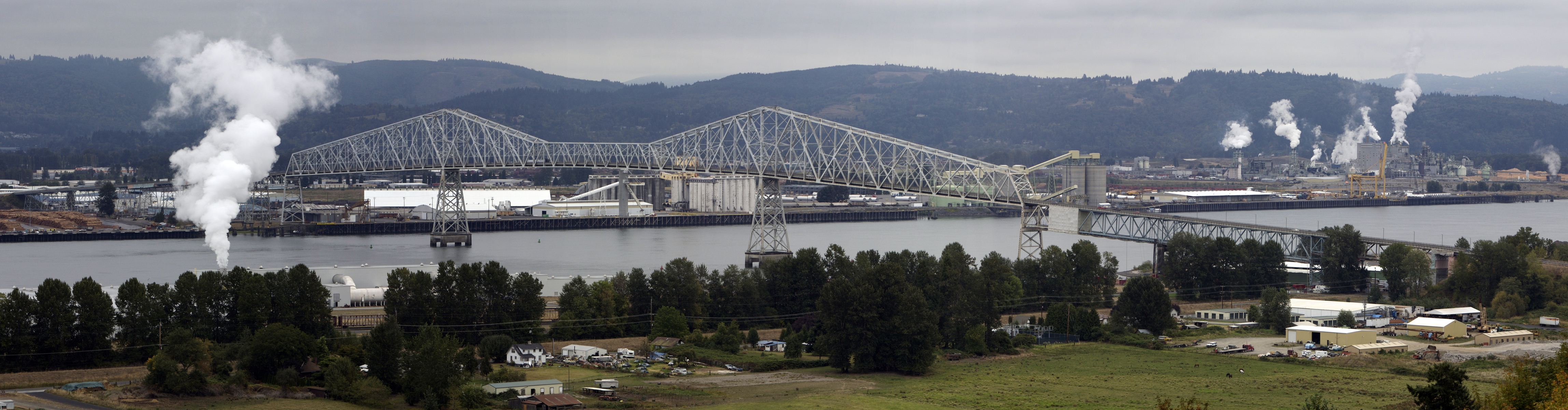
Deutsch: Die Lewis and Clark Bridge trägt Washington State Route 433 über den Lewis and Clark Bridge bei zwischen den Städten Longview, Washington und Rainier, Oregon. Shot aus der US Route 30 in Oregon nach Nordosten übernommen. Dies ist ein Stich von 4 Fotografien.
English: The Lewis and Clark Bridge carries Washington State Route 433 across the Columbia River at between the cities of Longview, Washington and Rainier, Oregon. Shot taken from U.S. Route 30 in Oregon looking northeast. This is a stitch of 4 exposures.
Français : Le pont Lewis et Clark permet à la Washington State Route 433 de traverser le fleuve Columbia entre les villes de Longview, Washington et Rainier, Oregon. Photo prise à partir de la US Route 30 dans l'Oregon en direction du nord-est. Cette photo est réalisée par assemblage de 4 clichés. |
||
| Datum | |||
| Quelle | Eigenes Werk | ||
| Urheber | Cacophony | ||
| Genehmigung (Weiternutzung dieser Datei) |
Ich, der Urheberrechtsinhaber dieses Werkes, veröffentliche es hiermit unter der folgenden Lizenz:
Diese Datei ist unter den Creative-Commons-Lizenzen „Namensnennung – Weitergabe unter gleichen Bedingungen 3.0 nicht portiert“, „2.5 generisch“, „2.0 generisch“ und „1.0 generisch“ lizenziert.
Du darfst es unter einer der obigen Lizenzen deiner Wahl verwenden. |

| Objektposition | | Dieses und weitere Bilder auf OpenStreetMap |
|---|
|

|
Dieses Bild ist nach den Kriterien für wertvolle Bilder beurteilt worden und gilt als das hochwertigste auf Commons im Bereich: Lewis and Clark Bridge. Die Nominierung des Bildes ist nachzulesen unter Commons:Kandidaturen hochwertiger Bilder/Lewis&ClarkBridgeSP.jpg. |
Dateiversionen
Klicke auf einen Zeitpunkt, um diese Version zu laden.
| Version vom | Vorschaubild | Maße | Benutzer | Kommentar | |
|---|---|---|---|---|---|
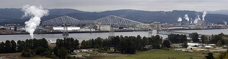
| aktuell | 19:05, 13. Sep. 2007 | 4.593 × 1.200 (2,26 MB) | Cacophony (Diskussion | Beiträge) | {{Information |Description=The Lewis and Clark Bridge across the Columbia River at Longview, Washington. Seen from the west along U.S. Highway 30. This is a stich of 4 exposures. |Source=self-made |Date=9/12/07 |Author= Cacophony }} |
Du kannst diese Datei nicht überschreiben.
Dateiverwendung
Die folgenden 33 Seiten verwenden diese Datei:
- User:Samsara/POTY 2011 overview
- User:Ö/Best/2011
- User talk:Admrboltz/Archive 1
- User talk:Cacophony
- Commons:Featured picture candidates/File:Lewis&ClarkBridgeSP.jpg
- Commons:Featured picture candidates/Log/February 2011
- Commons:Featured pictures/Places/Architecture/Bridges
- Commons:Featured pictures/Places/Panoramas
- Commons:Featured pictures/chronological/2011-A
- Commons:Files used on the AARoads Wiki/33
- Commons:Picture of the Year/2011/Galleries/2011-A
- Commons:Picture of the Year/2011/Galleries/A
- Commons:Picture of the Year/2011/Galleries/A/table
- Commons:Picture of the Year/2011/Galleries/ALL
- Commons:Picture of the Year/2011/Galleries/FEB
- Commons:Picture of the Year/2011/Galleries/Index/2
- Commons:Picture of the Year/2011/Galleries/Index/ALL
- Commons:Picture of the Year/2011/Galleries/Index/Panoramic views
- Commons:Picture of the Year/2011/Galleries/Panoramic views
- Commons:Picture of the Year/2011/Galleries/Panoramic views/Large
- Commons:Picture of the Year/2011/Galleries/Panoramic views/Small
- Commons:Picture of the Year/2011/Galleries/table
- Commons:Picture of the Year/2011/R1/Lewis&ClarkBridgeSP.jpg
- Commons:Picture of the Year/2011/Results/R1/ALL/table
- Commons:Picture of the Year/2011/Results/R1/Panoramic views
- Commons:Picture of the Year/2011/Results/R1/Panoramic views/table
- Commons:Quality images/Subject/Places/Mixed/Panorama/Archive 2008 to 2015
- Commons:Quality images candidates/Archives December 2010
- Commons:Valued image candidates/Lewis&ClarkBridgeSP.jpg
- Commons:Valued images by topic/Places/Buildings/Bridges
- Commons talk:Picture of the Year/2011/Results/R1/ALL/table
- Category:Lewis and Clark Bridge
- Category:Washington State Route 433
Globale Dateiverwendung
Die nachfolgenden anderen Wikis verwenden diese Datei:
- Verwendung auf bn.wikipedia.org
- Verwendung auf de.wikipedia.org
- Verwendung auf en.wikipedia.org
- Lewis and Clark Bridge (Columbia River)
- Wikipedia:WikiProject Bridges and Tunnels
- List of crossings of the Columbia River
- List of longest cantilever bridge spans
- Washington State Route 433
- National Register of Historic Places listings in Columbia County, Oregon
- Wikipedia:Featured picture candidates/February-2011
- Wikipedia:Featured picture candidates/Lewis and Clark Bridge Panorama
- File talk:Lewis&ClarkBridgeSP.jpg
- User:Another Believer/Travel/United States
- Verwendung auf es.wikipedia.org
- Verwendung auf fr.wikipedia.org
- Verwendung auf mg.wikipedia.org
- Verwendung auf nl.wikipedia.org
- Verwendung auf pl.wikipedia.org
- Verwendung auf vi.wikipedia.org
- Verwendung auf www.wikidata.org