File:Linfa, Chan-hom, Nangka, Pre-Halola and Pre-Iune 2015-07-07 0230Z.jpg
Jump to navigation
Jump to search
Size of this preview: 800 × 450 pixels. Other resolutions: 320 × 180 pixels | 640 × 360 pixels | 1,024 × 576 pixels | 1,280 × 720 pixels | 2,048 × 1,152 pixels.
Original file (2,048 × 1,152 pixels, file size: 935 KB, MIME type: image/jpeg)
Captions
Captions
Add a one-line explanation of what this file represents
Summary
[edit]
| Description |
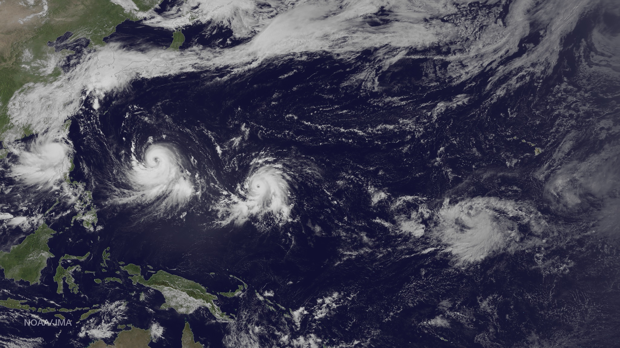
English: Two typhoons, one tropical storm, one formation alert and one large area of increased convection is making for a busy day in the northern Pacific Ocean. From left to right: Tropical Storm Linfa is in the South China Sea meandering slowly northward with winds holding steady near 55 knots. A turn to the west toward land is expected during July 8. Typhoon Chan-Hom has winds near 100 knots and strengthening, heading west-northwest toward the East China Sea, passing south of Okinawa around July 9. Typhoon Nangka is east of Guam heading west-northwest with winds intensifying near 140 knots in a couple of days. The large area of convection southwest of Hawaii is not expected at this time to develop into a tropical system, despite its satellite presentation. To the far east of this image can be seen the Hawaiian Islands; to the southeast of the Islands an area of convection is consolidating, and the Joint Typhoon Warning Center states, "Formation of a significant tropical cyclone is possible...within the next 12 to 24 hours." This image was taken by the JMA MTSAT-2 satellite at 0230Z on July 7, 2015. |
| Date | |
| Source | http://www.nnvl.noaa.gov/MediaDetail2.php?MediaID=1721&MediaTypeID=1 |
| Author | NOAA Environmental Visualization Laboratory, Japan Meteorological Agency |
Licensing
[edit]
This image is in the public domain because it contains materials that originally came from the U.S. National Oceanic and Atmospheric Administration, taken or made as part of an employee's official duties.
|
| Annotations | This image is annotated: View the annotations at Commons |
File history
Click on a date/time to view the file as it appeared at that time.
| Date/Time | Thumbnail | Dimensions | User | Comment | |
|---|---|---|---|---|---|
| current | 11:30, 19 November 2015 | | 2,048 × 1,152 (935 KB) | Nino Marakot (talk | contribs) | better from NOAA Environmental Visualization Laboratory |
| 03:27, 17 July 2015 |  | 720 × 405 (209 KB) | Typhoon2013 (talk | contribs) | User created page with UploadWizard |
You cannot overwrite this file.
File usage on Commons
The following page uses this file:
- File:5 Pacific storms 2015-07-07 1030Z.jpg (file redirect)
File usage on other wikis
The following other wikis use this file:
- Usage on en.wikipedia.org