File:Linguistic map of Eastern Europe, Max Müller, 1854.jpg
Jump to navigation
Jump to search
Size of this preview: 794 × 599 pixels. Other resolutions: 318 × 240 pixels | 636 × 480 pixels | 1,017 × 768 pixels | 1,280 × 966 pixels | 2,560 × 1,933 pixels | 3,913 × 2,954 pixels.
Original file (3,913 × 2,954 pixels, file size: 3.4 MB, MIME type: image/jpeg)
Captions
Captions
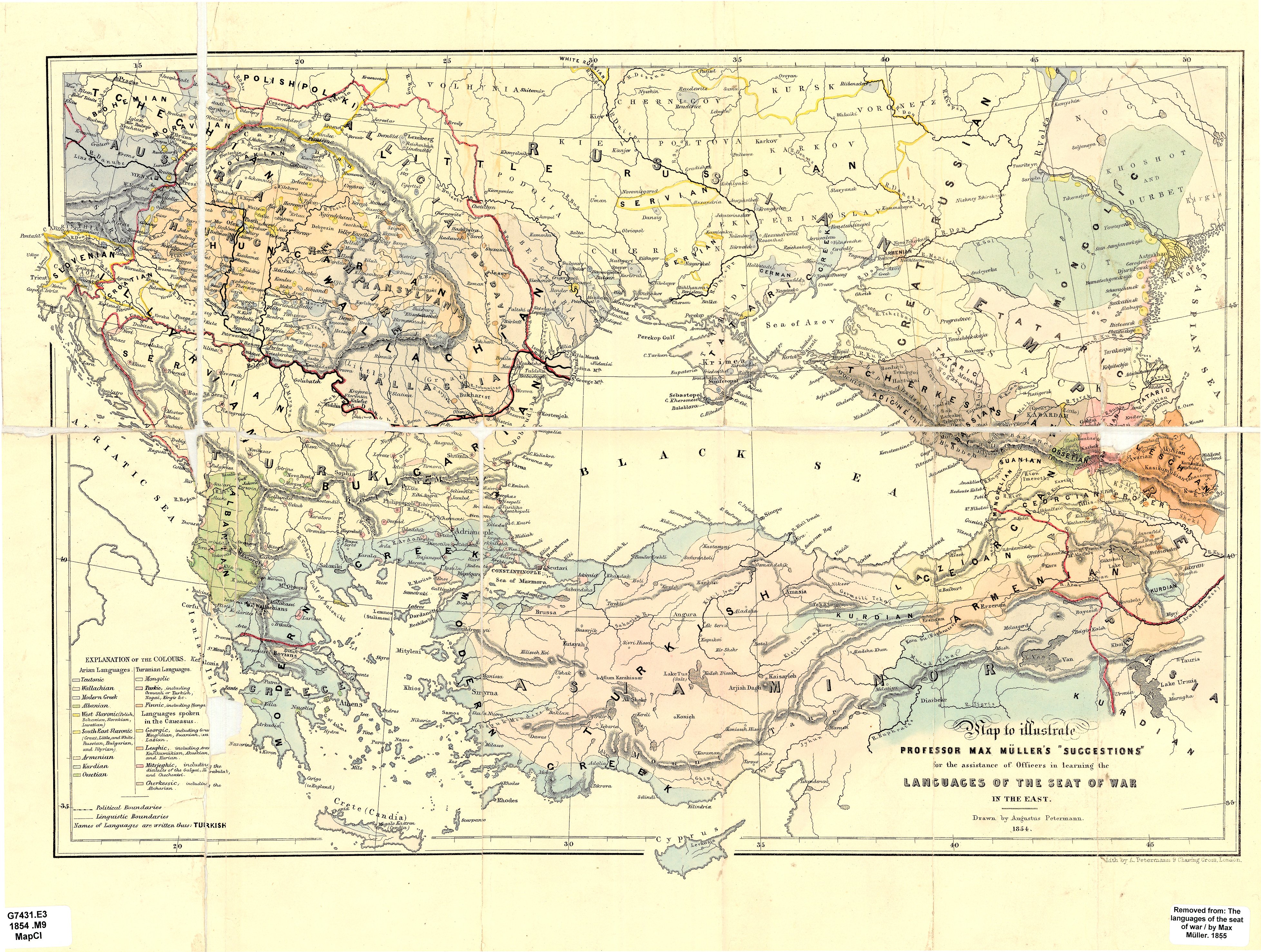
Linguistic map of Eastern Europe by Max Müller, 1854
Summary
[edit]| Description |
English: Map to illustrate Professor Max Müller's "Suggestions" for the assistance of officers in learning the languages of the seat of war in the East / drawn by Augustus Petermann, 1854 ; lith. by A. Petermann.
Retrieved from:
Українська: Карта професора Фрідріха Макса Мюллера для офіцерів, яка повинна була допомогти у вивченні мов на території, охопленій Кримською війною. Взята з джерела:
|
||||||||||||||||||||||||||||||||||||||||
| Date | |||||||||||||||||||||||||||||||||||||||||
| Source | THE UNIVERSITY OF CHICAGO VISUAL RESOURCES CENTER | ||||||||||||||||||||||||||||||||||||||||
| Author |
|
||||||||||||||||||||||||||||||||||||||||
| Other versions | |||||||||||||||||||||||||||||||||||||||||


Licensing
[edit]
|
This work is in the public domain in its country of origin and other countries and areas where the copyright term is the author's life plus 70 years or fewer. This work is in the public domain in the United States because it was published (or registered with the U.S. Copyright Office) before January 1, 1929. | |
| This file has been identified as being free of known restrictions under copyright law, including all related and neighboring rights. | |
File history
Click on a date/time to view the file as it appeared at that time.
| Date/Time | Thumbnail | Dimensions | User | Comment | |
|---|---|---|---|---|---|
| current | 19:07, 10 February 2020 | | 3,913 × 2,954 (3.4 MB) | ZxcvU (talk | contribs) | User created page with UploadWizard |
You cannot overwrite this file.
File usage on Commons
The following 4 pages use this file:
File usage on other wikis
The following other wikis use this file:
- Usage on uk.wikipedia.org