File:Linnaean Hill, 3545 Williamsburg Lane Northwest, Washington.tiff
(Redirected from File:Linnean Hill, 3545 Williamsburg Lane Northwest, Washington.tif)

Size of this JPG preview of this TIF file: 430 × 599 pixels. Other resolutions: 172 × 240 pixels | 344 × 480 pixels | 551 × 768 pixels | 734 × 1,024 pixels | 1,469 × 2,048 pixels | 3,587 × 5,000 pixels.
Original file (3,587 × 5,000 pixels, file size: 17.11 MB, MIME type: image/tiff)
Captions
Captions
Add a one-line explanation of what this file represents
Summary[edit]
{{en|1=
| English: Linnaean Hill
( |
||||||||||||||||||||||||
|---|---|---|---|---|---|---|---|---|---|---|---|---|---|---|---|---|---|---|---|---|---|---|---|---|
| Photographer |
Albert S. Burns, HABS Photographer |
|||||||||||||||||||||||
| Title |
English: Linnaean Hill |
|||||||||||||||||||||||
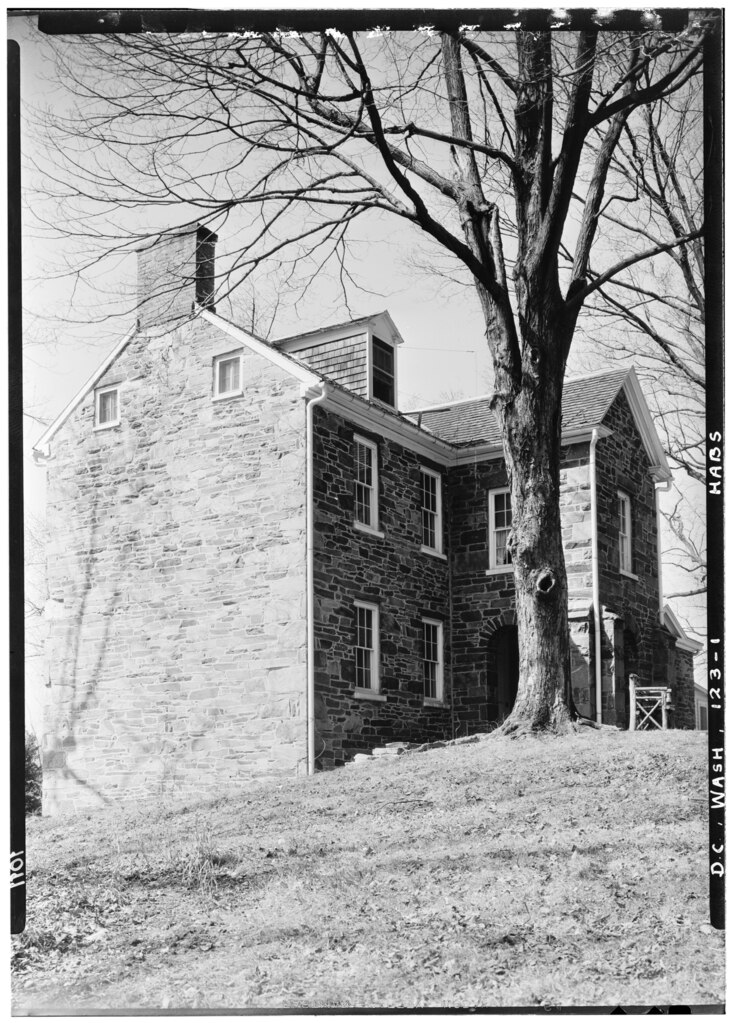
| Description |
English: 1. Historic American Buildings Survey Albert S. Burns, Photographer C. 1934, 1935. - Linnaean Hill, 3545 Williamsburg Lane, Northwest, Washington, District of Columbia
|
|||||||||||||||||||||||
| Date | circa 1934 | |||||||||||||||||||||||
| Medium | 1 photographic print. | |||||||||||||||||||||||
| Collection |
|
|||||||||||||||||||||||
| Source |
|
|||||||||||||||||||||||
| Permission (Reusing this file) |
Rights Advisory: No known restrictions on publication. | |||||||||||||||||||||||
| Other versions |
|
|||||||||||||||||||||||


| Camera location | | View this and other nearby images on: OpenStreetMap |
|---|
Licensing[edit]

|
This file comes from the Historic American Buildings Survey (HABS), Historic American Engineering Record (HAER) or Historic American Landscapes Survey (HALS). These are programs of the National Park Service established for the purpose of documenting historic places. Records consist of measured drawings, archival photographs, and written reports.
|
| This image or media file contains material based on a work of a National Park Service employee, created as part of that person's official duties. As a work of the U.S. federal government, such work is in the public domain in the United States. See the NPS website and NPS copyright policy for more information. |
File history
Click on a date/time to view the file as it appeared at that time.
| Date/Time | Thumbnail | Dimensions | User | Comment | |
|---|---|---|---|---|---|
| current | 17:00, 19 February 2013 |  | 3,587 × 5,000 (17.11 MB) | Slowking4 (talk | contribs) | User created page with UploadWizard |
You cannot overwrite this file.
File usage on Commons
The following 2 pages use this file: