File:Litoral argentino.svg
Jump to navigation
Jump to search

Size of this PNG preview of this SVG file: 257 × 600 pixels. Other resolutions: 103 × 240 pixels | 205 × 480 pixels | 329 × 768 pixels | 439 × 1,024 pixels | 877 × 2,048 pixels | 465 × 1,085 pixels.
Original file (SVG file, nominally 465 × 1,085 pixels, file size: 544 KB)
Captions
Captions
Add a one-line explanation of what this file represents
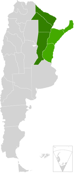
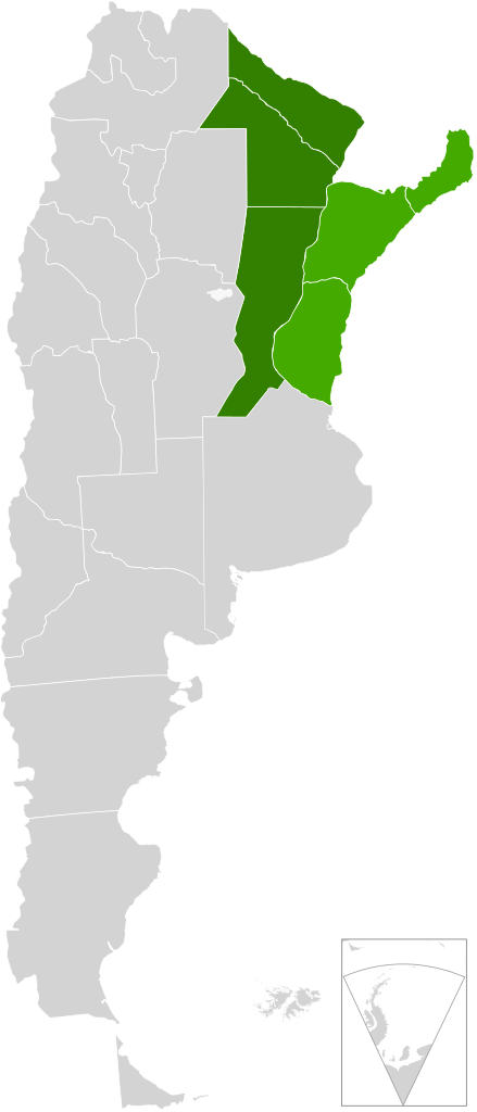
| Description | A map of Argentina, in scalable vector form, showing the provinces from the "Litoral argentino" |
| Date | (UTC) |
| Source | |
| Author |
|
| This is a retouched picture, which means that it has been digitally altered from its original version. The original can be viewed here: Blank Argentina Map.svg:
|
I, the copyright holder of this work, hereby publish it under the following license:
This file is licensed under the Creative Commons Attribution-Share Alike 3.0 Unported license.
- You are free:
- to share – to copy, distribute and transmit the work
- to remix – to adapt the work
- Under the following conditions:
- attribution – You must give appropriate credit, provide a link to the license, and indicate if changes were made. You may do so in any reasonable manner, but not in any way that suggests the licensor endorses you or your use.
- share alike – If you remix, transform, or build upon the material, you must distribute your contributions under the same or compatible license as the original.
Original upload log[edit]
This image is a derivative work of the following images:
- File:Blank_Argentina_Map.svg licensed with Cc-by-sa-3.0
- 2009-06-16T03:38:27Z Dexxter 465x1085 (556030 Bytes) minor corrections
- 2009-06-09T04:16:00Z Dexxter 475x1029 (571435 Bytes) size
- 2009-06-09T03:52:25Z Dexxter 475x1029 (653128 Bytes) darker background
- 2009-06-09T03:43:53Z Dexxter 475x1029 (560186 Bytes) == Summary == {{Information |Description=A blank map of Argentina in scalable vector form, including the territorials claims. |Source=Own work, based on the official cartography published by the Military Geographic Institute
Uploaded with derivativeFX
File history
Click on a date/time to view the file as it appeared at that time.
| Date/Time | Thumbnail | Dimensions | User | Comment | |
|---|---|---|---|---|---|
| current | 20:33, 4 August 2010 | | 465 × 1,085 (544 KB) | Mahadeva (talk | contribs) | {{Information |Description=A map of Argentina, in scalable vector form, showing the provinces from the "Litoral argentino" |Source=*File:Blank_Argentina_Map.svg |Date=2010-08-04 20:32 (UTC) |Author=*File:Blank_Argentina_Map.svg: [[User:Dexxter |
You cannot overwrite this file.
File usage on Commons
There are no pages that use this file.
File usage on other wikis
The following other wikis use this file:
- Usage on en.wikipedia.org
- Usage on eo.wikipedia.org
- Usage on es.wikipedia.org
- Usage on fr.wikipedia.org
- Usage on ja.wikipedia.org
- Usage on zh.wikipedia.org