File:Lobsterponds.jpg
Salta a la navegació
Salta a la cerca
No hi ha cap versió amb una resolució més gran.
Lobsterponds.jpg (640 × 480 píxels, mida del fitxer: 145 Ko, tipus MIME: image/jpeg)
Llegendes
Llegendes
Afegeix una explicació d'una línia del que representa aquest fitxer
Resum[modifica]
| Descripció |
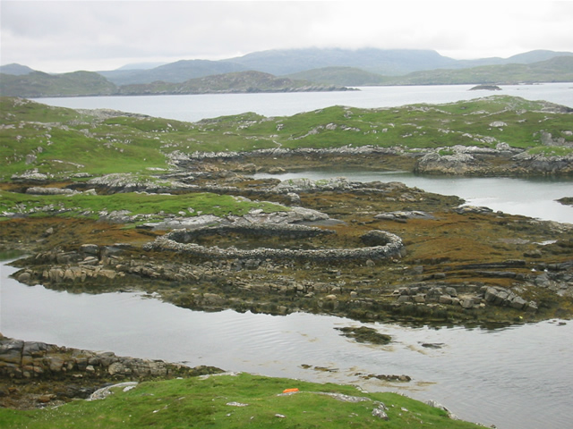
w:Great Bernera, w:Outer Hebrides, Scotland. Lobster ponds Huge stone lobster ponds, as viewed from the footpath from Bhalasaigh to Bostadh. |
||
| Data | See image source page. | ||
| Font |
This image was taken from the Geograph project collection. See this photograph's page on the Geograph website for the photographer's contact details. The copyright on this image is owned by Graham Orriss and is licensed for reuse under the Creative Commons Attribution-ShareAlike 2.0 license.
Aquest fitxer està publicat sota la llicència de Creative Commons Reconeixement i Compartir Igual 2.0 Genèrica. Reconeixement: Graham Orriss
|
||
| Autor | See above. | ||
| Permís (Com reutilitzar aquest fitxer) |
See above. |

| Posició de la càmera | | Aquesta i altres imatges properes a: OpenStreetMap |
|---|
| Posició de l'objecte | | Aquesta i altres imatges properes a: OpenStreetMap |
|---|
_region:GB-GBN_heading:202.00&language=ca)
Llicència[modifica]
Aquest fitxer està publicat sota la llicència de Creative Commons Reconeixement i Compartir Igual 2.0 Genèrica.
- Sou lliure de:
- compartir – copiar, distribuir i comunicar públicament l'obra
- adaptar – fer-ne obres derivades
- Amb les condicions següents:
- reconeixement – Heu de donar la informació adequada sobre l'autor, proporcionar un enllaç a la llicència i indicar si s'han realitzat canvis. Podeu fer-ho amb qualsevol mitjà raonable, però de cap manera no suggereixi que l'autor us dóna suport o aprova l'ús que en feu.
- compartir igual – Si modifiqueu, transformeu, o generareu amb el material, haureu de distribuir les vostres contribucions sota una llicència similar o una de compatible com l'original
Historial del fitxer
Cliqueu una data/hora per veure el fitxer tal com era aleshores.
| Data/hora | Miniatura | Dimensions | Usuari/a | Comentari | |
|---|---|---|---|---|---|
| actual | 12:51, 7 jul 2008 | | 640 × 480 (145 Ko) | MacRusgail (discussió | contribucions) | == Summary == {{Information| |Description=w:Great Bernera, w:Outer Hebrides, Scotland. Lobster ponds Huge stone lobster ponds, as viewed from the footpath from Bhalasaigh to Bostadh. |Source=This image was taken from the Geograph project c |
No podeu sobreescriure aquest fitxer.
Ús del fitxer
La pàgina següent utilitza aquest fitxer:
Ús global del fitxer
Utilització d'aquest fitxer en altres wikis:
- Utilització a ast.wikipedia.org
- Utilització a br.wikipedia.org
- Utilització a ca.wikipedia.org
- Utilització a ceb.wikipedia.org
- Utilització a cy.wikipedia.org
- Utilització a da.wikipedia.org
- Utilització a de.wikipedia.org
- Utilització a de.wikivoyage.org
- Utilització a en.wikipedia.org
- Utilització a es.wikipedia.org
- Utilització a eu.wikipedia.org
- Utilització a ga.wikipedia.org
- Utilització a gd.wikipedia.org
- Utilització a gl.wikipedia.org
- Utilització a gv.wikipedia.org
- Utilització a it.wikipedia.org
- Utilització a kw.wikipedia.org
- Utilització a nds.wikipedia.org
- Utilització a nl.wikipedia.org
- Utilització a pl.wikipedia.org
- Utilització a simple.wikipedia.org
- Utilització a sv.wikipedia.org
- Utilització a uk.wikipedia.org
- Utilització a www.wikidata.org