File:Local communities in New Belgrade 2019.svg
Jump to navigation
Jump to search

Size of this PNG preview of this SVG file: 800 × 399 pixels. Other resolutions: 320 × 160 pixels | 640 × 319 pixels | 1,024 × 511 pixels | 1,280 × 638 pixels | 2,560 × 1,277 pixels | 838 × 418 pixels.
Original file (SVG file, nominally 838 × 418 pixels, file size: 45 KB)
Captions
Captions
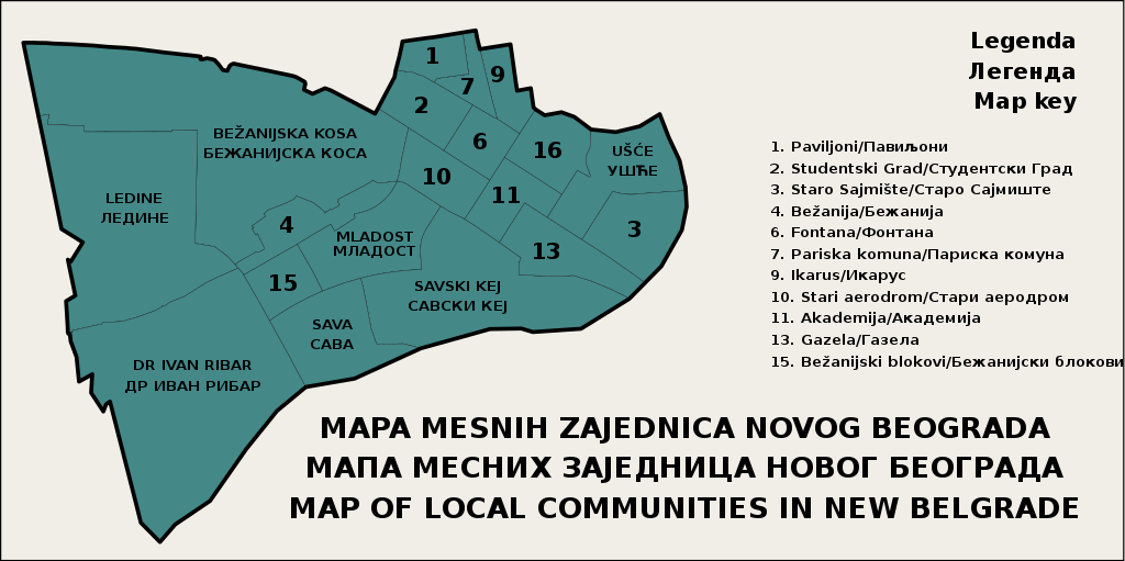
A map of local communities in the municipality of New Belgrade, Belgrade, Serbia
Summary
[edit]
| Description |
English: A map of administrative subdivisions of New Belgrade, an urban municipality in the City of Belgrade, the capital of Serbia. This map is based on data from the official website of the municipality, as well as OpenStreetMap data.
Srpskohrvatski / српскохрватски: Mapa administrativne podele Novog Beograda, gradske opštine u Gradu Beogradu, glavnom gradu Srbije. Mapa se zasniva na zvaničnoj veb stranici opštine, kao i na OpenStreetMap podacima.
Deutsch: Eine Karte der Verwaltungsunterteilungen von Neu-Belgrad, eine Stadtgemeinde in Belgrad, der Hauptstadt Serbiens. Die karte basiert auf der offiziellen Website Neu-Belgrads, und Daten von OpenStreetMap. |
| Date | |
| Source | Own work |
| Author | Sava Jevtić |
Licensing
[edit]
I, the copyright holder of this work, hereby publish it under the following license:
This file is licensed under the Creative Commons Attribution-Share Alike 4.0 International license.
- You are free:
- to share – to copy, distribute and transmit the work
- to remix – to adapt the work
- Under the following conditions:
- attribution – You must give appropriate credit, provide a link to the license, and indicate if changes were made. You may do so in any reasonable manner, but not in any way that suggests the licensor endorses you or your use.
- share alike – If you remix, transform, or build upon the material, you must distribute your contributions under the same or compatible license as the original.
File history
Click on a date/time to view the file as it appeared at that time.
| Date/Time | Thumbnail | Dimensions | User | Comment | |
|---|---|---|---|---|---|
| current | 22:20, 7 September 2019 | | 838 × 418 (45 KB) | Sjevtic (talk | contribs) | changed font to DejaVu Sans for compatibility/consistency purposes |
| 22:32, 27 March 2019 |  | 838 × 418 (44 KB) | Sjevtic (talk | contribs) | Changed font for compatibility purposes; realigned the text | |
| 23:03, 26 March 2019 |  | 838 × 418 (36 KB) | Sjevtic (talk | contribs) | aligned the image so that the margin doesn't cut off the text | |
| 22:54, 26 March 2019 |  | 838 × 418 (36 KB) | Sjevtic (talk | contribs) | User created page with UploadWizard |
You cannot overwrite this file.
File usage on Commons
The following 2 pages use this file:
File usage on other wikis
The following other wikis use this file:
- Usage on en.wikipedia.org
- Usage on sr.wikipedia.org