File:Locatie Floreszee.PNG
Naviqasiyaya keç
Axtarışa keç
Daha yüksək versiyası yoxdur.
Locatie_Floreszee.PNG (484 × 362 piksel, fayl həcmi: 12 KB, MIME növü: image/png)
Captions
Captions
Add a one-line explanation of what this file represents
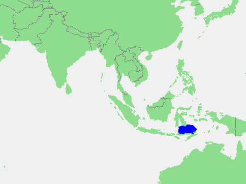
Location of the Flores Sea
| İzah | Flores Sea | ||||
| Mənbə | own work based on PD map | ||||
| Müəllif | edited by M.Minderhoud | ||||
| İcazə (Faylın təkrar istifadəsi) |
|
Faylın tarixçəsi
Faylın əvvəlki versiyasını görmək üçün gün/tarix bölməsindəki tarixlərə klikləyin.
| Tarix/Vaxt | Miniatür | Ölçülər | İstifadəçi | Şərh | |
|---|---|---|---|---|---|
| hal-hazırkı | 12:37, 17 sentyabr 2006 | | 484 × 362 (12 KB) | Michiel1972 (müzakirə | töhfələr) | {{Information |Description= Flores Sea |Source= own work based on PD map |Date= |Author= edited by M.Minderhoud |Permission= {{PD-Demis}} |other_versions= }} category:Locator maps of seas |
Siz bu faylı yenidən yükləyə bilməzsiniz.
Faylın istifadəsi
Bu faylı istifadə edən səhifə yoxdur.
Faylın qlobal istifadəsi
Bu fayl aşağıdakı vikilərdə istifadə olunur:
- af.wikipedia.org layihəsində istifadəsi
- an.wikipedia.org layihəsində istifadəsi
- ar.wikipedia.org layihəsində istifadəsi
- avk.wikipedia.org layihəsində istifadəsi
- az.wikipedia.org layihəsində istifadəsi
- ban.wikipedia.org layihəsində istifadəsi
- ba.wikipedia.org layihəsində istifadəsi
- be-tarask.wikipedia.org layihəsində istifadəsi
- br.wikipedia.org layihəsində istifadəsi
- bs.wikipedia.org layihəsində istifadəsi
- ca.wikipedia.org layihəsində istifadəsi
- cs.wikipedia.org layihəsində istifadəsi
- cv.wikipedia.org layihəsində istifadəsi
- da.wikipedia.org layihəsində istifadəsi
- de.wikipedia.org layihəsində istifadəsi
- el.wikipedia.org layihəsində istifadəsi
- en.wikipedia.org layihəsində istifadəsi
- eo.wikipedia.org layihəsində istifadəsi
- es.wikipedia.org layihəsində istifadəsi
- fa.wikipedia.org layihəsində istifadəsi
- fi.wikipedia.org layihəsində istifadəsi
- frr.wikipedia.org layihəsində istifadəsi
- fr.wikipedia.org layihəsində istifadəsi
- fy.wikipedia.org layihəsində istifadəsi
- gl.wikipedia.org layihəsində istifadəsi
- id.wikipedia.org layihəsində istifadəsi
- ilo.wikipedia.org layihəsində istifadəsi
- is.wikipedia.org layihəsində istifadəsi
- it.wikipedia.org layihəsində istifadəsi
- ja.wikipedia.org layihəsində istifadəsi
- jv.wikipedia.org layihəsində istifadəsi
- ka.wikipedia.org layihəsində istifadəsi
- kk.wikipedia.org layihəsində istifadəsi
- ko.wikipedia.org layihəsində istifadəsi
- la.wikipedia.org layihəsində istifadəsi
- lt.wikipedia.org layihəsində istifadəsi
- mhr.wikipedia.org layihəsində istifadəsi
- mk.wikipedia.org layihəsində istifadəsi
- ml.wikipedia.org layihəsində istifadəsi
- ms.wikipedia.org layihəsində istifadəsi
- nl.wikipedia.org layihəsində istifadəsi
- nn.wikipedia.org layihəsində istifadəsi
- no.wikipedia.org layihəsində istifadəsi
Bu faylın qlobal istifadəsinə baxın.