File:Locatie Noordzee.PNG
Aller à la navigation
Aller à la recherche
Pas de plus haute résolution disponible.
Locatie_Noordzee.PNG (649 × 475 pixels, taille du fichier : 20 kio, type MIME : image/png)
Légendes
Légendes
Ajoutez en une ligne la description de ce que représente ce fichier
| Description |
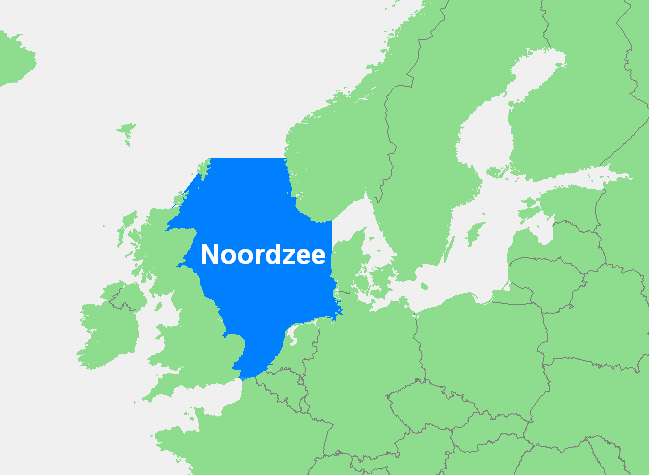
Nederlands: Noordzee
English: Locator map of the North Sea in the Atlantic Ocean, in northern Europe. |
||||
| Source | own work based on PD map | ||||
| Auteur | edited by M.Minderhoud | ||||
| Autorisation (Réutilisation de ce fichier) |
|
||||
| Autres versions | File:Locatie Noordzee -none-.PNG |
Historique du fichier
Cliquer sur une date et heure pour voir le fichier tel qu'il était à ce moment-là.
| Date et heure | Vignette | Dimensions | Utilisateur | Commentaire | |
|---|---|---|---|---|---|
| actuel | 14 janvier 2017 à 19:04 | | 649 × 475 (20 kio) | Mdd (d | contributions) | Aanpassing van originele kaart met ook een stukje Frankrijk aan de Noordzee |
| 10 septembre 2006 à 20:16 |  | 649 × 475 (21 kio) | Michiel1972 (d | contributions) | ||
| 10 septembre 2006 à 20:14 |  | 777 × 540 (27 kio) | Michiel1972 (d | contributions) | {{Information |Description={{nl}} Noordzee |Source= own work based on PD map |Date= |Author= edited by M.Minderhoud |Permission= {{PD-Demis}} |other_versions= }} category:Locator maps of seas |
Vous ne pouvez pas remplacer ce fichier.
Utilisations locales du fichier
La page suivante utilise ce fichier :
Utilisations du fichier sur d’autres wikis
Les autres wikis suivants utilisent ce fichier :
- Utilisation sur af.wikipedia.org
- Utilisation sur an.wikipedia.org
- Utilisation sur avk.wikipedia.org
- Utilisation sur ca.wikipedia.org
- Utilisation sur en.wikipedia.org
- Utilisation sur es.wikipedia.org
- Utilisation sur fr.wikipedia.org
- Utilisation sur fy.wikipedia.org
- Utilisation sur gl.wikipedia.org
- Utilisation sur ia.wikipedia.org
- Utilisation sur it.wiktionary.org
- Utilisation sur nl.wikipedia.org
- Utilisation sur nl.wikinews.org
- Utilisation sur pt.wikipedia.org
- Utilisation sur sc.wikipedia.org
- Utilisation sur stq.wikipedia.org
- Utilisation sur vec.wiktionary.org
- Utilisation sur vls.wikipedia.org
- Utilisation sur zea.wikipedia.org
- Utilisation sur zh.wikipedia.org