File:LocationAntarctica.png
跳去導覽
跳去搵嘢

預覽大細:800 × 407 像素。 第啲解像度:320 × 163 像素 | 640 × 326 像素 | 1,024 × 521 像素 | 1,280 × 651 像素 | 2,759 × 1,404 像素。
原本檔案 (2,759 × 1,404 像素,檔案大細:50 KB ,MIME類型:image/png)
Captions
Captions
Add a one-line explanation of what this file represents

|
File:Antarctica Location.svg is a vector version of this file. It should be used in place of this PNG file when not inferior.
File:LocationAntarctica.png → File:Antarctica Location.svg
For more information, see Help:SVG. |
 |
摘要[編輯]
Español: Mapamundi mostrando la ubicación de la Antártida.
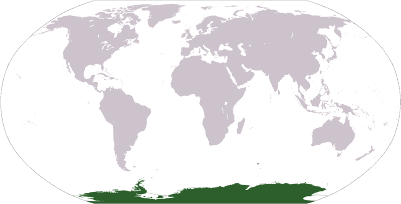
World map depicting Antarctica; map adapted from PDF world map at CIA World Fact Book.
Updated March 31, 2006 to remove green above 60°S line. in december there is 24 hours of sun light
協議[編輯]
This image is in the public domain because it contains materials that originally came from the United States Central Intelligence Agency's World Factbook.
|
 |
檔案歷史
撳個日期/時間去睇響嗰個時間出現過嘅檔案。
| 日期/時間 | 縮圖 | 尺寸 | 用戶 | 註解 | |
|---|---|---|---|---|---|
| 現時 | 2013年4月23號 (二) 17:13 | | 2,759 × 1,404(50 KB) | User02062000(傾偈 | 貢獻) | |
| 2013年4月23號 (二) 17:10 |  | 2,759 × 1,404(50 KB) | User02062000(傾偈 | 貢獻) | Reverted to version as of 18:54, 20 December 2005 | |
| 2008年1月19號 (六) 12:37 |  | 2,759 × 1,404(97 KB) | F l a n k e r(傾偈 | 貢獻) | Transparency | |
| 2006年3月31號 (五) 01:04 |  | 2,759 × 1,404(55 KB) | David Kernow~commonswiki(傾偈 | 貢獻) | ||
| 2005年12月20號 (二) 18:54 |  | 2,759 × 1,404(50 KB) | E Pluribus Anthony~commonswiki(傾偈 | 貢獻) | World map: Antarctica (location) | |
| 2005年4月28號 (四) 12:38 |  | 2,759 × 1,404(39 KB) | Ghalas(傾偈 | 貢獻) | Extracted from CIA World Factbook PDF world map, then rasterized and colored. {{PD-USGov-CIA-WF}} |
你無得衾咗個檔案。
檔案用途
以下嘅4版用到呢個檔:
全域檔案使用情況
下面嘅維基都用緊呢個檔案:
- af.wikipedia.org嘅使用情況
- am.wikipedia.org嘅使用情況
- ang.wikipedia.org嘅使用情況
- arc.wikipedia.org嘅使用情況
- ar.wikipedia.org嘅使用情況
- arz.wikipedia.org嘅使用情況
- ba.wikipedia.org嘅使用情況
- bcl.wikipedia.org嘅使用情況
- be-tarask.wikipedia.org嘅使用情況
- bjn.wikipedia.org嘅使用情況
- bn.wikipedia.org嘅使用情況
- bo.wikipedia.org嘅使用情況
- bpy.wikipedia.org嘅使用情況
- br.wikipedia.org嘅使用情況
睇呢個檔案嘅更多全域使用情況。