File:LocationReunion.svg
跳至導覽
跳至搜尋

此 SVG 檔案的 PNG 預覽的大小:800 × 398 像素。 其他解析度:320 × 159 像素 | 640 × 318 像素 | 1,024 × 509 像素 | 1,280 × 636 像素 | 2,560 × 1,272 像素 | 998 × 496 像素。
原始檔案 (SVG 檔案,表面大小:998 × 496 像素,檔案大小:4.15 MB)
說明
說明
添加單行說明來描述出檔案所代表的內容
摘要
[編輯]
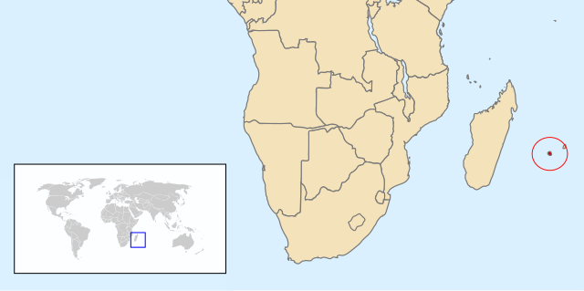
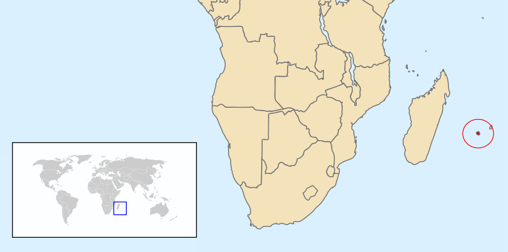
| 描述 | Map of Renunion based on Image:A large blank world map with oceans marked in blue.svg |
| 日期 | |
| 來源 | 自己的作品 |
| 作者 | Chris huh |
授權條款
[編輯]
| 我,此作品的版權所有人,釋出此作品至公共領域。此授權條款在全世界均適用。 這可能在某些國家不合法,如果是的話: 我授予任何人有權利使用此作品於任何用途,除受法律約束外,不受任何限制。 |
檔案歷史
點選日期/時間以檢視該時間的檔案版本。
| 日期/時間 | 縮圖 | 尺寸 | 使用者 | 備註 | |
|---|---|---|---|---|---|
| 目前 | 2013年2月12日 (二) 07:49 | | 998 × 496(4.15 MB) | Citypeek(留言 | 貢獻) | removal border, clip |
| 2008年5月6日 (二) 21:06 |  | 1,000 × 500(2.76 MB) | Chris huh(留言 | 貢獻) | ||
| 2008年5月6日 (二) 21:00 |  | 1,000 × 500(2.76 MB) | Chris huh(留言 | 貢獻) | {{Information |Description=Map of Renunion based on Image:A large blank world map with oceans marked in blue.svg |Source=self-made |Date=6 May 2008 |Author= Chris huh |Permission= |other_versions= }} [[Category:Locator maps of cou |
無法覆蓋此檔案。
檔案用途
下列4個頁面有用到此檔案:
全域檔案使用狀況
以下其他 wiki 使用了這個檔案:
- af.wikipedia.org 的使用狀況
- am.wikipedia.org 的使用狀況
- ar.wikipedia.org 的使用狀況
- ban.wikipedia.org 的使用狀況
- bg.wikipedia.org 的使用狀況
- bjn.wikipedia.org 的使用狀況
- ca.wikipedia.org 的使用狀況
- ceb.wikipedia.org 的使用狀況
- cs.wikipedia.org 的使用狀況
- en.wikipedia.org 的使用狀況
- eo.wikipedia.org 的使用狀況
- es.wikipedia.org 的使用狀況
- et.wikipedia.org 的使用狀況
- eu.wikipedia.org 的使用狀況
- fa.wikipedia.org 的使用狀況
- fr.wikipedia.org 的使用狀況
- ha.wikipedia.org 的使用狀況
- hif.wikipedia.org 的使用狀況
- hu.wikipedia.org 的使用狀況
- id.wikipedia.org 的使用狀況
- it.wikipedia.org 的使用狀況
- ka.wikipedia.org 的使用狀況
- mk.wikipedia.org 的使用狀況
- nl.wikipedia.org 的使用狀況
- no.wikipedia.org 的使用狀況
- pl.wikipedia.org 的使用狀況
- pnb.wikipedia.org 的使用狀況
- pt.wikipedia.org 的使用狀況
檢視此檔案的更多全域使用狀況。