File:LocationSomaliland3.png
Jump to navigation
Jump to search
No higher resolution available.
LocationSomaliland3.png (798 × 398 pixels, file size: 95 KB, MIME type: image/png)
Captions
Captions
Add a one-line explanation of what this file represents
Summary[edit]
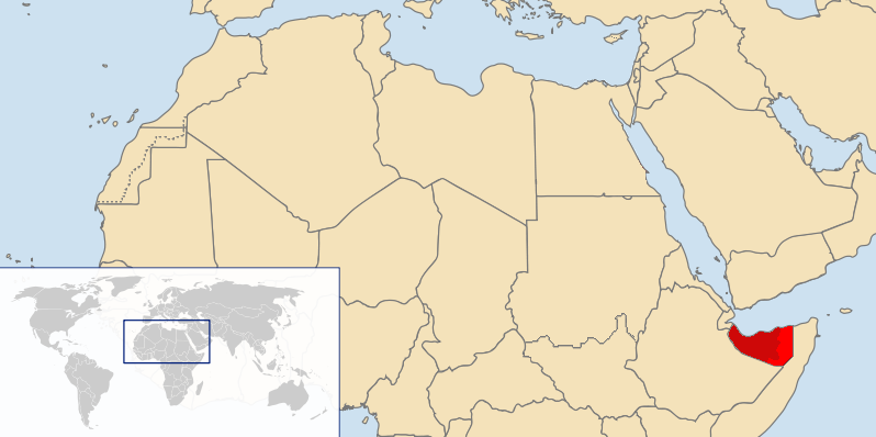
| Description | Map showing the location of Somaliland |
| Date | 6 May 2007 (original upload date) |
| Source | Transferred from en.wikipedia to Commons. |
| Author | Abdullah Geelah at English Wikipedia |
Licensing[edit]
Abdullah Geelah at English Wikipedia, the copyright holder of this work, hereby publishes it under the following licenses:

|
Permission is granted to copy, distribute and/or modify this document under the terms of the GNU Free Documentation License, Version 1.2 or any later version published by the Free Software Foundation; with no Invariant Sections, no Front-Cover Texts, and no Back-Cover Texts. A copy of the license is included in the section entitled GNU Free Documentation License. |
| This file is licensed under the Creative Commons Attribution-Share Alike 3.0 Unported license. | ||
| Attribution: Abdullah Geelah at English Wikipedia | ||
| ||
| This licensing tag was added to this file as part of the GFDL licensing update. |
This file is licensed under the Creative Commons Attribution-Share Alike 2.5 Generic, 2.0 Generic and 1.0 Generic license.
Attribution: Abdullah Geelah at English Wikipedia
- You are free:
- to share – to copy, distribute and transmit the work
- to remix – to adapt the work
- Under the following conditions:
- attribution – You must give appropriate credit, provide a link to the license, and indicate if changes were made. You may do so in any reasonable manner, but not in any way that suggests the licensor endorses you or your use.
- share alike – If you remix, transform, or build upon the material, you must distribute your contributions under the same or compatible license as the original.
You may select the license of your choice.
Original upload log[edit]
The original description page was here. All following user names refer to en.wikipedia.
- 2007-05-06 19:34 Abdullah Geelah 800×399×8 (76305 bytes)
File history
Click on a date/time to view the file as it appeared at that time.
| Date/Time | Thumbnail | Dimensions | User | Comment | |
|---|---|---|---|---|---|
| current | 11:44, 29 December 2023 | | 798 × 398 (95 KB) | Siirski (talk | contribs) | Reverted to version as of 23:06, 26 August 2021 (UTC) |
| 19:31, 1 October 2023 |  | 798 × 398 (101 KB) | Caawiyahaderon (talk | contribs) | https://www.thehindu.com/news/international/pro-somalia-militia-takes-key-army-base-in-breakaway-region/article67238670.ece | |
| 23:06, 26 August 2021 |  | 798 × 398 (95 KB) | Siirski (talk | contribs) | Reverted to version as of 14:11, 29 January 2012 (UTC) | |
| 14:19, 26 August 2021 |  | 800 × 399 (75 KB) | Siirski (talk | contribs) | Reverted to version as of 11:45, 19 July 2007 (UTC) | |
| 14:11, 29 January 2012 |  | 798 × 398 (95 KB) | Nicolay Sidorov (talk | contribs) | fix border | |
| 08:22, 21 July 2011 |  | 798 × 398 (75 KB) | Nicolay Sidorov (talk | contribs) | highlighted | |
| 22:44, 13 February 2011 |  | 798 × 398 (69 KB) | Ras67 (talk | contribs) | cropped and squeezed | |
| 15:44, 11 January 2011 |  | 800 × 399 (95 KB) | Nicolay Sidorov (talk | contribs) | Southern Sudan is already de-facto independent. | |
| 17:36, 27 December 2010 |  | 800 × 399 (75 KB) | Nicolay Sidorov (talk | contribs) | Обозначать де-факто границу Сомалиленда нет смысла, поскольку это государство уже почти полностью контролирует свою территорию | |
| 09:19, 7 November 2010 |  | 800 × 399 (75 KB) | Nicolay Sidorov (talk | contribs) | Изменил фактическую границу в соответствии с состоянием дел на 2010 год (http://en.wikipedia.org/wiki/File:Somalia_map_states_regions_districts.png) |
You cannot overwrite this file.
File usage on Commons
There are no pages that use this file.
File usage on other wikis
The following other wikis use this file:
- Usage on af.wikipedia.org
- Usage on an.wikipedia.org
- Usage on ba.wikipedia.org
- Usage on be-tarask.wikipedia.org
- Usage on be.wikipedia.org
- Usage on bn.wikipedia.org
- Usage on br.wikipedia.org
- Usage on cs.wikipedia.org
- Usage on da.wikipedia.org
- Usage on de.wikipedia.org
- Usage on en.wikipedia.org
- Usage on eo.wikipedia.org
- Usage on gag.wikipedia.org
- Usage on id.wikipedia.org
- Usage on kg.wikipedia.org
- Usage on ln.wikipedia.org
- Usage on mk.wikipedia.org
- Usage on ml.wikipedia.org
- Usage on mr.wikipedia.org
- Usage on ms.wikipedia.org
- Usage on no.wikipedia.org
- Usage on oc.wikipedia.org
- Usage on pl.wikipedia.org
- Usage on pl.wiktionary.org
- Usage on pnb.wikipedia.org
- Usage on pt.wikipedia.org
- Usage on ro.wikipedia.org
- Usage on ru.wikipedia.org
- Usage on ru.wikinews.org
- Usage on sk.wikipedia.org
- Usage on tk.wikipedia.org
- Usage on tr.wikipedia.org
- Usage on uk.wikipedia.org
- Usage on vi.wikipedia.org