File:Location map Japan Satsumasendai city.png
Jump to navigation
Jump to search
Size of this preview: 681 × 600 pixels. Other resolutions: 273 × 240 pixels | 545 × 480 pixels | 730 × 643 pixels.
Original file (730 × 643 pixels, file size: 491 KB, MIME type: image/png)
Captions
Captions
Add a one-line explanation of what this file represents
Summary
[edit]
| Description |
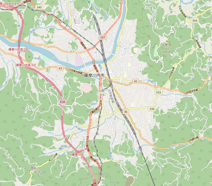
日本語: 薩摩川内市街地地図
English: Map of Satsumasendai city central |
| Date | |
| Source | OpenStreetMap |
| Author | OpenStreetMap and contributors |
Licensing
[edit]
| This work contains information from OpenStreetMap, which is made available under the Open Database License (ODbL).
The ODbL does not require any particular license for maps produced from ODbL data. Prior to 1 August 2020, map tiles produced by the OpenStreetMap Foundation were licensed under the CC-BY-SA-2.0 license. Maps produced by other people may be subject to other licences. |
File history
Click on a date/time to view the file as it appeared at that time.
| Date/Time | Thumbnail | Dimensions | User | Comment | |
|---|---|---|---|---|---|
| current | 12:56, 4 February 2021 | | 730 × 643 (491 KB) | Sakoppi (talk | contribs) | {{Information |description={{ja|1=薩摩川内市街地地図}} {{en|1=Map of Satsumasendai city central}} |date=2021-02-04 |source=OpenStreetMap |author=[http://www.openstreetmap.org OpenStreetMap] and contributors |permission= |other versions= }} =={{int:license-header}}== {{ODbL OpenStreetMap}} Category:OpenStreetMap maps of Japan Category:Location maps of Japan Category:Maps of Kagoshima Prefecture |
You cannot overwrite this file.
File usage on Commons
There are no pages that use this file.
File usage on other wikis
The following other wikis use this file:
- Usage on fr.wikipedia.org
- Usage on ja.wikipedia.org