File:Location map of Monmouth County, New Jersey.svg
Jump to navigation
Jump to search

Size of this PNG preview of this SVG file: 700 × 600 pixels. Other resolutions: 280 × 240 pixels | 560 × 480 pixels | 896 × 768 pixels | 1,195 × 1,024 pixels | 2,389 × 2,048 pixels.
Original file (SVG file, nominally 896 × 768 pixels, file size: 1.01 MB)
Captions
Captions
Add a one-line explanation of what this file represents
Summary[edit]
| Description |
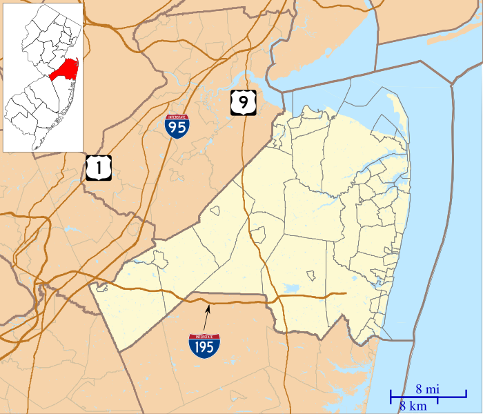
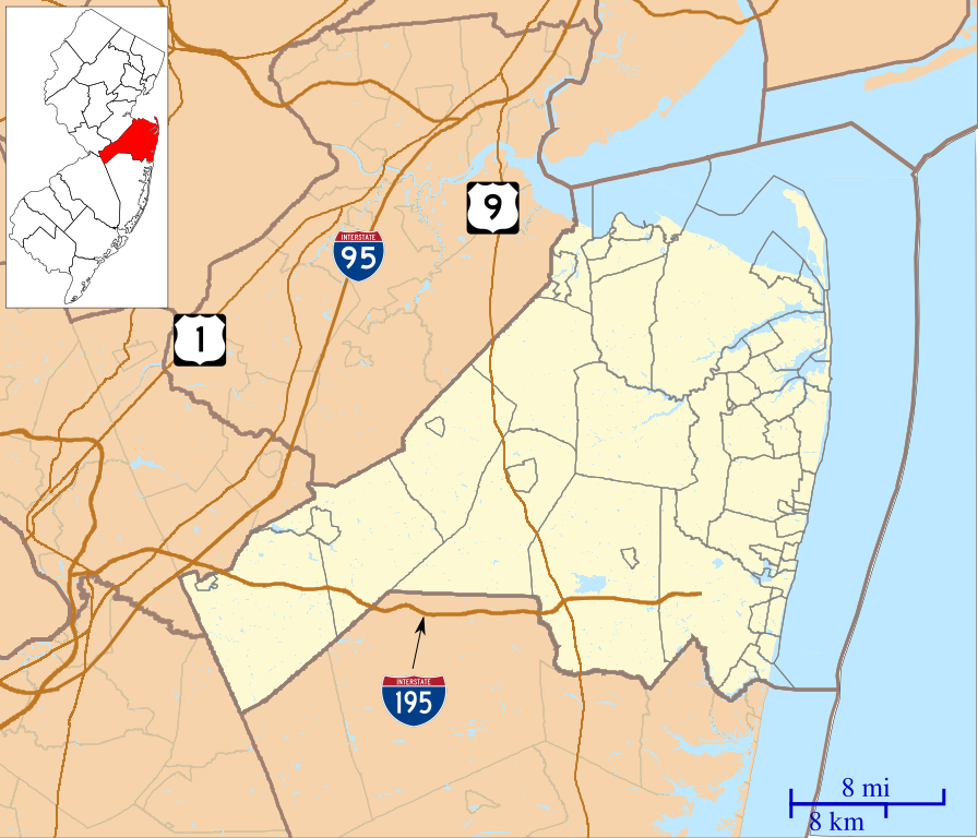
English: This is a map of Monmouth County, New Jersey, USA which includes incorporated settlements, township borders, and major highways. |
| Date | |
| Source | My own work, using custom-written MapScript applications with United States Census Bureau data |
| Author | Omnedon |
Licensing[edit]
| I, the copyright holder of this work, release this work into the public domain. This applies worldwide. In some countries this may not be legally possible; if so: I grant anyone the right to use this work for any purpose, without any conditions, unless such conditions are required by law. |
File history
Click on a date/time to view the file as it appeared at that time.
| Date/Time | Thumbnail | Dimensions | User | Comment | |
|---|---|---|---|---|---|
| current | 02:29, 25 September 2012 | | 896 × 768 (1.01 MB) | Omnedon (talk | contribs) | == {{int:filedesc}} == {{Information |Description={{en|This is a map of Monmouth County, New Jersey, USA which includes incorporated settlements, township borders, and major highways.}} |Source=My own work, using cust... |
You cannot overwrite this file.
File usage on Commons
There are no pages that use this file.
File usage on other wikis
The following other wikis use this file:
- Usage on ar.wikipedia.org
- Usage on azb.wikipedia.org
- کلیفوود، نیوجرسی
- ایملایزتاون، نیوجرسی
- کلارکسبرق، نیوجرسی
- البرون، نیوجرسی
- رابرتسویل، نیوجرسی
- آدلفیا، نیوجرسی
- سویتمان، نیوجرسی
- آلایر، نیوجرسی
- والنفورد، نیوجرسی
- دیل، نیوجرسی
- تننت، نیوجرسی
- واترویچ، نیوجرسی
- وایسید، نیوجرسی
- آسبوری پارک، نیوجرسی
- توون بروک، نیوجرسی
- وزت دیل، نیوجرسی
- وزت فارمز، نیوجرسی
- وزت قروو، نیوجرسی
- ویکاتونک، نیوجرسی
- برئیدولت، نیوجرسی
- واندربورق، نیوجرسی
- شارون، نیوجرسی
- ایسمیتبورق، نیوجرسی
- سوتارد، نیوجرسی
- ایسپرینق میل، نیوجرسی
- سکوانکوم، نیوجرسی
- ماتیوس، نیوجرسی
- Usage on ceb.wikipedia.org
- Usage on en.wikipedia.org
- Aberdeen Township, New Jersey
- Allenhurst, New Jersey
- Allentown, New Jersey
- Asbury Park, New Jersey
- Avon-by-the-Sea, New Jersey
- Belmar, New Jersey
- Brielle, New Jersey
- Cliffwood Beach, New Jersey
- Colts Neck Township, New Jersey
- East Freehold, New Jersey
- Englishtown, New Jersey
- Fair Haven, New Jersey
- Fairview, Monmouth County, New Jersey
- Farmingdale, New Jersey
- Freehold Borough, New Jersey
- Freehold Township, New Jersey
- Hazlet, New Jersey
- Highlands, New Jersey
- Howell Township, New Jersey
- Interlaken, New Jersey
- Keansburg, New Jersey
View more global usage of this file.