File:Location map of Montgomery County, Indiana.svg
Jump to navigation
Jump to search

Size of this PNG preview of this SVG file: 600 × 600 pixels. Other resolutions: 240 × 240 pixels | 480 × 480 pixels | 768 × 768 pixels | 1,024 × 1,024 pixels | 2,048 × 2,048 pixels | 960 × 960 pixels.
Original file (SVG file, nominally 960 × 960 pixels, file size: 1.32 MB)
Captions
Captions
Add a one-line explanation of what this file represents
Summary
[edit]
| Description |
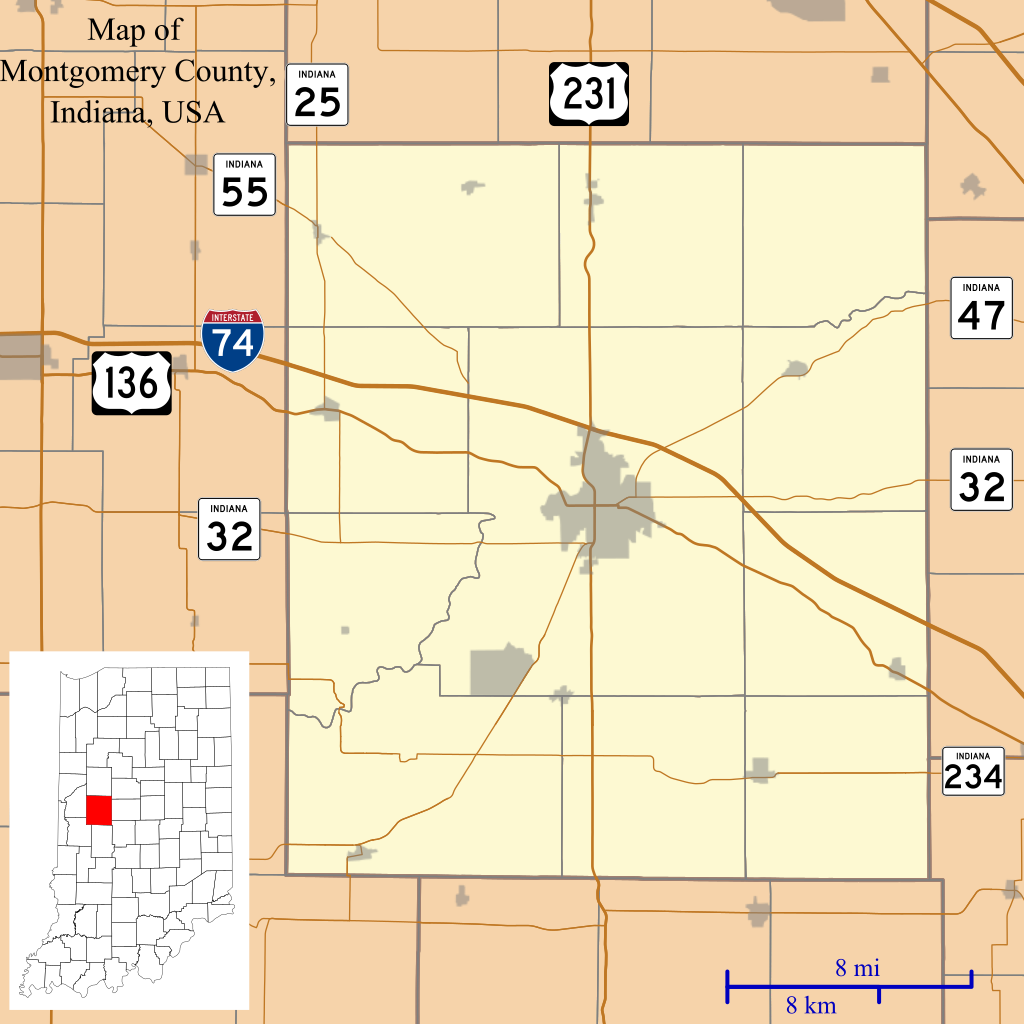
English: This is a map of Montgomery County, Indiana, USA which includes incorporated settlements, township borders, and major highways. |
| Date | |
| Source | Source=My own work, using custom-written MapScript applications with United States Census Bureau TIGER 2013 data |
| Author | Omnedon |
Licensing
[edit]
| I, the copyright holder of this work, release this work into the public domain. This applies worldwide. In some countries this may not be legally possible; if so: I grant anyone the right to use this work for any purpose, without any conditions, unless such conditions are required by law. |
File history
Click on a date/time to view the file as it appeared at that time.
| Date/Time | Thumbnail | Dimensions | User | Comment | |
|---|---|---|---|---|---|
| current | 03:47, 27 December 2013 | | 960 × 960 (1.32 MB) | Omnedon (talk | contribs) | == {{int:filedesc}} == {{Information |Description={{en|This is a map of Montgomery County, Indiana, USA which includes incorporated settlements, township borders, and major highways.}} |Source=Source=My own work, using... |
You cannot overwrite this file.
File usage on Commons
The following page uses this file:
File usage on other wikis
The following other wikis use this file:
- Usage on ar.wikipedia.org
- Usage on azb.wikipedia.org
- Usage on ceb.wikipedia.org
- Usage on en.wikipedia.org
- Alamo, Indiana
- Crawfordsville, Indiana
- Darlington, Indiana
- Ladoga, Indiana
- Linden, Indiana
- New Market, Indiana
- New Richmond, Indiana
- New Ross, Indiana
- Waveland, Indiana
- Waynetown, Indiana
- Browns Valley, Indiana
- Bowers, Indiana
- Deer's Mill, Indiana
- Elmdale, Indiana
- Garfield, Indiana
- Hibernia, Montgomery County, Indiana
- Kirkpatrick, Indiana
- Lapland, Indiana
- Mace, Indiana
- Parkersburg, Indiana
- Shannondale, Indiana
- Smartsburg, Indiana
- Wesley, Indiana
- Whitesville, Indiana
- Yountsville, Indiana
- Cherry Grove, Indiana
- Balhinch, Indiana
- Linnsburg, Indiana
- Lake Holiday, Indiana
- Darlington Woods, Indiana
- Module:Location map/data/USA Indiana Montgomery County/doc
- Beckville, Indiana
- North Union, Indiana
- Fiskville, Indiana
- Manchester, Montgomery County, Indiana
View more global usage of this file.