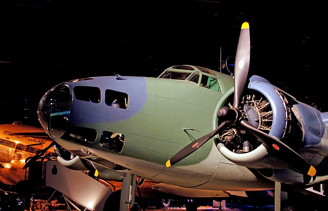
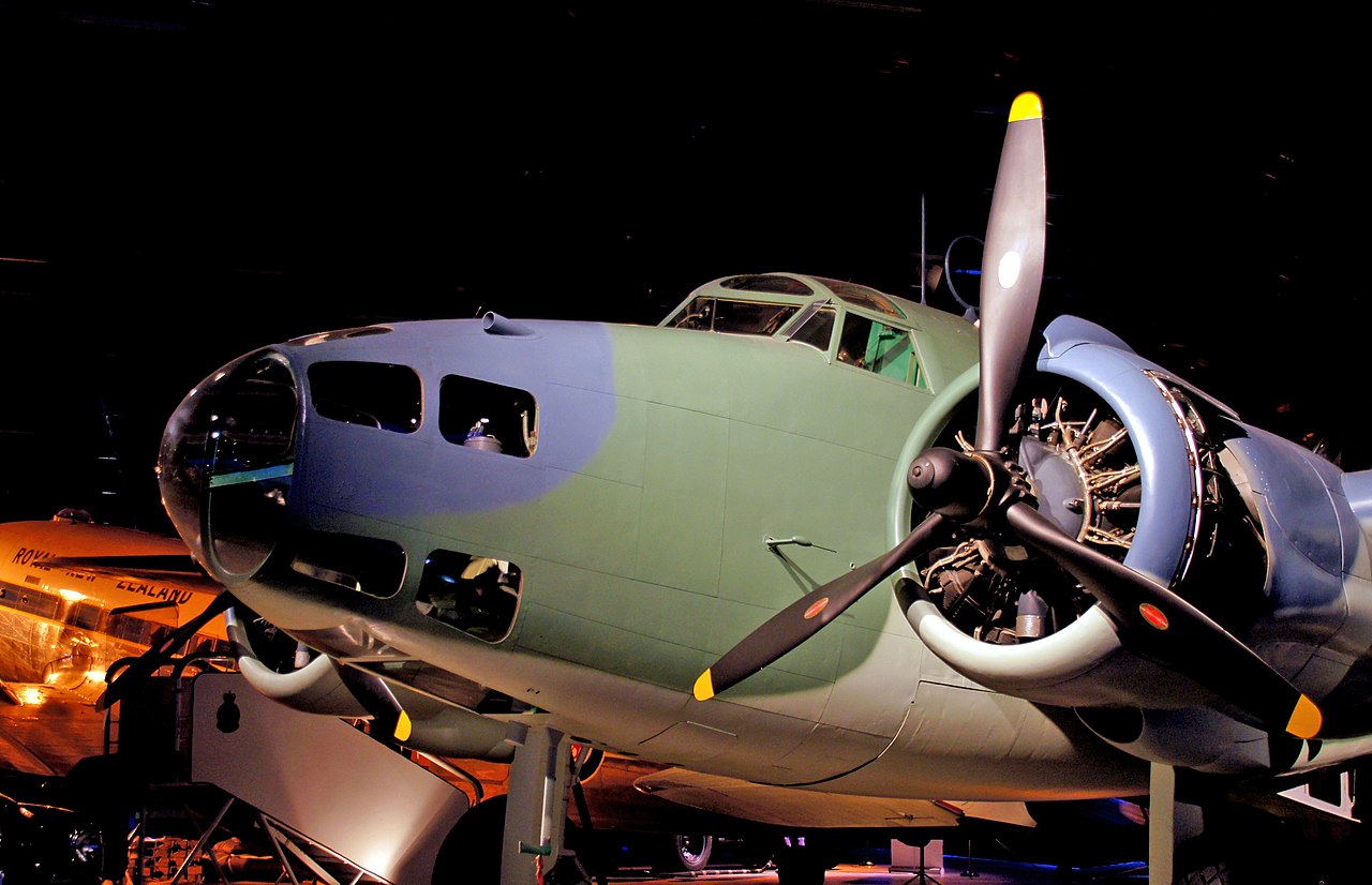
File:Lockheed Hudson MKIII (14112383695).jpg

Original file (2,400 × 1,549 pixels, file size: 1.53 MB, MIME type: image/jpeg)
Captions
Captions
Summary
[edit].jpg&action=edit§ion=1)
| Description |
The RNZAF received 94 Hudsons in 1941-42 as part of measures to counter the threat of German raiders around the New Zealand coastline. Subsequently they formed a major part of the RNZAF's operational capabilities to counter the Japanese threat. They were operated by No. 1,2,3,4 and 9 Squadrons until replaced in 1943-44 by the more powerful Lockheed Venturas. The Hudson performed the roles of maritime search and strike operations.
|
| Date | |
| Source | Lockheed Hudson MKIII |
| Author | Bernard Spragg. NZ from Christchurch, New Zealand |
| Camera location | | View this and other nearby images on: OpenStreetMap |
|---|
.jpg¶ms=-43.547070_N_0172.547471_E_globe:Earth_type:camera_source:Flickr_&language=en)
Licensing
[edit].jpg&action=edit§ion=2)
| This file is made available under the Creative Commons CC0 1.0 Universal Public Domain Dedication. | |
| The person who associated a work with this deed has dedicated the work to the public domain by waiving all of their rights to the work worldwide under copyright law, including all related and neighboring rights, to the extent allowed by law. You can copy, modify, distribute and perform the work, even for commercial purposes, all without asking permission.
|
| This image was originally posted to Flickr by Bernard Spragg at https://flickr.com/photos/88123769@N02/14112383695 (archive). It was reviewed on 21 June 2018 by FlickreviewR 2 and was confirmed to be licensed under the terms of the cc-zero. |
File history
Click on a date/time to view the file as it appeared at that time.
| Date/Time | Thumbnail | Dimensions | User | Comment | |
|---|---|---|---|---|---|
| current | 11:21, 21 June 2018 | | 2,400 × 1,549 (1.53 MB) | Meisam (talk | contribs) | Transferred from Flickr via #flickr2commons |
You cannot overwrite this file.
File usage on Commons
The following page uses this file:
.jpg&oldid=680794472)