File:Locks 63andthird 64andtwothirds 66 Paw Paw Tunnel Drawing from HABS.png
Jump to navigation
Jump to search

Size of this preview: 800 × 534 pixels. Other resolutions: 320 × 213 pixels | 640 × 427 pixels | 1,024 × 683 pixels | 1,280 × 854 pixels | 2,560 × 1,707 pixels | 14,442 × 9,632 pixels.
Original file (14,442 × 9,632 pixels, file size: 1.13 MB, MIME type: image/png)
Captions
Captions
Add a one-line explanation of what this file represents
| Warning | The original file is very high-resolution. It might not load properly or could cause your browser to freeze when opened at full size. |
|---|
| Description |
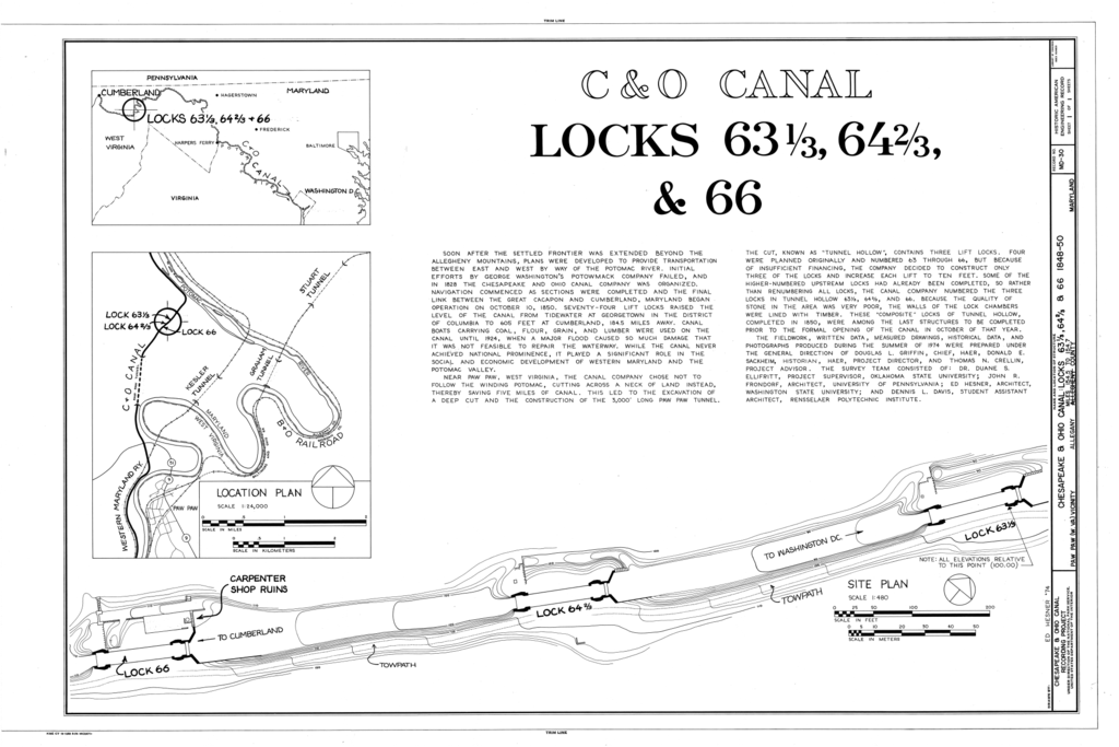
English: Drawings of locks 63⅓, 64⅔, and 66, with location of Paw Paw Tunnel.
HABS says: HAER MD,1-PAW.V,1- (sheet 1 of 1) - Chesapeake & Ohio Canal, Locks 63 1/3, 64 2/3, & 66, State Route 51, Town Creek, Allegany County, MD |
|||||
| Date | ||||||
| Source |
|
|||||
| Author | Historic American Buildings Survey | |||||
| Permission (Reusing this file) |
|


| Camera location | | View this and other nearby images on: OpenStreetMap |
|---|
File history
Click on a date/time to view the file as it appeared at that time.
| Date/Time | Thumbnail | Dimensions | User | Comment | |
|---|---|---|---|---|---|
| current | 19:28, 9 January 2014 | | 14,442 × 9,632 (1.13 MB) | Bonnachoven (talk | contribs) | {{Information |Description ={{en|1=Drawings of locks 63⅓, 64⅔, and 66, with location of Paw Paw Tunnel. HABS says: HAER MD,1-PAW.V,1- (sheet 1 of 1) - Chesapeake & Ohio Canal, Locks 63 1/3, 64 2/3, & 66, State Route 51, Town Creek, Allegany Co... |
You cannot overwrite this file.
File usage on Commons
There are no pages that use this file.